
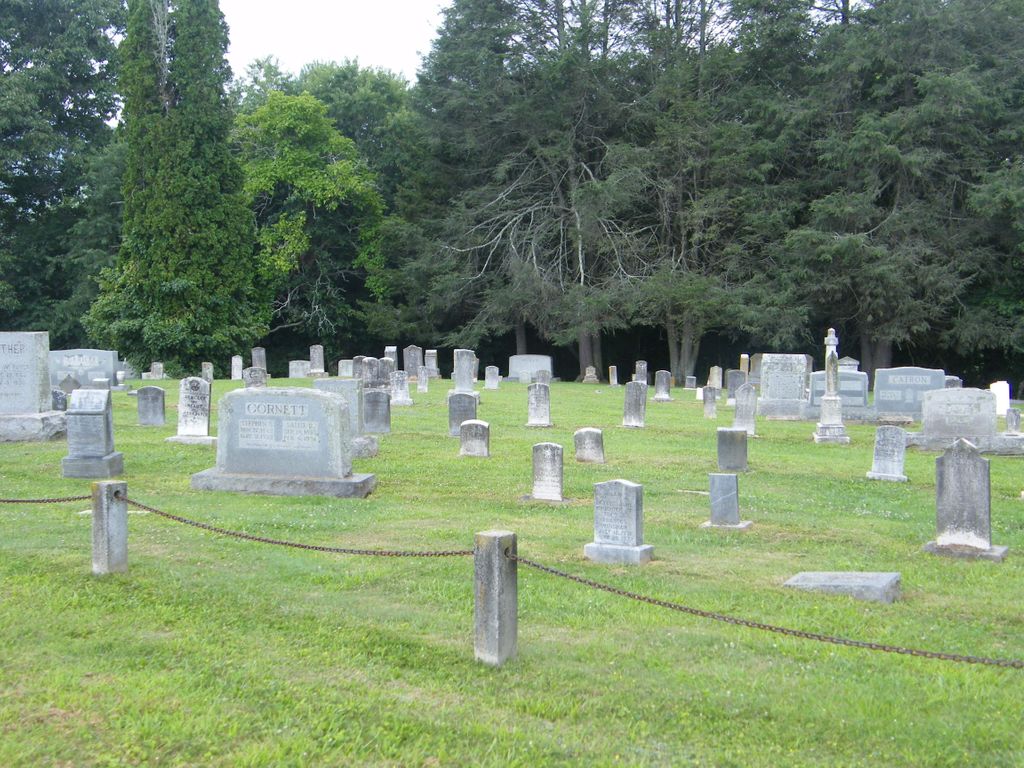
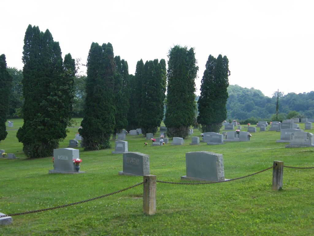
| Memorials | : | 27 |
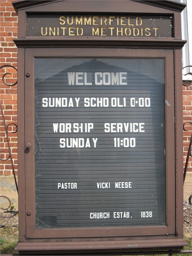
| Location | : | Fries, Grayson County, USA |
| Phone | : | 276-237-8288 |
| Coordinate | : | 36.6963200, -81.1046600 |
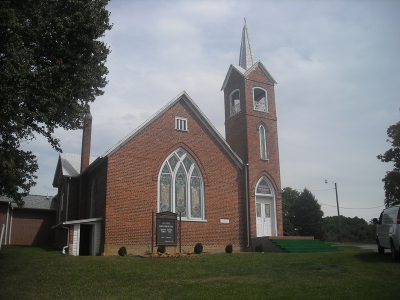
| Description | : | The church and cemetery are on the north side of Carsonville Rd (Rt 660) and Churchview Rd (Rt 717). From the junction of Elk Creek Pwy (US 21) and Carsonville Rd in Elk Creek drive about 4.7 miles east on Carsonville Rd. Both the cemetery and church are visible from the road. |
frequently asked questions (FAQ):
-
Where is Summerfield United Methodist Church Cemetery?
Summerfield United Methodist Church Cemetery is located at Fries, Grayson County ,Virginia ,USA.
-
Summerfield United Methodist Church Cemetery cemetery's updated grave count on graveviews.com?
26 memorials
-
Where are the coordinates of the Summerfield United Methodist Church Cemetery?
Latitude: 36.6963200
Longitude: -81.1046600
Nearby Cemetories:
1. Old Fulton Cemetery
Peach Bottom, Grayson County, USA
Coordinate: 36.6932930, -81.1172570
2. Hackler Cemetery
Independence, Grayson County, USA
Coordinate: 36.6799500, -81.1036520
3. Hines Branch Cemetery
Elk Creek, Grayson County, USA
Coordinate: 36.7105480, -81.1155940
4. Tolbert Wright Cemetery
Carsonville, Grayson County, USA
Coordinate: 36.6915240, -81.0799330
5. Andrew Funk Cemetery
Elk Creek, Grayson County, USA
Coordinate: 36.7189360, -81.1254560
6. Pilgrims Rest Primitive Baptist Church Cemetery
Independence, Grayson County, USA
Coordinate: 36.6658330, -81.0933970
7. Old Pool Cemetery
Elk Creek, Grayson County, USA
Coordinate: 36.7288370, -81.1073930
8. Pleasant Hill Methodist Church Cemetery
Elk Creek, Grayson County, USA
Coordinate: 36.6767600, -81.0701040
9. Rhudy - Brewer Cemetery
Independence, Grayson County, USA
Coordinate: 36.7032911, -81.1478268
10. Bedwell - Wiley Cemetery
Independence, Grayson County, USA
Coordinate: 36.6598600, -81.1152200
11. Jackson Family Cemetery
Elk Creek, Grayson County, USA
Coordinate: 36.7258090, -81.1352080
12. Abel Carrico IV Cemetery
Carsonville, Grayson County, USA
Coordinate: 36.6797000, -81.0548800
13. Stephen G. Bourne Cemetery
Fries, Grayson County, USA
Coordinate: 36.7353430, -81.0753090
14. Combs Family Cemetery
Fries, Grayson County, USA
Coordinate: 36.6982817, -81.0476962
15. Francis Cornett Family Cemetery
Fallville, Grayson County, USA
Coordinate: 36.7354430, -81.1344060
16. Lewis Bryant Cemetery
Grayson County, USA
Coordinate: 36.6550630, -81.1305770
17. William Billy Buck Bourne Cemetery
Elk Creek, Grayson County, USA
Coordinate: 36.7402740, -81.1241160
18. Fielder Cemetery
Fallville, Grayson County, USA
Coordinate: 36.7433790, -81.1012350
19. Fulton Family Cemetery
Independence, Grayson County, USA
Coordinate: 36.6484470, -81.0901500
20. Jerusalem United Methodist Church Cemetery
Elk Creek, Grayson County, USA
Coordinate: 36.7456017, -81.1125031
21. Reece Vaught Family Cemetery
Fallville, Grayson County, USA
Coordinate: 36.7417580, -81.1311460
22. William Hale Cemetery
Elk Creek, Grayson County, USA
Coordinate: 36.7035290, -81.1668170
23. Ebenezer Cemetery
Grayson County, USA
Coordinate: 36.7400017, -81.0717010
24. Chestnut Hill Cemetery
Independence, Grayson County, USA
Coordinate: 36.6506430, -81.1335430