
| Memorials | : | 0 |
| Location | : | Chapman, Dickinson County, USA |
| Coordinate | : | 39.0330190, -97.0368770 |
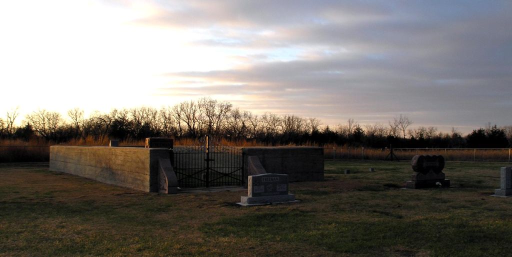
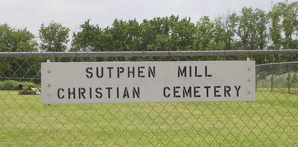
| Description | : | Northwest of Chapman on Quail Road, just north of Hwy 18. The Freeman Cemetery is at the back of the Sutphen Mill Cemetery and in the same fenced enclosure. Part of the Freeman family are buried in an area that is enclosed with a concrete wall. However, some of the younger members of the family are outside the enclosure in the part of the cemetery considered to be Sutphen Mill. Just north of the intersection of Quail Road and hwy 18. |
frequently asked questions (FAQ):
-
Where is Sutphen Mill Cemetery?
Sutphen Mill Cemetery is located at Chapman, Dickinson County ,Kansas ,USA.
-
Sutphen Mill Cemetery cemetery's updated grave count on graveviews.com?
0 memorials
-
Where are the coordinates of the Sutphen Mill Cemetery?
Latitude: 39.0330190
Longitude: -97.0368770

Nearby Cemetories:
1. Good Hope Cemetery
Chapman, Dickinson County, USA
Coordinate: 39.0388985, -96.9991989
2. Jones Cemetery
Dickinson County, USA
Coordinate: 39.0703011, -97.0860977
3. Liberty Cemetery
Upland, Dickinson County, USA
Coordinate: 39.0896988, -97.0278015
4. Saint Patricks Cemetery
Chapman, Dickinson County, USA
Coordinate: 38.9803330, -97.0062850
5. Indian Hill Cemetery
Chapman, Dickinson County, USA
Coordinate: 38.9714012, -97.0327988
6. Bethel Cemetery
Moonlight, Dickinson County, USA
Coordinate: 39.0022011, -97.1110535
7. Alida Zion Evangelical Cemetery
Upland, Dickinson County, USA
Coordinate: 39.0750008, -96.9721985
8. Saint Johns Cemetery
Geary County, USA
Coordinate: 39.0741997, -96.9610977
9. Alida Cemetery
Geary County, USA
Coordinate: 39.1030998, -96.9618988
10. Buckeye Cemetery
Buckeye, Dickinson County, USA
Coordinate: 39.0463070, -97.1665840
11. Detroit Cemetery
Detroit, Dickinson County, USA
Coordinate: 38.9439300, -97.1255100
12. Union Cemetery
Buckeye, Dickinson County, USA
Coordinate: 39.0243988, -97.1856003
13. Greenridge Cemetery
Dickinson County, USA
Coordinate: 39.1199989, -97.1433029
14. Henry Cemetery
Buckeye, Dickinson County, USA
Coordinate: 39.0828018, -97.1857986
15. Zion Cemetery
Abilene, Dickinson County, USA
Coordinate: 39.0319240, -97.2045850
16. Geary County Poor Farm Cemetery
Junction City, Geary County, USA
Coordinate: 39.0064500, -96.8727100
17. Lutheran Cemetery #17
Enterprise, Dickinson County, USA
Coordinate: 38.9009209, -97.0734787
18. Rinehart Cemetery
Enterprise, Dickinson County, USA
Coordinate: 38.9021988, -96.9638977
19. Saint Marys Cemetery
Junction City, Geary County, USA
Coordinate: 39.0092010, -96.8522034
20. Pleasant Hill Cemetery
Enterprise, Dickinson County, USA
Coordinate: 38.8885150, -97.0749560
21. Madura Cemetery
Wakefield, Clay County, USA
Coordinate: 39.1842003, -97.0117035
22. Highland Cemetery
Junction City, Geary County, USA
Coordinate: 39.0139008, -96.8416977
23. Mount Hope Cemetery
Enterprise, Dickinson County, USA
Coordinate: 38.8869019, -97.1121979
24. Episcopal Church of the Covenant Columbarium
Junction City, Geary County, USA
Coordinate: 39.0259480, -96.8338650