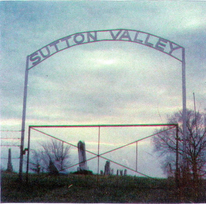
| Memorials | : | 9 |
| Location | : | Greeley, Anderson County, USA |
| Coordinate | : | 38.3311005, -95.1044006 |
| Description | : | This old cemetery is located on a hillside, 2 miles south and 1 mile east of Greeley, Kansas. |
frequently asked questions (FAQ):
-
Where is Sutton Valley Cemetery?
Sutton Valley Cemetery is located at Greeley, Anderson County ,Kansas ,USA.
-
Sutton Valley Cemetery cemetery's updated grave count on graveviews.com?
9 memorials
-
Where are the coordinates of the Sutton Valley Cemetery?
Latitude: 38.3311005
Longitude: -95.1044006
Nearby Cemetories:
1. Saint Johns Cemetery
Greeley, Anderson County, USA
Coordinate: 38.3546982, -95.1256027
2. Greeley City Cemetery
Greeley, Anderson County, USA
Coordinate: 38.3752327, -95.1258011
3. Lanter Family Cemetery
Anderson County, USA
Coordinate: 38.3827100, -95.1059000
4. Wait Cemetery
Parker, Linn County, USA
Coordinate: 38.3527985, -95.0378036
5. Judy Cemetery
Garnett, Anderson County, USA
Coordinate: 38.3093987, -95.1753006
6. South Sugar Valley Cemetery
Garnett, Anderson County, USA
Coordinate: 38.2697890, -95.1021450
7. Pottawatomie Baptist Mission Cemetery
Lane, Franklin County, USA
Coordinate: 38.4049500, -95.1028200
8. Saint Boniface Catholic Cemetery
Scipio, Anderson County, USA
Coordinate: 38.3650017, -95.2109985
9. Highland Cemetery
Parker, Linn County, USA
Coordinate: 38.3157997, -94.9907990
10. Berea Cemetery
Franklin County, USA
Coordinate: 38.3981018, -95.1849976
11. Ashburn Family Cemetery
Garnett, Anderson County, USA
Coordinate: 38.2629600, -95.1872900
12. Garnett Cemetery
Garnett, Anderson County, USA
Coordinate: 38.2961006, -95.2249985
13. Holy Angels Cemetery
Garnett, Anderson County, USA
Coordinate: 38.2974100, -95.2312200
14. Morris Family Cemetery
Garnett, Anderson County, USA
Coordinate: 38.2434600, -95.1842400
15. Sturgeon Cemetery
Lane, Franklin County, USA
Coordinate: 38.4376100, -95.1254100
16. Baker Cemetery
Lane, Franklin County, USA
Coordinate: 38.4371986, -95.1333008
17. Goodrich Cemetery
Goodrich, Linn County, USA
Coordinate: 38.2771988, -94.9831009
18. Smith Cemetery
Richmond, Franklin County, USA
Coordinate: 38.4253700, -95.1785950
19. Lane Cemetery
Lane, Franklin County, USA
Coordinate: 38.4411011, -95.0699997
20. Chandler Family Cemetery
Beagle, Miami County, USA
Coordinate: 38.4057600, -94.9951200
21. Mound Creek Cemetery
Beagle, Miami County, USA
Coordinate: 38.3958015, -94.9760971
22. Lockhart Cemetery
Beagle, Miami County, USA
Coordinate: 38.4112400, -94.9828500
23. Beacon of Truth Cemetery
Richmond, Franklin County, USA
Coordinate: 38.3895300, -95.2470200
24. Myers Cemetery
Lane, Franklin County, USA
Coordinate: 38.4578820, -95.0935150

