
| Memorials | : | 80 |
| Location | : | Swan Creek, Southern Downs Region, Australia |
| Coordinate | : | -28.1974400, 152.1364830 |
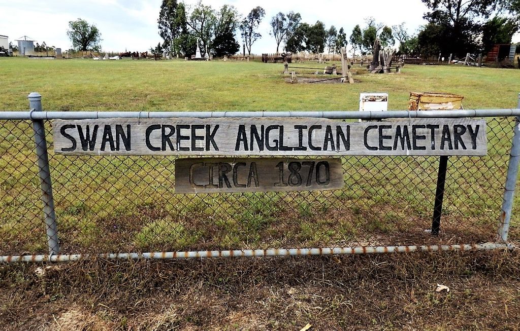
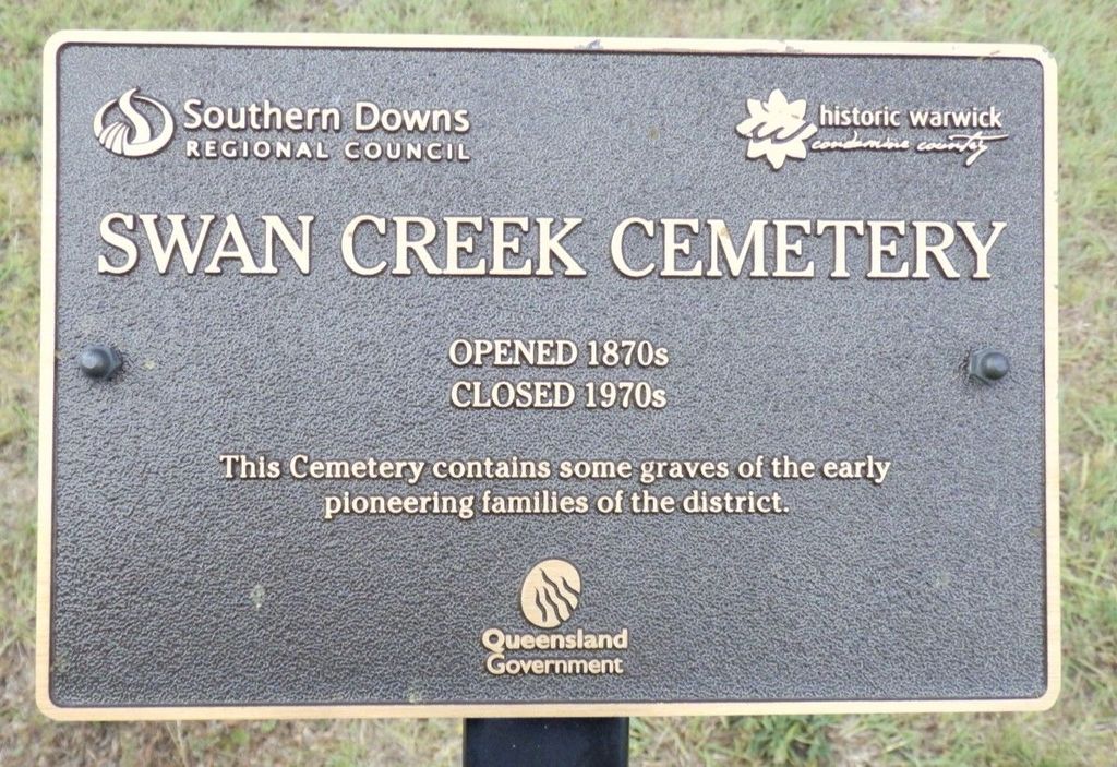
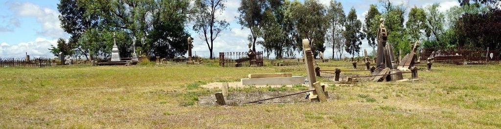
| Description | : | Swan Creek Anglican Cemetery occupies a relatively large site and contains inscriptions dating from 1876 to 1966. It once adjoined the Swan Creek Anglican Church, now long closed. Swan Creek is 13.4km east of Warwick on the Warwick Yangan Road. At Swan Creek, turn south onto Swan Creek School Road for 500m to the cemetery. |
frequently asked questions (FAQ):
-
Where is Swan Creek Anglican Cemetery?
Swan Creek Anglican Cemetery is located at Swan Creek, Southern Downs Region ,Queensland ,Australia.
-
Swan Creek Anglican Cemetery cemetery's updated grave count on graveviews.com?
80 memorials
-
Where are the coordinates of the Swan Creek Anglican Cemetery?
Latitude: -28.1974400
Longitude: 152.1364830
Nearby Cemetories:
1. Yangan Presbyterian Church Cemetery
Yangan, Southern Downs Region, Australia
Coordinate: -28.1972310, 152.2142130
2. Yangan General and Anglican Cemetery
Emu Vale, Southern Downs Region, Australia
Coordinate: -28.2059990, 152.2207110
3. St Marks Anglican Church Columbarium Wall
Warwick, Southern Downs Region, Australia
Coordinate: -28.2161000, 152.0347600
4. Warwick-Conway Family Homestead Cemetery
Warwick, Southern Downs Region, Australia
Coordinate: -28.1258400, 152.0395700
5. Glengallan Station
Warwick, Southern Downs Region, Australia
Coordinate: -28.1027016, 152.0585067
6. Warwick General Cemetery
Warwick, Southern Downs Region, Australia
Coordinate: -28.2100890, 152.0044080
7. Warwick General Lawn Cemetery
Warwick, Southern Downs Region, Australia
Coordinate: -28.2106310, 152.0039087
8. Warwick War Cemetery
Warwick, Southern Downs Region, Australia
Coordinate: -28.2089620, 152.0033530
9. Eden Gardens Memorial Park
Warwick, Southern Downs Region, Australia
Coordinate: -28.2229690, 152.0031130
10. Lone Grave Warwick
Warwick, Southern Downs Region, Australia
Coordinate: -28.2316590, 151.9833180
11. Maryvale Homestead Cemetery
Warwick, Southern Downs Region, Australia
Coordinate: -28.0669430, 152.2405230
12. Maryvale Cemetery
Maryvale, Southern Downs Region, Australia
Coordinate: -28.0607800, 152.2474610
13. Killarney Lawn Cemetery
Killarney, Southern Downs Region, Australia
Coordinate: -28.3475760, 152.2742790
14. Allora Cemetery
Allora, Southern Downs Region, Australia
Coordinate: -28.0199230, 151.9750720
15. Spicers Gap
Boonah, Scenic Rim Region, Australia
Coordinate: -28.0733318, 152.4255524
16. Dalveen-Mitchell Family Homestead Cemetery
Dalveen, Southern Downs Region, Australia
Coordinate: -28.4423200, 151.9604000
17. Headington Hill Lutheran Cemetery
Allora, Southern Downs Region, Australia
Coordinate: -27.9037210, 152.0020290
18. Clifton General Cemetery
Clifton, Toowoomba Region, Australia
Coordinate: -27.9389150, 151.9120790
19. Strath Elbess Cemetery
Dalveen, Southern Downs Region, Australia
Coordinate: -28.4883070, 151.9692850
20. Pratten Cemetery
Pratten, Southern Downs Region, Australia
Coordinate: -28.0858450, 151.7790540
21. Back Plains Cemetery
Back Plains, Toowoomba Region, Australia
Coordinate: -27.9121770, 151.7970240
22. Aratula Lutheran Cemetery
Aratula, Scenic Rim Region, Australia
Coordinate: -27.9813240, 152.5425210
23. Mount Alford Church Cemetery
Mount Alford, Scenic Rim Region, Australia
Coordinate: -28.0656790, 152.5952250
24. Nobby Cemetery
Nobby, Toowoomba Region, Australia
Coordinate: -27.8322200, 151.8662000