
| Memorials | : | 0 |
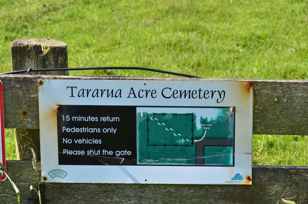
| Location | : | Otara, Southland District, New Zealand |
| Coordinate | : | -46.6551940, 168.8762500 |
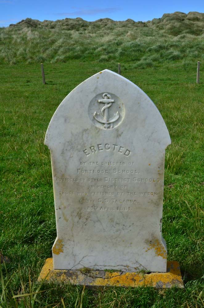
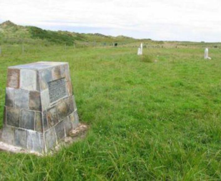
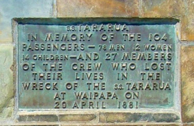
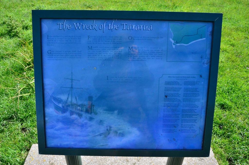
| Description | : | This site became known as the Tararua Acre after many of the casualties of New Zealand’s worst civilian shipwreck at Waipapa Point were buried here in 1881. Other recovered bodies are buried at the Fortrose Cemetery. On 29 April 1881, the SS Tararua ran aground on Waipapa Reef. Attempts were made to get passengers and crew ashore by lifeboats, but they encountered difficulties because of the rising sea. George Lawrence successfully swam 300 metres from a lifeboat to shore and made it to the nearest building owned by the Bruntons. From there a man rode to Wyndham to raise the alarm. Of... Read More |
frequently asked questions (FAQ):
-
Where is Tararua Acre?
Tararua Acre is located at Otara, Southland District ,Southland ,New Zealand.
-
Tararua Acre cemetery's updated grave count on graveviews.com?
0 memorials
-
Where are the coordinates of the Tararua Acre?
Latitude: -46.6551940
Longitude: 168.8762500

Nearby Cemetories:
1. Fortrose Cemetery
Fortrose, Southland District, New Zealand
Coordinate: -46.5694400, 168.8088500
2. Quarry Hills Cemetery
Quarry Hills, Southland District, New Zealand
Coordinate: -46.5433100, 169.0398300
3. Waikawa Cemetery
Waikawa, Southland District, New Zealand
Coordinate: -46.6093780, 169.1289750
4. Mokoreta Cemetery
Southland District, New Zealand
Coordinate: -46.4332000, 169.0649650
5. Ruapuke Island Cemetery
Southland District, New Zealand
Coordinate: -46.7881040, 168.5048690
6. Chaslands Cemetery
Chaslands, Clutha District, New Zealand
Coordinate: -46.5912638, 169.3424280
7. Wyndham Cemetery
Wyndham, Southland District, New Zealand
Coordinate: -46.3147020, 168.8823690
8. Captain Stirling Grave
Bluff, Invercargill City, New Zealand
Coordinate: -46.6016466, 168.3691108
9. Edendale Cemetery
Edendale, Southland District, New Zealand
Coordinate: -46.3080400, 168.7327360
10. Woodlands Cemetery
Woodlands, Southland District, New Zealand
Coordinate: -46.3568800, 168.5463770
11. Bluff Cemetery
Bluff, Invercargill City, New Zealand
Coordinate: -46.6017310, 168.3248670
12. Te Hau Mutunga Urupā
Invercargill, Invercargill City, New Zealand
Coordinate: -46.4288704, 168.4148361
13. Papatowai Cemetery
Papatowai, Clutha District, New Zealand
Coordinate: -46.5407600, 169.4367300
14. Green Point Cemetery
Bluff, Invercargill City, New Zealand
Coordinate: -46.5739350, 168.3006450
15. Southland Crematorium
Invercargill, Invercargill City, New Zealand
Coordinate: -46.4109100, 168.3961330
16. Eastern Cemetery
Invercargill, Invercargill City, New Zealand
Coordinate: -46.4070770, 168.3961480
17. Holy Trinity Anglican Church
Invercargill, Invercargill City, New Zealand
Coordinate: -46.3984736, 168.3660057
18. All Saints Anglican Church
Invercargill, Invercargill City, New Zealand
Coordinate: -46.3906042, 168.3476728
19. Mataura Cemetery
Mataura, Gore District, New Zealand
Coordinate: -46.2016960, 168.8808060
20. Saint Johns Cemetery
Invercargill, Invercargill City, New Zealand
Coordinate: -46.3748600, 168.3431480
21. Otaraia Cemetery
Gore District, New Zealand
Coordinate: -46.1978780, 169.0815990
22. Purekireki Cemetery
Owaka, Clutha District, New Zealand
Coordinate: -46.3760000, 169.4818000
23. Wallacetown New Cemetery
Wallacetown, Southland District, New Zealand
Coordinate: -46.3374900, 168.2835700
24. Wallacetown Old Cemetery
Wallacetown, Southland District, New Zealand
Coordinate: -46.3321840, 168.2861670