
| Memorials | : | 0 |
| Location | : | Orange, Orange County, USA |
| Coordinate | : | 38.2289770, -78.0785470 |
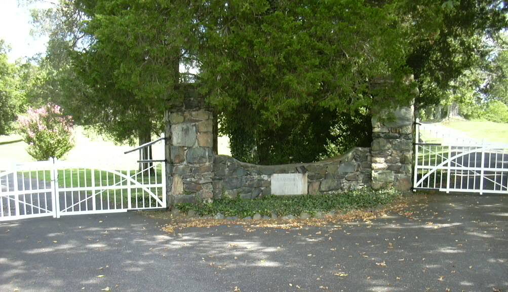
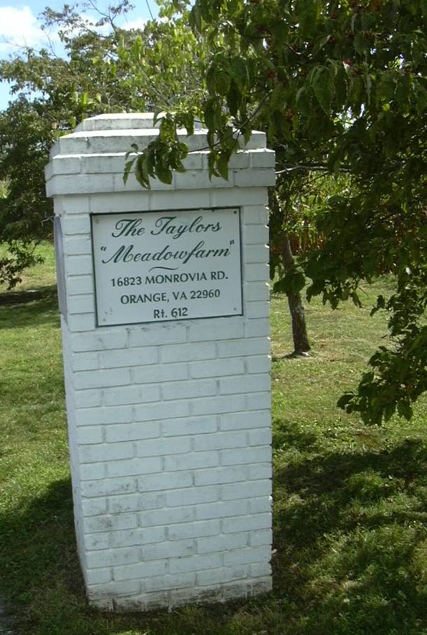
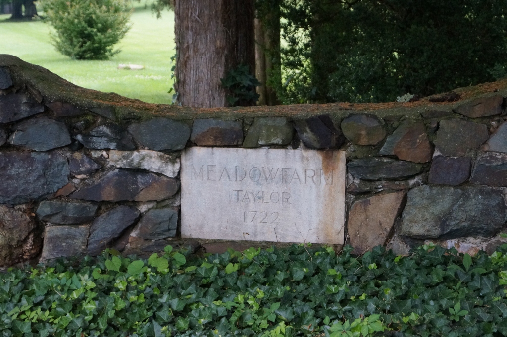
| Description | : | The cemetery is in the back yard of Meadow Farm Estate, a gated residence. The current residents are descendants of the Taylors who originally owned the land. Visiting the cemetery can be arranged by calling the Orange County Historical Society at 540-672-5366, who will in turn contact the owner of the estate to see if you may visit. As of June 2012, Virginia Blossom, a Find A Grave member, has photographed and posted all 29 markers in this cemetery and documented their inscriptions in the photo captions, adding greatly to the Taylor family history. (Thanks to... Read More |
frequently asked questions (FAQ):
-
Where is Taylor Family Cemetery?
Taylor Family Cemetery is located at 16823 Monrovia Road Orange, Orange County ,Virginia , 22960USA.
-
Taylor Family Cemetery cemetery's updated grave count on graveviews.com?
0 memorials
-
Where are the coordinates of the Taylor Family Cemetery?
Latitude: 38.2289770
Longitude: -78.0785470
Nearby Cemetories:
1. Pierce Family Cemetery
Orange, Orange County, USA
Coordinate: 38.2325570, -78.0576850
2. Greenfield Cemetery
Orange, Orange County, USA
Coordinate: 38.2533500, -78.1003900
3. Saint Thomas Episcopal Church Cemetery
Orange, Orange County, USA
Coordinate: 38.2437740, -78.1128630
4. Jerdone Cemetery
Orange, Orange County, USA
Coordinate: 38.2565280, -78.0561670
5. Taylor-Quarles Family Cemetery
Orange, Orange County, USA
Coordinate: 38.2562940, -78.0539430
6. Munday Cemetery
Orange County, USA
Coordinate: 38.2640720, -78.0973980
7. Graham Cemetery
Orange, Orange County, USA
Coordinate: 38.2433014, -78.1267014
8. Westview Cemetery
Orange, Orange County, USA
Coordinate: 38.2428017, -78.1303024
9. Lewis Cemetery
Orange County, USA
Coordinate: 38.2400017, -78.0194016
10. Finnell Family Cemetery
Orange County, USA
Coordinate: 38.2403200, -78.0186800
11. Saint Isidore The Farmer Catholic Church Cemetery
Orange, Orange County, USA
Coordinate: 38.2049390, -78.1353760
12. Mount Calvary Cemetery
Orange, Orange County, USA
Coordinate: 38.2505989, -78.0194016
13. Zion Baptist Church
Orange, Orange County, USA
Coordinate: 38.1957990, -78.1322480
14. Dade - Cason - Kemper Cemetery
Orange, Orange County, USA
Coordinate: 38.2720000, -78.1367600
15. Mount Pleasant Baptist Church Cemetery
Lahore, Orange County, USA
Coordinate: 38.2034970, -78.0052870
16. Hopewell Baptist Church Cemetery
Orange, Orange County, USA
Coordinate: 38.2844150, -78.0311140
17. Woodberry Forest School Columbarium
Five Forks, Madison County, USA
Coordinate: 38.2909930, -78.1229230
18. North Pamunkey Cemetery
Orange, Orange County, USA
Coordinate: 38.1983260, -77.9959150
19. Watkins Cemetery
Orange County, USA
Coordinate: 38.1652985, -78.0327988
20. Montpelier Slave Cemetery
Montpelier Station, Orange County, USA
Coordinate: 38.2196010, -78.1726330
21. Kemper Family Cemetery
Orange, Orange County, USA
Coordinate: 38.2742004, -78.1547012
22. Madison-Taliaferro Family Cemetery
Madison Mills, Madison County, USA
Coordinate: 38.2856700, -78.1418200
23. Montpelier Estate National Historic Site
Montpelier Station, Orange County, USA
Coordinate: 38.2177730, -78.1748230
24. Arjalon Price Cemetery
Orange County, USA
Coordinate: 38.3007770, -78.0438280