
| Memorials | : | 2 |
| Location | : | Rutherfordton, Rutherford County, USA |
| Coordinate | : | 35.3334464, -82.0399813 |
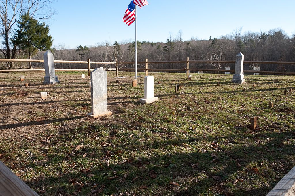
| Description | : | The location of the cemetery is The Taylor Family Cemetery, located 5 miles West of Ruthefordton, NC on Hwy 108. Located on top of a hill overlooking the Broad River in Rutherford County, and above the old Taylor homesite. To Reach from the Highway 108 bridge over the river, go 0.6 miles west towards Polk County to a farm road leading to the old Taylor home site The location of the Taylor Family cemetery is at 2950 NC 108 Hwy, Rutherfordton NC; Lat 35.33344642858649, Long -82.03998130564287 Note this is private property |
frequently asked questions (FAQ):
-
Where is Taylor Plantation Cemetery?
Taylor Plantation Cemetery is located at 2950 NC 108 Hwy, Rutherfordton NC Rutherfordton, Rutherford County ,North Carolina ,USA.
-
Taylor Plantation Cemetery cemetery's updated grave count on graveviews.com?
2 memorials
-
Where are the coordinates of the Taylor Plantation Cemetery?
Latitude: 35.3334464
Longitude: -82.0399813


Nearby Cemetories:
1. Morris Cemetery
Rutherford County, USA
Coordinate: 35.3481960, -82.0460780
2. Walker Cemetery
Rutherford County, USA
Coordinate: 35.3474428, -82.0281717
3. Pleasant Hill Baptist Church Cemetery
Rutherfordton, Rutherford County, USA
Coordinate: 35.3468170, -82.0257410
4. Gray's Chapel Cemetery
Rutherfordton, Rutherford County, USA
Coordinate: 35.3138150, -82.0380630
5. New Salem CME Church Cemetery
Rutherfordton, Rutherford County, USA
Coordinate: 35.3576000, -82.0310890
6. Miller-Twitty Cemetery
Rutherford County, USA
Coordinate: 35.3287200, -82.0056400
7. Dickey-Lynch Cemetery
Rutherford County, USA
Coordinate: 35.3612320, -82.0517680
8. West Point Baptist Church Cemetery
Rutherford County, USA
Coordinate: 35.3282480, -81.9893440
9. Union Cemetery
Rutherford County, USA
Coordinate: 35.3157997, -81.9922028
10. Moores Grove Baptist Church Cemetery
Mill Spring, Polk County, USA
Coordinate: 35.3141000, -82.0907500
11. Pleasant Grove Baptist Church Cemetery
Polk County, USA
Coordinate: 35.3560982, -82.0905991
12. Manus Chapel
Mill Spring, Polk County, USA
Coordinate: 35.3206400, -82.0967530
13. Pea Ridge Baptist Church Cemetery
Mill Spring, Polk County, USA
Coordinate: 35.3205900, -82.0996800
14. Wheat Creek Baptist Cemetery
Mill Spring, Polk County, USA
Coordinate: 35.2878900, -82.0678900
15. Piedmont Baptist Church Cemetery
Rutherfordton, Rutherford County, USA
Coordinate: 35.3764840, -81.9913030
16. Bryan Twitty Cemetery
Rutherfordton, Rutherford County, USA
Coordinate: 35.3871640, -82.0065630
17. Byars Baptist Church Cemetery
Pea Ridge, Polk County, USA
Coordinate: 35.3250520, -82.1153570
18. West Memorial Baptist Cemetery
Rutherford County, USA
Coordinate: 35.3679800, -81.9731500
19. Mountain View Baptist Church Cemetery
Rutherfordton, Rutherford County, USA
Coordinate: 35.3323070, -81.9591380
20. Green Hill Baptist Church Cemetery
Green Hill, Rutherford County, USA
Coordinate: 35.3988991, -82.0233002
21. Lebanon Methodist Church Cemetery
Mill Spring, Polk County, USA
Coordinate: 35.3532710, -82.1189030
22. New Hope Cemetery
Rutherfordton, Rutherford County, USA
Coordinate: 35.3757470, -81.9671180
23. Matthew Chapel AME Zion Church Cemetery
Rutherfordton, Rutherford County, USA
Coordinate: 35.4021760, -82.0736150
24. Grays Creek Baptist Church Cemetery
Shiloh, Rutherford County, USA
Coordinate: 35.2854652, -81.9674301