
| Memorials | : | 2 |
| Location | : | Logansport, Butler County, USA |
| Coordinate | : | 37.3074900, -86.7852000 |
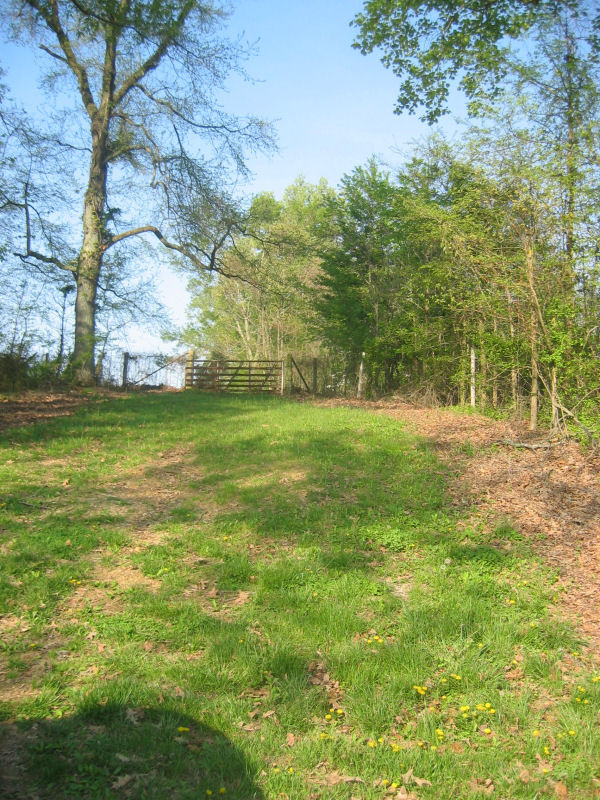
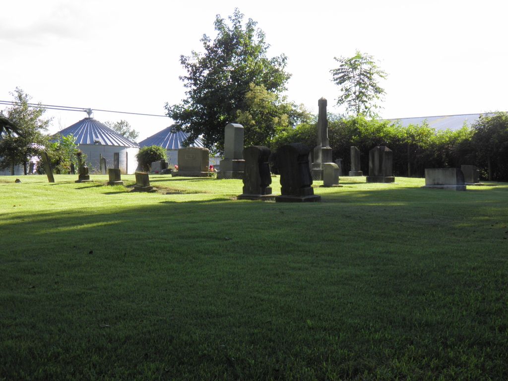
| Description | : | Taylor's Lake Cemetery contains about thirty graves and is fenced and maintained in a pasture about two hundred yards down Taylor's Lake Club Road west of Route 403 and about 1.8 miles north of the Salem Baptist Church which is about 6 miles North of Logansport, in the Big Bend Area of Butler County, KY. |
frequently asked questions (FAQ):
-
Where is Taylors Lake Cemetery?
Taylors Lake Cemetery is located at Taylor Lake Club Road Logansport, Butler County ,Kentucky , 42261USA.
-
Taylors Lake Cemetery cemetery's updated grave count on graveviews.com?
2 memorials
-
Where are the coordinates of the Taylors Lake Cemetery?
Latitude: 37.3074900
Longitude: -86.7852000
Nearby Cemetories:
1. Salem Church Cemetery
Logansport, Butler County, USA
Coordinate: 37.2857740, -86.7683200
2. Green River Cemetery
Ohio County, USA
Coordinate: 37.3255100, -86.7600800
3. Miller Graveyard
Cromwell, Ohio County, USA
Coordinate: 37.3274190, -86.7620120
4. Wilson-Martin Cemetery
Morgantown, Butler County, USA
Coordinate: 37.2954300, -86.7470900
5. Whalin Cemetery
Logansport, Butler County, USA
Coordinate: 37.2746680, -86.7748260
6. New Harmony Baptist Church Cemetery
Mining City, Butler County, USA
Coordinate: 37.2728900, -86.8136100
7. Point Pleasant Presbyterian Cemetery
Butler County, USA
Coordinate: 37.2654114, -86.8088379
8. Lebanon Cemetery
Logansport, Butler County, USA
Coordinate: 37.2690500, -86.7502600
9. Daugherty Cemetery
Flint Springs, Ohio County, USA
Coordinate: 37.3410600, -86.7223400
10. Old Point Pleasant Church Cemetery
Mining City, Butler County, USA
Coordinate: 37.2470000, -86.7830000
11. New Liberty Cemetery
Butler County, USA
Coordinate: 37.3179640, -86.7084440
12. Warren's Mill Cemetery
Gilstrap, Butler County, USA
Coordinate: 37.3163100, -86.7073300
13. Dennis Cemetery
Cool Springs, Ohio County, USA
Coordinate: 37.2989180, -86.8684260
14. Rogers-Reid Cemetery
Beaver Dam, Ohio County, USA
Coordinate: 37.3687800, -86.8268600
15. Hawes Cemetery
Provo, Butler County, USA
Coordinate: 37.2399510, -86.8077530
16. Bald Knob Methodist Church Cemetery
Cromwell, Ohio County, USA
Coordinate: 37.3781030, -86.7799900
17. Brick House Cemetery
Cromwell, Ohio County, USA
Coordinate: 37.3782090, -86.7799665
18. Browns Cemetery
Mining City, Butler County, USA
Coordinate: 37.2364006, -86.8131027
19. Cool Springs Cemetery
Beaver Dam, Ohio County, USA
Coordinate: 37.2935000, -86.8806000
20. Monticello Cemetery
Morgantown, Butler County, USA
Coordinate: 37.2329903, -86.8150711
21. Rone Cemetery
Butler County, USA
Coordinate: 37.2355995, -86.8296967
22. Doolin-Rone Cemetery
Provo, Butler County, USA
Coordinate: 37.2354400, -86.8298200
23. Swain Cemetery
Cool Springs, Ohio County, USA
Coordinate: 37.2536280, -86.8615790
24. Walnut Grove Cemetery
Morgantown, Butler County, USA
Coordinate: 37.2680500, -86.6956400