
| Memorials | : | 9 |
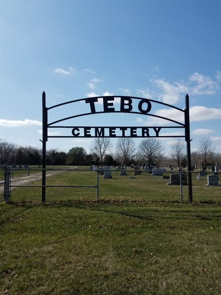
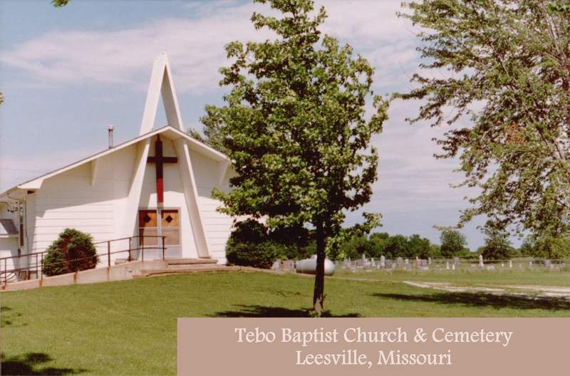
| Location | : | Leesville, Henry County, USA |
| Coordinate | : | 38.3538017, -93.5447998 |
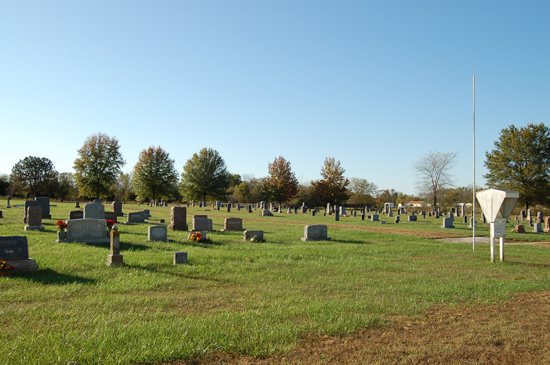
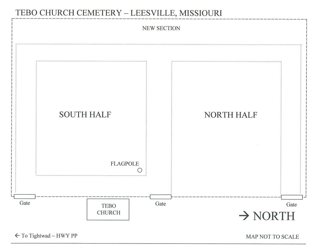
| Description | : | The cemetery is North of Tightwad, Missouri on Road PP. It's about 2 1/2 miles SW of the original location. The cemetery was relocated to this area by the Corps of Engineers due to the Kaysinger Bluff Dam project, so named in 1954 when construction was authorized. It was renamed Harry S Truman Dam and Reservoir when construction began in 1964, work was completed in 1979. |
frequently asked questions (FAQ):
-
Where is Tebo Church Cemetery?
Tebo Church Cemetery is located at Leesville, Henry County ,Missouri ,USA.
-
Tebo Church Cemetery cemetery's updated grave count on graveviews.com?
9 memorials
-
Where are the coordinates of the Tebo Church Cemetery?
Latitude: 38.3538017
Longitude: -93.5447998
Nearby Cemetories:
1. Timberlake Cemetery
Leesville, Henry County, USA
Coordinate: 38.3526710, -93.5567590
2. Baugh Cemetery
Benton County, USA
Coordinate: 38.3622017, -93.4989014
3. Tindle Cemetery
Lincoln, Benton County, USA
Coordinate: 38.3469009, -93.4961014
4. Fewell Farm Graveyard
Benton County, USA
Coordinate: 38.3922100, -93.5109000
5. Logan Cemetery
Leesville, Henry County, USA
Coordinate: 38.3051186, -93.5282211
6. Summers Family Burial Grounds
Racket, Benton County, USA
Coordinate: 38.3196000, -93.4891900
7. Osborn Cemetery
Benton County, USA
Coordinate: 38.3142014, -93.4946976
8. Mount Olivet Cemetery
Roseland, Henry County, USA
Coordinate: 38.4122400, -93.5474300
9. Parks Chapel Cemetery
Leesville, Henry County, USA
Coordinate: 38.2966805, -93.5707474
10. George Grave Yard
Calhoun, Henry County, USA
Coordinate: 38.4070160, -93.5829940
11. Shady Grove Cemetery
Racket, Benton County, USA
Coordinate: 38.2964700, -93.4970000
12. King Cemetery
Leesville, Henry County, USA
Coordinate: 38.3030070, -93.6119360
13. Clear Creek Cemetery
Lincoln, Benton County, USA
Coordinate: 38.3804200, -93.4497100
14. Good Hope Cemetery
Coal, Henry County, USA
Coordinate: 38.3194008, -93.6373978
15. Downing Cemetery (Defunct)
Benton County, USA
Coordinate: 38.2963982, -93.4589005
16. Combs Cemetery
Clinton, Henry County, USA
Coordinate: 38.3986015, -93.6421967
17. McIntire Chapel Cemetery
Windsor Junction, Benton County, USA
Coordinate: 38.4303017, -93.4760971
18. Sunnyside Cemetery
Lincoln, Benton County, USA
Coordinate: 38.3713400, -93.4242200
19. McMillian Cemetery
Santiago, Benton County, USA
Coordinate: 38.4504800, -93.5072780
20. Cooper Cemetery (Defunct)
Benton County, USA
Coordinate: 38.2661018, -93.4756012
21. Gregory Cemetery
Benton County, USA
Coordinate: 38.3330994, -93.4135971
22. Robinson Cemetery
Leesville, Henry County, USA
Coordinate: 38.4566130, -93.5982370
23. Harmony Baptist Church Cemetery
Benton County, USA
Coordinate: 38.4460600, -93.4643000
24. Poe Cemetery
Benton County, USA
Coordinate: 38.3116989, -93.4077988