
| Memorials | : | 0 |
| Location | : | Lost River, Hardy County, USA |
| Coordinate | : | 38.9626430, -78.7770140 |
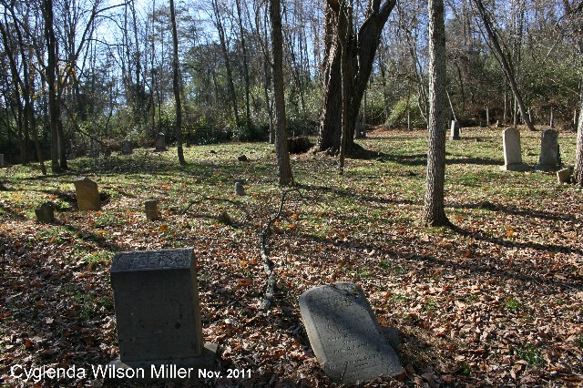
| Description | : | KELLER GRAVEYARD. TEETS-WILSON CEMETERY AND KELLER FARM Are ONE IN THE SAME I Think it was Keller Family Cemetery And When it was recorded by researchers in 1970's,they werent aware of an actual name for the cemetery,or it was being called teets-Wilson Cemetery by 1970's.In the older days Family cemeteries went through several different names sometimes. Directions TEETS-WILSON CEMETERY (176) (N38º 57.749’ & W078º 46.620’) – At Lost River on WV 259, turn east onto CR 16 (Thorne Bottom Road/Mill Gap Road), go 1.9 miles, turn left (north) onto CR 951 (Settlers Valley Way), go 0.4 miles, turn left onto Whispering Pines Way,... Read More |
frequently asked questions (FAQ):
-
Where is Teets-Wilson Cemetery?
Teets-Wilson Cemetery is located at Lost River, Hardy County ,West Virginia ,USA.
-
Teets-Wilson Cemetery cemetery's updated grave count on graveviews.com?
0 memorials
-
Where are the coordinates of the Teets-Wilson Cemetery?
Latitude: 38.9626430
Longitude: -78.7770140
Nearby Cemetories:
1. Sager Cemetery
Lost River, Hardy County, USA
Coordinate: 38.9540200, -78.7588500
2. Greenwood Cemetery
Lost River, Hardy County, USA
Coordinate: 38.9618988, -78.8063965
3. Harper Cemetery
Lost River, Hardy County, USA
Coordinate: 38.9506470, -78.8078510
4. Fogle Cemetery
Lost River, Hardy County, USA
Coordinate: 38.9471400, -78.8069300
5. Fravel Cemetery
Lost River, Hardy County, USA
Coordinate: 38.9474800, -78.8097900
6. David Barbe Cemetery
Lost River, Hardy County, USA
Coordinate: 38.9736100, -78.7389700
7. Elizabeth Wilson Gravesite
Lost River, Hardy County, USA
Coordinate: 38.9530100, -78.8157400
8. Wood Cemetery
Lost River, Hardy County, USA
Coordinate: 38.9364100, -78.8139600
9. Funkhouser - Miller Cemetery
Baker, Hardy County, USA
Coordinate: 39.0016000, -78.7963900
10. Chrisman Cemetery
Lost City, Hardy County, USA
Coordinate: 38.9313300, -78.8194300
11. Cemetery On Big Ridge
Moorefield, Hardy County, USA
Coordinate: 38.9757400, -78.8345700
12. Mountain View Cemetery
Lost City, Hardy County, USA
Coordinate: 38.9133200, -78.7962500
13. Funkhouser - Link Cemetery
Baker, Hardy County, USA
Coordinate: 39.0141000, -78.7874900
14. Wilkins Cemetery
Lost River, Hardy County, USA
Coordinate: 38.9829000, -78.8389100
15. Chrisman Cemetery
Lost City, Hardy County, USA
Coordinate: 38.9368100, -78.8383000
16. Laurel Hill Cemetery
Lost City, Hardy County, USA
Coordinate: 38.9297300, -78.8328900
17. Hisghman Cemetery
Baughman Settlement, Hardy County, USA
Coordinate: 39.0119800, -78.7413900
18. Mount Moriah Lutheran Church Cemetery
Baughman Settlement, Hardy County, USA
Coordinate: 39.0136500, -78.7427500
19. Combs and Coby Cemetery
Lost River, Hardy County, USA
Coordinate: 39.0140390, -78.8118500
20. New Dale Cemetery
Hardy County, USA
Coordinate: 38.9963989, -78.8383026
21. Pharoah Wilkins Cemetery
Needmore, Hardy County, USA
Coordinate: 39.0041900, -78.8307400
22. Holly Hill Cemetery
Lost River, Hardy County, USA
Coordinate: 38.9734900, -78.8522300
23. Funkhouser Family Cemetery
Baker, Hardy County, USA
Coordinate: 39.0234300, -78.7691900
24. Funkhouser Cemetery
Needmore, Hardy County, USA
Coordinate: 39.0111000, -78.8250800