
| Memorials | : | 1 |
| Location | : | Oklahoma City, Oklahoma County, USA |
| Coordinate | : | 35.6044690, -97.4936040 |
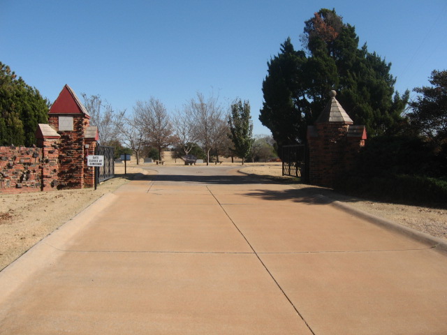
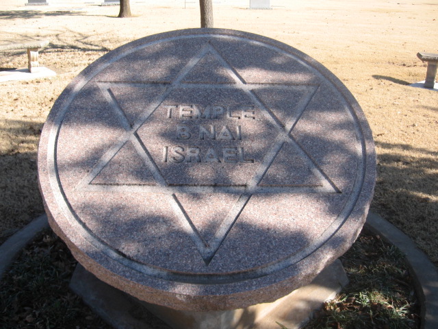
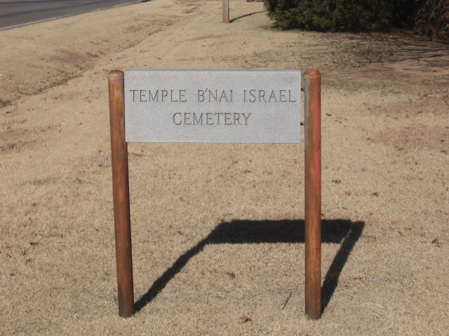
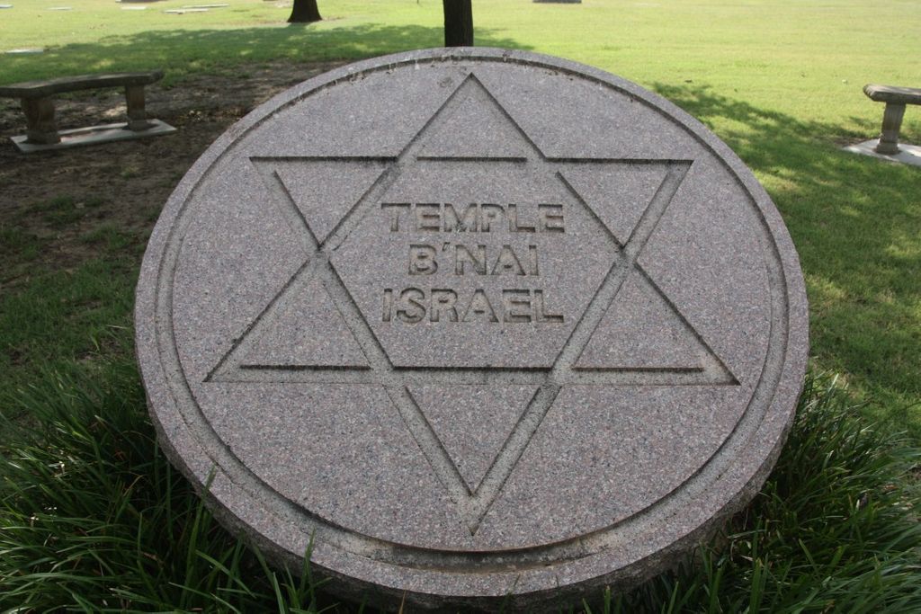
| Description | : | Temple Bnai Israel Cemetery is a small Jewish cemetery. The cemetery appears to be located in Memorial Park Cemetery, however, the cemetery entrances is about 0.25 miles south of Memorial Park Cemetery entrance on the east side of the road; and is not associated with Memorial Park Cemetery. There is a separate drive entrance off of Kelly, but you can walk to the cemetery from Memorial Park. There are approximately 200-300 burials, and two beautifully landscaped areas near the entrance. There is an electronic gate at the entrance. Right inside the cemetery there is a large circular monument with the... Read More |
frequently asked questions (FAQ):
-
Where is Temple Bnai Israel Cemetery?
Temple Bnai Israel Cemetery is located at 13343 N. Kelley Avenue Oklahoma City, Oklahoma County ,Oklahoma , 73131USA.
-
Temple Bnai Israel Cemetery cemetery's updated grave count on graveviews.com?
1 memorials
-
Where are the coordinates of the Temple Bnai Israel Cemetery?
Latitude: 35.6044690
Longitude: -97.4936040

Nearby Cemetories:
1. Memorial Park Cemetery
Oklahoma City, Oklahoma County, USA
Coordinate: 35.6053009, -97.4910965
2. Right of Way Graves
Edmond, Oklahoma County, USA
Coordinate: 35.6270854, -97.4872066
3. Reflection Pointe Gardens
Oklahoma City, Oklahoma County, USA
Coordinate: 35.5801000, -97.4781000
4. Witcher Cemetery
Witcher, Oklahoma County, USA
Coordinate: 35.5942001, -97.4507980
5. Britton Cemetery
Oklahoma City, Oklahoma County, USA
Coordinate: 35.5723076, -97.5323105
6. Saint Mary's Episcopal Church Columbarium
Edmond, Oklahoma County, USA
Coordinate: 35.6538350, -97.4766950
7. Martin Cemetery
Witcher, Oklahoma County, USA
Coordinate: 35.5907500, -97.4282800
8. Alice M. Norton Memorial Columbarium
Oklahoma City, Oklahoma County, USA
Coordinate: 35.6206800, -97.5659400
9. Hediger Cemetery
Oklahoma County, USA
Coordinate: 35.6236430, -97.5693000
10. Gracelawn Cemetery
Edmond, Oklahoma County, USA
Coordinate: 35.6697006, -97.4792023
11. National Cowboy and Western Heritage Museum
Oklahoma City, Oklahoma County, USA
Coordinate: 35.5357200, -97.4831600
12. Nichols Hills United Methodist Church Columbarium
Nichols Hills, Oklahoma County, USA
Coordinate: 35.5411000, -97.5343000
13. Christ the King Catholic Church Cemetery
Oklahoma City, Oklahoma County, USA
Coordinate: 35.5528000, -97.5576000
14. All Souls Church Columbarium
Oklahoma City, Oklahoma County, USA
Coordinate: 35.5373000, -97.5472100
15. Rose Hill Burial Park
Oklahoma City, Oklahoma County, USA
Coordinate: 35.5313988, -97.5369034
16. Rogan Cemetery
Oklahoma City, Oklahoma County, USA
Coordinate: 35.5364690, -97.4334310
17. Pilgrims Rest Cemetery
Oklahoma City, Oklahoma County, USA
Coordinate: 35.5361550, -97.4320580
18. East View Cemetery
Oklahoma City, Oklahoma County, USA
Coordinate: 35.5347220, -97.4319440
19. Lyon Cemetery
Oklahoma City, Oklahoma County, USA
Coordinate: 35.5360000, -97.5650700
20. Trice Hill Cemetery
Oklahoma City, Oklahoma County, USA
Coordinate: 35.5236800, -97.4438700
21. Oakwood Cemetery
Edmond, Oklahoma County, USA
Coordinate: 35.6385994, -97.3893967
22. Westminster Presbyterian Church Columbarium
Oklahoma City, Oklahoma County, USA
Coordinate: 35.5160200, -97.5247400
23. Wright Cemetery
Spencer, Oklahoma County, USA
Coordinate: 35.5367012, -97.4141998
24. Oklahoma Veterans Cemetery
Oklahoma City, Oklahoma County, USA
Coordinate: 35.5072900, -97.4752600