| Memorials | : | 0 |
| Location | : | Jackson, Madison County, USA |
| Coordinate | : | 35.5924000, -88.8576000 |
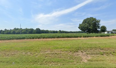
| Description | : | "Approached from Boon Lane by a dirt field road (on the south side) at 1.4 miles west from the intersection of Boon Lane and Riverside Drive. Situated on the William McCommon land, in a woods area, about .3 mile from Boon Lane, by the field road, on a slight rise among cedar trees about 40 feet south of a pond in an open field. A stream called Hicks Creek on contemporary maps meanders a short distance east of this burial ground. Only one large shaft tombstone sited here (no evidence of others having once been sited here), that of Matthew... Read More |
frequently asked questions (FAQ):
-
Where is Tomlin Graves?
Tomlin Graves is located at 464 Boone Lane Jackson, Madison County ,Tennessee , 38301USA.
-
Tomlin Graves cemetery's updated grave count on graveviews.com?
0 memorials
-
Where are the coordinates of the Tomlin Graves?
Latitude: 35.5924000
Longitude: -88.8576000
Nearby Cemetories:
1. Boon Cemetery
Madison County, USA
Coordinate: 35.5985720, -88.8629270
2. Robinson Family Cemetery
Jackson, Madison County, USA
Coordinate: 35.5823000, -88.8695420
3. Benthall Cemetery
Westover, Madison County, USA
Coordinate: 35.5976650, -88.8774790
4. Oak Grove U.M. Church Cemetery
Westover, Madison County, USA
Coordinate: 35.6054280, -88.8847280
5. Sweeney Cemetery
Madison Hall, Madison County, USA
Coordinate: 35.5659000, -88.8672000
6. Saint Mark Memorial Gardens
Westover, Madison County, USA
Coordinate: 35.6137450, -88.8801480
7. Sugars McLemore Cemetery
Madison County, USA
Coordinate: 35.6195421, -88.8393936
8. Bemis Cemetery
Madison County, USA
Coordinate: 35.5689011, -88.8324966
9. Hall and King Cemetery
Madison County, USA
Coordinate: 35.5624720, -88.8689290
10. Riverside Cemetery
Jackson, Madison County, USA
Coordinate: 35.6105995, -88.8255997
11. Oak Grove M.B. Church Cemetery
Westover, Madison County, USA
Coordinate: 35.6023550, -88.8958160
12. Cane Creek Church Cemetery
Jackson, Madison County, USA
Coordinate: 35.5610720, -88.8379380
13. Cerro Gordo Missionary Baptist Church Cemetery
Jackson, Madison County, USA
Coordinate: 35.5795670, -88.8980160
14. B'nai Israel Cemetery
Jackson, Madison County, USA
Coordinate: 35.6237390, -88.8360580
15. Hollywood Cemetery
Jackson, Madison County, USA
Coordinate: 35.6232986, -88.8343964
16. Saint Luke's Episcopal Church Columbarium
Jackson, Madison County, USA
Coordinate: 35.6134750, -88.8168950
17. Wallace Family Cemetery
Madison County, USA
Coordinate: 35.6347170, -88.8377810
18. Hill Cemetery
Madison Hall, Madison County, USA
Coordinate: 35.5483240, -88.8723260
19. Coble Cemetery
Jackson, Madison County, USA
Coordinate: 35.5622000, -88.8154000
20. Rope Field Burying Ground
Jackson, Madison County, USA
Coordinate: 35.5466000, -88.8538000
21. Alston-Johnson Cemetery
Denmark, Madison County, USA
Coordinate: 35.5781270, -88.9140360
22. Greater Saint Luke Church Cemetery
Jackson, Madison County, USA
Coordinate: 35.6412100, -88.8490970
23. Mount Olivet Cemetery
Jackson, Madison County, USA
Coordinate: 35.6360360, -88.8143410
24. Mount Calvary Cemetery
Jackson, Madison County, USA
Coordinate: 35.6333770, -88.8065840

