| Memorials | : | 0 |
| Location | : | Rockford, Kent County, USA |
| Coordinate | : | 43.1470280, -85.4219210 |
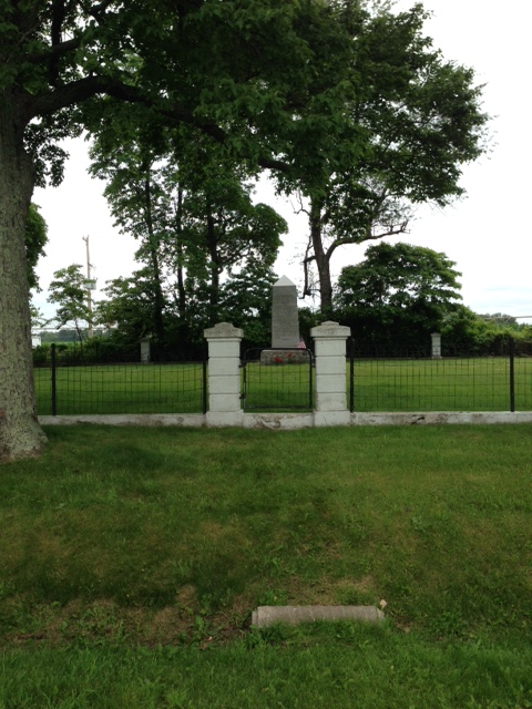
| Description | : | It was begun by the Tower Family who were early settlers in the area and still have family located near here. It is only the early Tower family that are buried here. There is one grave outside of the cemetery boundaries but it is not known who was buried there or when the burial took place. This memorial was erected by Ray J. Tower in memory of his mother, Editha Newton Tower and in memory of his sisters, Sarah, Augusta and Georgia, who rest here and in memory of his brother, George, who sleeps near Murfreesboro, Tennesee. |
frequently asked questions (FAQ):
-
Where is Tower Family Cemetery?
Tower Family Cemetery is located at South side of 12 Mile Road at Harvard Avenue Rockford, Kent County ,Michigan ,USA.
-
Tower Family Cemetery cemetery's updated grave count on graveviews.com?
0 memorials
-
Where are the coordinates of the Tower Family Cemetery?
Latitude: 43.1470280
Longitude: -85.4219210
Nearby Cemetories:
1. White Swan Cemetery
Rockford, Kent County, USA
Coordinate: 43.1474991, -85.4119034
2. Horton Cemetery
Oakfield Township, Kent County, USA
Coordinate: 43.1767006, -85.4111023
3. Oakfield Cemetery
Rockford, Kent County, USA
Coordinate: 43.1693993, -85.3814011
4. Courtland Township Cemetery
Rockford, Kent County, USA
Coordinate: 43.1521988, -85.4897003
5. Saint Margarets Catholic Cemetery
Spencer Township, Kent County, USA
Coordinate: 43.2063890, -85.4169440
6. DeGraw Family Cemetery
Cedar Springs, Kent County, USA
Coordinate: 43.2066585, -85.4283281
7. Bostwick Lake Cemetery
Rockford, Kent County, USA
Coordinate: 43.0849991, -85.4449997
8. Old Bostwick Lake Cemetery
Bostwick Lake, Kent County, USA
Coordinate: 43.0857130, -85.4510380
9. Grattan Cemetery
Grattan, Kent County, USA
Coordinate: 43.0837860, -85.3832420
10. Ashley Cemetery
Grattan Township, Kent County, USA
Coordinate: 43.1149560, -85.3329510
11. Spencer Mills Cemetery
Spencer Township, Kent County, USA
Coordinate: 43.2209920, -85.3556680
12. East Nelson Cemetery
Cedar Springs, Kent County, USA
Coordinate: 43.2355995, -85.4561005
13. Cannonsburg Cemetery
Belmont, Kent County, USA
Coordinate: 43.0647011, -85.4796982
14. Briggs Family Cemetery
Rockford, Kent County, USA
Coordinate: 43.1391670, -85.5508330
15. Rockford Pioneer Cemetery
Rockford, Kent County, USA
Coordinate: 43.1177780, -85.5525000
16. Rockford Cemetery
Rockford, Kent County, USA
Coordinate: 43.1152992, -85.5522003
17. Carmelite Cemetery
Parnell, Kent County, USA
Coordinate: 43.0431430, -85.4192810
18. Saint Patrick Cemetery
Ada, Kent County, USA
Coordinate: 43.0419440, -85.4097220
19. Wolverton Plains Cemetery
Greenville, Montcalm County, USA
Coordinate: 43.2094002, -85.3024979
20. Mason Cemetery
Grattan Township, Kent County, USA
Coordinate: 43.0611000, -85.3321991
21. Elmwood Cemetery
Cedar Springs, Kent County, USA
Coordinate: 43.2118988, -85.5532990
22. Saint Charles Catholic Cemetery
Greenville, Montcalm County, USA
Coordinate: 43.1889000, -85.2733002
23. Forest Home Cemetery
Greenville, Montcalm County, USA
Coordinate: 43.1638985, -85.2613983
24. Eureka Township Cemetery
Greenville, Montcalm County, USA
Coordinate: 43.1622500, -85.2603000

