
| Memorials | : | 18 |
| Location | : | Jacks Creek, Chester County, USA |
| Coordinate | : | 35.4284800, -88.5915870 |
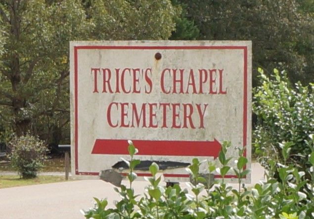
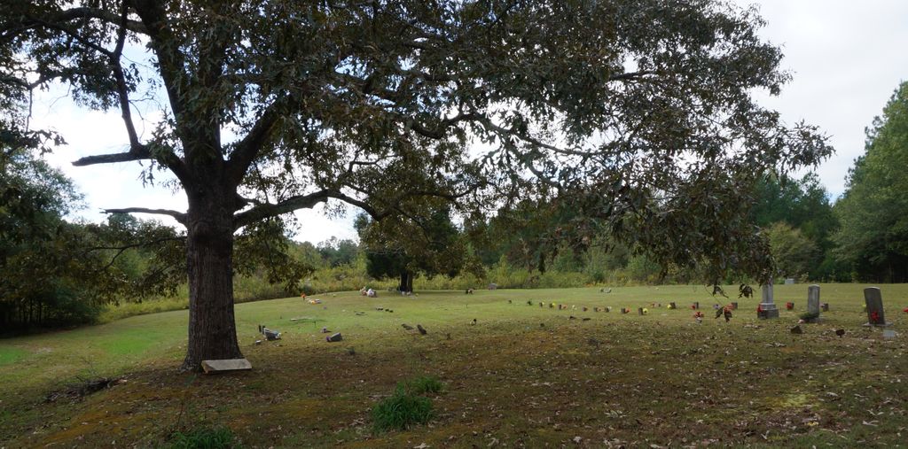
| Description | : | From Highway 45 drive east on Main Street (Highway 100) through Henderson, Tennessee, about 3.2 miles to Talley Store Road; turn onto this road, drive about 1.1 miles to Old Jacks Creek Road; turn east onto the latter road and drive about .6 mile to Enville Road, turn south onto this road and at a point about .5 mile turn west onto a gravel access lane and drive about .1 mile to the cemetery which is at the terminus of this lane. This is a very old burial ground. There are several hundred unmarked graves here. The old Trice Chapel... Read More |
frequently asked questions (FAQ):
-
Where is Trice's Chapel Cemetery?
Trice's Chapel Cemetery is located at Jacks Creek, Chester County ,Tennessee ,USA.
-
Trice's Chapel Cemetery cemetery's updated grave count on graveviews.com?
18 memorials
-
Where are the coordinates of the Trice's Chapel Cemetery?
Latitude: 35.4284800
Longitude: -88.5915870
Nearby Cemetories:
1. Ross Cemetery
Henderson, Chester County, USA
Coordinate: 35.4252000, -88.6088000
2. Brummer Cemetery
Henderson, Chester County, USA
Coordinate: 35.4262740, -88.6114100
3. Faith Baptist Church Cemetery
Henderson, Chester County, USA
Coordinate: 35.4155970, -88.5666890
4. Oak Grove Cemetery
Oak Grove, Chester County, USA
Coordinate: 35.4025002, -88.5858002
5. Smith Cemetery
Henderson, Chester County, USA
Coordinate: 35.4502983, -88.6207962
6. Robertson Cemetery
Henderson, Chester County, USA
Coordinate: 35.4013460, -88.5639870
7. Robinson Cemetery
Chester County, USA
Coordinate: 35.4011002, -88.5642014
8. Robertson Cemetery
Chester County, USA
Coordinate: 35.4616660, -88.5648800
9. Hart Cemetery
Chester County, USA
Coordinate: 35.4575005, -88.5552979
10. Old Oak Grove Cemetery
Henderson, Chester County, USA
Coordinate: 35.3879000, -88.5727200
11. Chester County Memory Gardens
Henderson, Chester County, USA
Coordinate: 35.4100760, -88.6411590
12. Henderson City Cemetery
Henderson, Chester County, USA
Coordinate: 35.4393997, -88.6453018
13. Harmony Cemetery
Chester County, USA
Coordinate: 35.3960991, -88.6311035
14. Tillman's Chapel Cemetery
Henderson, Chester County, USA
Coordinate: 35.3894610, -88.6225830
15. Wheatley Cemetery
Chester County, USA
Coordinate: 35.4738000, -88.5742000
16. Dean Cemetery
Henderson, Chester County, USA
Coordinate: 35.4437980, -88.6506490
17. Massengill Cemetery
Jacks Creek, Chester County, USA
Coordinate: 35.4299500, -88.5287180
18. Oak Grove Church of Christ Cemetery
Chester County, USA
Coordinate: 35.4756012, -88.5603027
19. Sanford Rodgers Cemetery
Chester County, USA
Coordinate: 35.4218970, -88.6611280
20. Estes Church of Christ Cemetery
Henderson, Chester County, USA
Coordinate: 35.3858370, -88.6398660
21. Old Estes Cemetery
Henderson, Chester County, USA
Coordinate: 35.3859790, -88.6462870
22. Kerby Family Cemetery
Finger, McNairy County, USA
Coordinate: 35.3656810, -88.5971940
23. House of Prayer Church Cemetery
Henderson, Chester County, USA
Coordinate: 35.4674470, -88.5300870
24. White Plains Cemetery
Finger, McNairy County, USA
Coordinate: 35.3731670, -88.5516960