
| Memorials | : | 0 |
| Location | : | Henderson, Chester County, USA |
| Coordinate | : | 35.4013460, -88.5639870 |
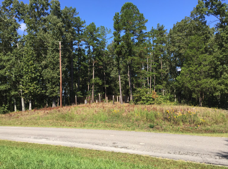
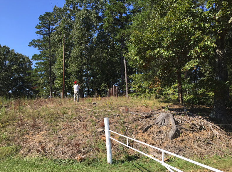
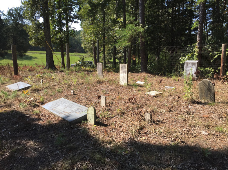
| Description | : | Located on the V. M. Plunk farm near Sand Hill, 670 Deerwood Road, Chester County, Henderson, TN. The cemetery is located left of the entrance gate on the bank near the road. |
frequently asked questions (FAQ):
-
Where is Robertson Cemetery?
Robertson Cemetery is located at 670 Deerwood Road Henderson, Chester County ,Tennessee , 383340USA.
-
Robertson Cemetery cemetery's updated grave count on graveviews.com?
0 memorials
-
Where are the coordinates of the Robertson Cemetery?
Latitude: 35.4013460
Longitude: -88.5639870
Nearby Cemetories:
1. Robinson Cemetery
Chester County, USA
Coordinate: 35.4011002, -88.5642014
2. Faith Baptist Church Cemetery
Henderson, Chester County, USA
Coordinate: 35.4155970, -88.5666890
3. Old Oak Grove Cemetery
Henderson, Chester County, USA
Coordinate: 35.3879000, -88.5727200
4. Oak Grove Cemetery
Oak Grove, Chester County, USA
Coordinate: 35.4025002, -88.5858002
5. White Plains Cemetery
Finger, McNairy County, USA
Coordinate: 35.3731670, -88.5516960
6. Trice's Chapel Cemetery
Jacks Creek, Chester County, USA
Coordinate: 35.4284800, -88.5915870
7. Sweetlips Cemetery
Sweet Lips, Chester County, USA
Coordinate: 35.3992004, -88.5205994
8. Massengill Cemetery
Jacks Creek, Chester County, USA
Coordinate: 35.4299500, -88.5287180
9. Malone Cemetery
Finger, McNairy County, USA
Coordinate: 35.3602440, -88.5572960
10. Anderson Slave Cemetery
Finger, McNairy County, USA
Coordinate: 35.3598000, -88.5659000
11. Ross Cemetery
Henderson, Chester County, USA
Coordinate: 35.4252000, -88.6088000
12. Hopewell Church Cemetery
Finger, McNairy County, USA
Coordinate: 35.3758011, -88.5203018
13. Kerby Family Cemetery
Finger, McNairy County, USA
Coordinate: 35.3656810, -88.5971940
14. Brummer Cemetery
Henderson, Chester County, USA
Coordinate: 35.4262740, -88.6114100
15. Tillman's Chapel Cemetery
Henderson, Chester County, USA
Coordinate: 35.3894610, -88.6225830
16. Harmony Cemetery
Chester County, USA
Coordinate: 35.3960991, -88.6311035
17. Hart Cemetery
Chester County, USA
Coordinate: 35.4575005, -88.5552979
18. Finger Church Cemetery
Finger, McNairy County, USA
Coordinate: 35.3581900, -88.6107260
19. Robertson Cemetery
Chester County, USA
Coordinate: 35.4616660, -88.5648800
20. Finger Christian Fellowship Cemetery
Finger, McNairy County, USA
Coordinate: 35.3576110, -88.6189170
21. Chester County Memory Gardens
Henderson, Chester County, USA
Coordinate: 35.4100760, -88.6411590
22. Estes Church of Christ Cemetery
Henderson, Chester County, USA
Coordinate: 35.3858370, -88.6398660
23. Mount Carmel Cemetery
Finger, McNairy County, USA
Coordinate: 35.3424988, -88.6003036
24. Smith Cemetery
Henderson, Chester County, USA
Coordinate: 35.4502983, -88.6207962