
| Memorials | : | 0 |
| Location | : | Eudora, DeSoto County, USA |
| Coordinate | : | 34.8072810, -90.1789750 |
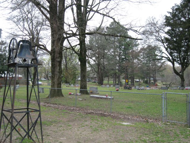
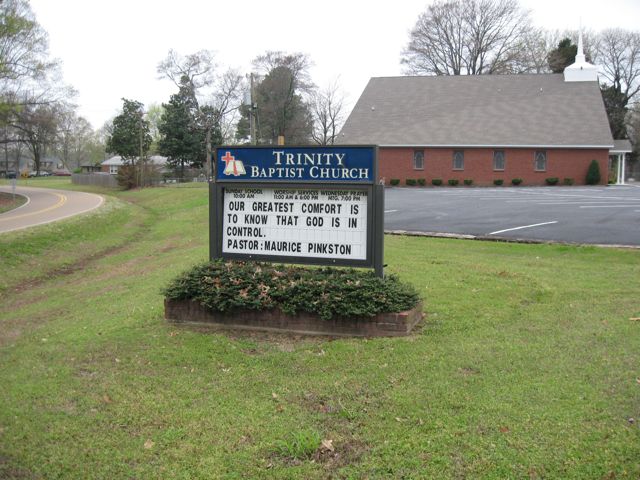
| Description | : | From the intersection of MS-301 & I-69, east of Lake Cormorant, travel south on MS-301 S for 2.6 mi.; turning west (right) onto MS-304, going 1.8 mi.; turning south (left) onto Bluff Rd., going 1.3 mi.; turning west (right) to stay on Bluff Rd., going 210'; turning south (left) into the parking lot of the Trinity Baptist Church & to their 'deeded' cemetery to the west of the church, as notated on USGS topo maps. |
frequently asked questions (FAQ):
-
Where is Trinity Baptist Cemetery?
Trinity Baptist Cemetery is located at 3669 Bluff Rd Eudora, DeSoto County ,Mississippi ,USA.
-
Trinity Baptist Cemetery cemetery's updated grave count on graveviews.com?
0 memorials
-
Where are the coordinates of the Trinity Baptist Cemetery?
Latitude: 34.8072810
Longitude: -90.1789750
Nearby Cemetories:
1. Goodrum Memorial Cemetery
Eudora, DeSoto County, USA
Coordinate: 34.8307290, -90.1673980
2. Koko Reef Church of Christ Cemetery
Hernando, DeSoto County, USA
Coordinate: 34.7811260, -90.1857990
3. Pleasant Grove CME Church Cemetery
Eudora, DeSoto County, USA
Coordinate: 34.7947270, -90.1475890
4. Old Eudora Baptist Cemetery
Eudora, DeSoto County, USA
Coordinate: 34.8356300, -90.1485860
5. Union Hill Cemetery
Eudora, DeSoto County, USA
Coordinate: 34.7710470, -90.1640790
6. Eudora Baptist Cemetery
Eudora, DeSoto County, USA
Coordinate: 34.8372500, -90.1494100
7. Second Eudora M. B. Church Cemetery
Lake Cormorant, DeSoto County, USA
Coordinate: 34.8300900, -90.1400310
8. Bullard's Chapel CME Cemetery
Eudora, DeSoto County, USA
Coordinate: 34.8596720, -90.1318260
9. Ella Green Baptist Church Cemetery
Coldwater, Tate County, USA
Coordinate: 34.7416920, -90.1293610
10. Pleasant Hill MB Church Cemetery
Pleasant Hill, DeSoto County, USA
Coordinate: 34.7863640, -90.0852230
11. Oak Grove Church Cemetery
Hernando, DeSoto County, USA
Coordinate: 34.8092190, -90.0782130
12. Brown Family Cemetery
Hernando, DeSoto County, USA
Coordinate: 34.7933040, -90.0769560
13. Rising Sun Road Cemetery
Hernando, DeSoto County, USA
Coordinate: 34.8231110, -90.0694400
14. Johnson Chapel Cemetery
Tunica County, USA
Coordinate: 34.8025017, -90.2906036
15. Bethlehem Cemetery
Tunica County, USA
Coordinate: 34.8011017, -90.2949982
16. Rising Sun MB Church Cemetery
Lake Cormorant, DeSoto County, USA
Coordinate: 34.8619600, -90.2751200
17. Liberty Hill Church Cemetery
Lake Cormorant, DeSoto County, USA
Coordinate: 34.9007690, -90.1500420
18. New Pleasant Hill MB Church Cemetery
Arkabutla, Tate County, USA
Coordinate: 34.7136680, -90.1506790
19. Shiloh Cemetery
Tunica County, USA
Coordinate: 34.7425003, -90.2675018
20. Mullin Cemetery
Tunica County, USA
Coordinate: 34.8418465, -90.2980499
21. Dean Hill Baptist Church Cemetery
Lake Cormorant, DeSoto County, USA
Coordinate: 34.8755930, -90.0827820
22. Bluff Road Cemetery
Arkabutla, Tate County, USA
Coordinate: 34.6992110, -90.1842580
23. Glenns Chapel Church Cemetery
Lake Cormorant, DeSoto County, USA
Coordinate: 34.9040230, -90.1131410
24. Dean Family Cemetery
Nesbit, DeSoto County, USA
Coordinate: 34.8861650, -90.0839050