
| Memorials | : | 0 |
| Location | : | Pima County, USA |
| Coordinate | : | 31.9041996, -111.0658035 |
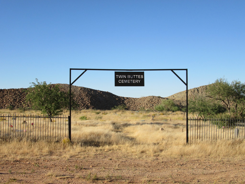
| Description | : | The cemetery is on private property owned by a mining company and is only accessible to family members of the deceased or by special permission. They have erected a fence around the cemetery, but is believed that many of the headstones were buried by mining tailings and are under tons of rubble. |
frequently asked questions (FAQ):
-
Where is Twin Buttes Cemetery?
Twin Buttes Cemetery is located at Pima County ,Arizona ,USA.
-
Twin Buttes Cemetery cemetery's updated grave count on graveviews.com?
0 memorials
-
Where are the coordinates of the Twin Buttes Cemetery?
Latitude: 31.9041996
Longitude: -111.0658035

Nearby Cemetories:
1. Green Valley Cemetery
Sahuarita, Pima County, USA
Coordinate: 31.9094009, -110.9944992
2. Good Shepherd United Church of Christ Columbarium
Sahuarita, Pima County, USA
Coordinate: 31.9280600, -110.9956000
3. UMC of Green Valley Memorial Garden
Green Valley, Pima County, USA
Coordinate: 31.8713710, -110.9958050
4. Saint Francis-in-the-Valley Episcopal Church Colum
Green Valley, Pima County, USA
Coordinate: 31.8608500, -110.9976400
5. Lutheran Church of the Risen Savior Columbarium
Green Valley, Pima County, USA
Coordinate: 31.8619580, -110.9958520
6. Desert Hills Lutheran Church Columbarium
Green Valley, Pima County, USA
Coordinate: 31.8385990, -111.0167810
7. Valley Presbyterian Church Columbarium
Green Valley, Pima County, USA
Coordinate: 31.8297600, -111.0156500
8. La Posada Columbarium
Green Valley, Pima County, USA
Coordinate: 31.8611333, -110.9777222
9. Nelson Sawyer Cemetery
Green Valley, Pima County, USA
Coordinate: 31.8878498, -110.9592293
10. Continental Cemetery
Continental, Pima County, USA
Coordinate: 31.8516617, -110.9667969
11. McGee Ranch Cemetery
Green Valley, Pima County, USA
Coordinate: 31.8934000, -111.1820000
12. Arivaca Junction Cemetery
Arivaca Junction, Pima County, USA
Coordinate: 31.7375500, -111.0522100
13. Amado Cemetery
Amado, Santa Cruz County, USA
Coordinate: 31.7078000, -111.0709200
14. San Xavier Cemetery
Tucson, Pima County, USA
Coordinate: 32.1076012, -111.0142975
15. San Xavier del Bac Chapel Cemetery
Pima County, USA
Coordinate: 32.1070000, -111.0082500
16. Monte Calvario Cemetery
Tucson, Pima County, USA
Coordinate: 32.1146011, -111.0748978
17. Whitehouse Gravesite
Madera Canyon, Santa Cruz County, USA
Coordinate: 31.7401562, -110.8862305
18. Helvetia Cemetery
Pima County, USA
Coordinate: 31.8514004, -110.8080978
19. Los Reales Cemetery
Tucson, Pima County, USA
Coordinate: 32.1194440, -110.9819440
20. Madera Canyon Gravesite
Madera Canyon, Santa Cruz County, USA
Coordinate: 31.7348000, -110.8823700
21. Ahmadiyya Muslim Cemetery
Tucson, Pima County, USA
Coordinate: 32.1520360, -110.9513440
22. South Lawn Memorial Cemetery
Tucson, Pima County, USA
Coordinate: 32.1521988, -110.9494019
23. Mount Zion Lutheran Church Memorial Garden
Tucson, Pima County, USA
Coordinate: 32.1749500, -111.0613070
24. Tellos-Ramos-Espinosa-Lopez Burial Site
Calabasas, Santa Cruz County, USA
Coordinate: 31.6295700, -111.0414200