| Memorials | : | 0 |
| Location | : | Madera Canyon, Santa Cruz County, USA |
| Coordinate | : | 31.7401562, -110.8862305 |
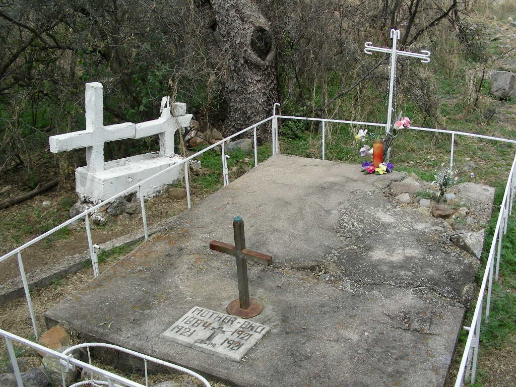
| Description | : | The graves of a mother and her infant son who lived at the Whitehouse. The Whitehouse stood at the entrance to Madera Canyon. From I-19. Exit 63 -- Continental. East on White House Canyon Rd. Stay on pavement as it turns South (Madera Canyon Rd.) To access this gravesite, park in the Proctor Parking Area. Take the trail south. The gravesite is to the East of the trail before you cross Proctor Road (dirtroad). The White House Ruins are located on the other side of Proctor Road. Note that there is another gravesite in the canyon. See the Madera Canyon Gravesite. |
frequently asked questions (FAQ):
-
Where is Whitehouse Gravesite?
Whitehouse Gravesite is located at Madera Canyon, Santa Cruz County ,Arizona ,USA.
-
Whitehouse Gravesite cemetery's updated grave count on graveviews.com?
0 memorials
-
Where are the coordinates of the Whitehouse Gravesite?
Latitude: 31.7401562
Longitude: -110.8862305
Nearby Cemetories:
1. Madera Canyon Gravesite
Madera Canyon, Santa Cruz County, USA
Coordinate: 31.7348000, -110.8823700
2. Greaterville Cemetery
Greaterville, Pima County, USA
Coordinate: 31.7647000, -110.7505100
3. Alto Cemetery
Alto, Santa Cruz County, USA
Coordinate: 31.6208500, -110.8749200
4. Helvetia Cemetery
Pima County, USA
Coordinate: 31.8514004, -110.8080978
5. Continental Cemetery
Continental, Pima County, USA
Coordinate: 31.8516617, -110.9667969
6. Arivaca Junction Cemetery
Arivaca Junction, Pima County, USA
Coordinate: 31.7375500, -111.0522100
7. Valley Presbyterian Church Columbarium
Green Valley, Pima County, USA
Coordinate: 31.8297600, -111.0156500
8. La Posada Columbarium
Green Valley, Pima County, USA
Coordinate: 31.8611333, -110.9777222
9. Salero Ranch Cemetery
Tubac, Santa Cruz County, USA
Coordinate: 31.5933100, -110.8965100
10. Desert Hills Lutheran Church Columbarium
Green Valley, Pima County, USA
Coordinate: 31.8385990, -111.0167810
11. Lutheran Church of the Risen Savior Columbarium
Green Valley, Pima County, USA
Coordinate: 31.8619580, -110.9958520
12. Saint Francis-in-the-Valley Episcopal Church Colum
Green Valley, Pima County, USA
Coordinate: 31.8608500, -110.9976400
13. Nelson Sawyer Cemetery
Green Valley, Pima County, USA
Coordinate: 31.8878498, -110.9592293
14. Amado Cemetery
Amado, Santa Cruz County, USA
Coordinate: 31.7078000, -111.0709200
15. UMC of Green Valley Memorial Garden
Green Valley, Pima County, USA
Coordinate: 31.8713710, -110.9958050
16. Tellos-Ramos-Espinosa-Lopez Burial Site
Calabasas, Santa Cruz County, USA
Coordinate: 31.6295700, -111.0414200
17. Tubac Cemetery
Tubac, Santa Cruz County, USA
Coordinate: 31.6162000, -111.0489000
18. Green Valley Cemetery
Sahuarita, Pima County, USA
Coordinate: 31.9094009, -110.9944992
19. Hall
Sonoita, Santa Cruz County, USA
Coordinate: 31.6741000, -110.6555760
20. Good Shepherd United Church of Christ Columbarium
Sahuarita, Pima County, USA
Coordinate: 31.9280600, -110.9956000
21. Saint Josephs Cemetery
Tumacacori, Santa Cruz County, USA
Coordinate: 31.5655500, -111.0375900
22. Tumacacori Mission Cemetery
Tumacacori, Santa Cruz County, USA
Coordinate: 31.5688000, -111.0509000
23. Twin Buttes Cemetery
Pima County, USA
Coordinate: 31.9041996, -111.0658035
24. Patagonia Cemetery
Patagonia, Santa Cruz County, USA
Coordinate: 31.5316940, -110.7631890

