
| Memorials | : | 0 |
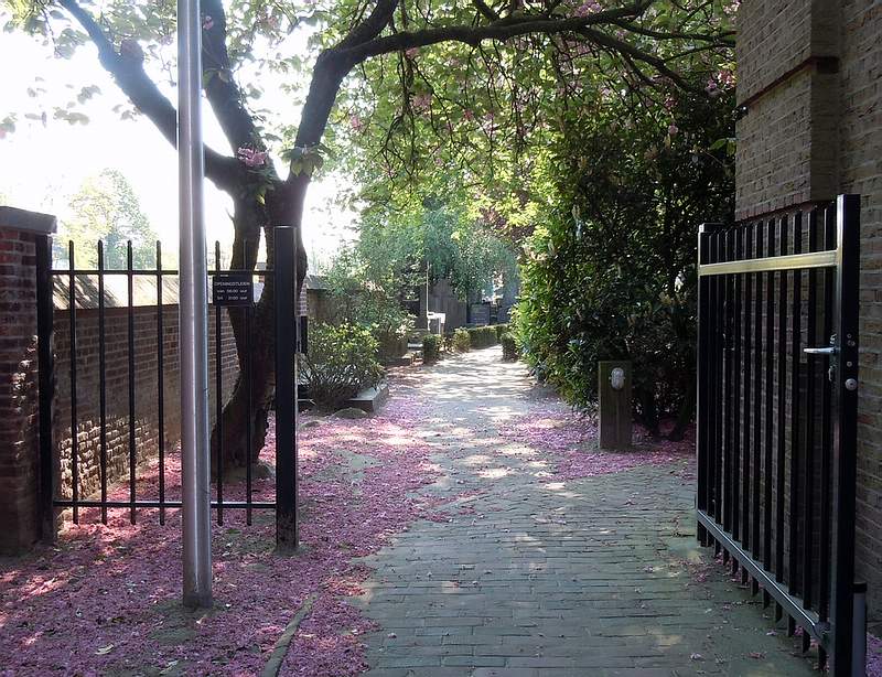
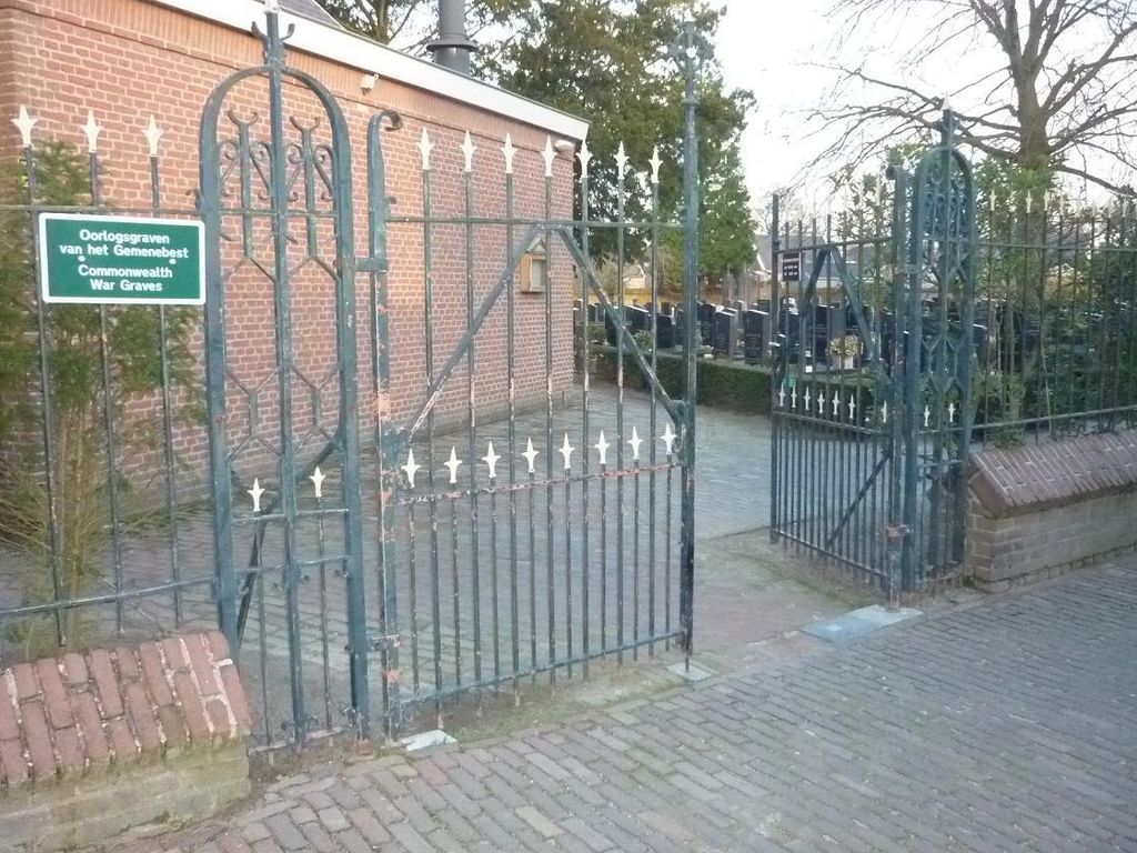
| Location | : | Udenhout, Tilburg Municipality, Netherlands |
| Coordinate | : | 51.6106700, 5.1412200 |
frequently asked questions (FAQ):
-
Where is Udenhout Roman Catholic Churchyard?
Udenhout Roman Catholic Churchyard is located at Udenhout, Tilburg Municipality ,Noord-Brabant ,Netherlands.
-
Udenhout Roman Catholic Churchyard cemetery's updated grave count on graveviews.com?
0 memorials
-
Where are the coordinates of the Udenhout Roman Catholic Churchyard?
Latitude: 51.6106700
Longitude: 5.1412200
Nearby Cemetories:
1. Berkel Roman Catholic Cemetery
Berkel-Enschot, Tilburg Municipality, Netherlands
Coordinate: 51.5889200, 5.1430100
2. Biezenmortel Roman Catholic Cemetery
Biezenmortel, Haaren Municipality, Netherlands
Coordinate: 51.6241100, 5.1786400
3. St. Peter Roman Catholic Churchyard
Oisterwijk, Oisterwijk Municipality, Netherlands
Coordinate: 51.5780500, 5.1841500
4. Oisterwijk Protestant Churchyard
Oisterwijk, Oisterwijk Municipality, Netherlands
Coordinate: 51.5796900, 5.1874600
5. Joodse Begraafplaats
Oisterwijk, Oisterwijk Municipality, Netherlands
Coordinate: 51.5659700, 5.1857700
6. Tilburg Goirke Roman Catholic Cemetery
Tilburg, Tilburg Municipality, Netherlands
Coordinate: 51.5729600, 5.0808700
7. RK begraafplaats Hasselt
Tilburg Municipality, Netherlands
Coordinate: 51.5712940, 5.0756710
8. Tilburg Sint-Joseph Roman Catholic Cemetery
Tilburg, Tilburg Municipality, Netherlands
Coordinate: 51.5560700, 5.1042200
9. Sint-Nicolaaskerk
Helvoirt, Haaren Municipality, Netherlands
Coordinate: 51.6342300, 5.2295500
10. Tilburg Heike Roman Catholic Cemetery
Tilburg, Tilburg Municipality, Netherlands
Coordinate: 51.5553200, 5.0780800
11. Moergestel Rooms Katholieke Begraafplaats
Moergestel, Oisterwijk Municipality, Netherlands
Coordinate: 51.5436600, 5.1858400
12. Tilburg Broekhoven Catholic Cemetery
Tilburg, Tilburg Municipality, Netherlands
Coordinate: 51.5452770, 5.0883180
13. Kaatsheuvel Sint-Jozef Kerkhof
Kaatsheuvel, Loon op Zand Municipality, Netherlands
Coordinate: 51.6570600, 5.0470500
14. Cromvoirt Sint-Lambertus Roman Catholic Cemetery
Cromvoirt, Vught Municipality, Netherlands
Coordinate: 51.6615300, 5.2309800
15. Drunen Roman Catholic Cemetery
Drunen, Heusden Municipality, Netherlands
Coordinate: 51.6885800, 5.1295700
16. Tilburg Korvel Roman Catholic Cemetery
Tilburg, Tilburg Municipality, Netherlands
Coordinate: 51.5472900, 5.0663900
17. Joodes Begraafplaats
Tilburg Municipality, Netherlands
Coordinate: 51.5590130, 5.0418920
18. Gilzerbaan General Cemetery
Tilburg, Tilburg Municipality, Netherlands
Coordinate: 51.5544500, 5.0463600
19. Elshout Roman Catholic Churchyard
Elshout, Heusden Municipality, Netherlands
Coordinate: 51.7004700, 5.1364900
20. St. Johannes Roman Catholic Churchyard
Waalwijk, Waalwijk Municipality, Netherlands
Coordinate: 51.6894300, 5.0676600
21. Nieuwkuijk Algemene Begraafplaats Onsenoort
Nieuwkuijk, Heusden Municipality, Netherlands
Coordinate: 51.6974300, 5.1895300
22. Israëlitische begraafplaats
Vught, Vught Municipality, Netherlands
Coordinate: 51.6549100, 5.2793800
23. Goirle Maria Boodschap Roman Catholic Cemetery
Goirle, Goirle Municipality, Netherlands
Coordinate: 51.5259300, 5.0632200
24. Loonschedijk Protestant Cemetery
Loon op Zand, Loon op Zand Municipality, Netherlands
Coordinate: 51.6700400, 5.0130500