
| Memorials | : | 8 |
| Location | : | Laconia, Harrison County, USA |
| Coordinate | : | 38.0730362, -86.1044769 |
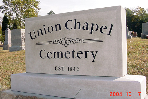
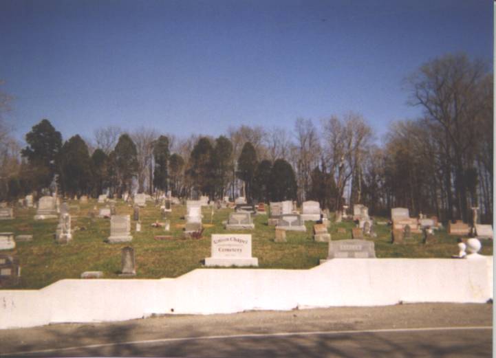
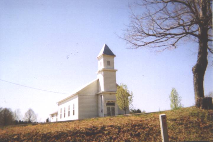
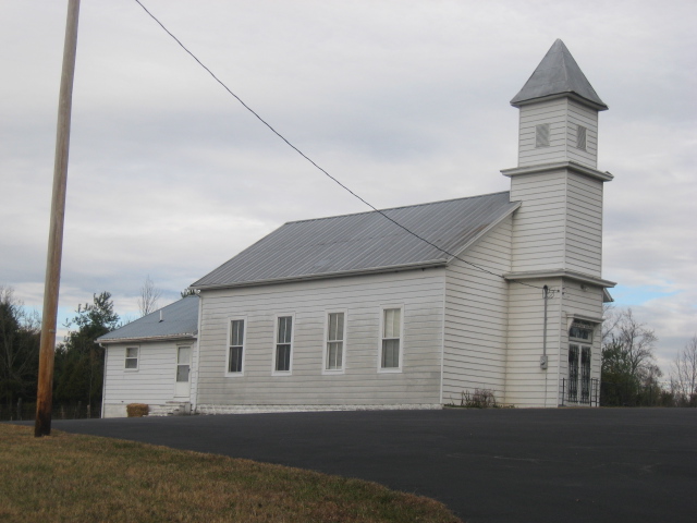
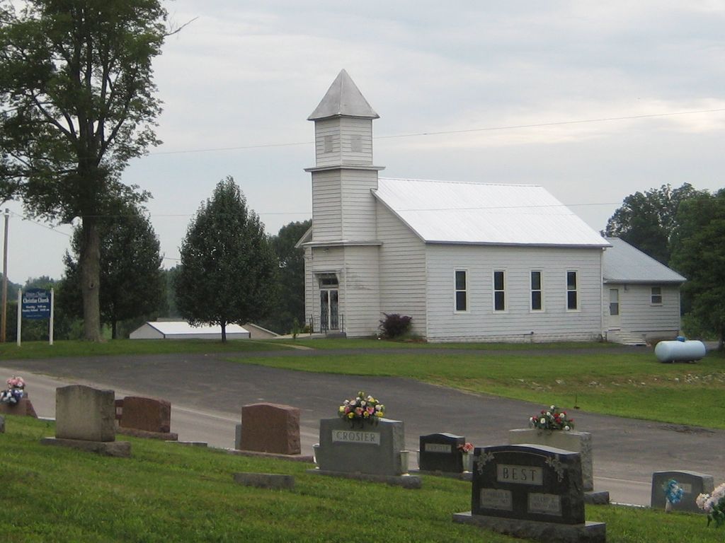
| Description | : | The cemetery is located in Boone Township (SW quadrant of the NW quadrant of the SW quadrant of Section 17 Township 5S Range 4E) on the east side of Union Chapel Road SE about 0.3 miles north of its intersection with W Old Goshen Road SE. Indiana Cemetery Locations, Volume 4, published by the Indiana Genealogical Society (April 2009), gives the primary cemetery name as Union Chapel Cemetery. The cemetery is listed in the Cemetery and Burial Grounds Registry of the Indiana Department of Natural Resources (DNR) and in the State Historical Architectural and Archaeological Research Database (SHAARD)... Read More |
frequently asked questions (FAQ):
-
Where is Union Chapel Cemetery?
Union Chapel Cemetery is located at Union Chapel Road SE Laconia, Harrison County ,Indiana , 47135USA.
-
Union Chapel Cemetery cemetery's updated grave count on graveviews.com?
3 memorials
-
Where are the coordinates of the Union Chapel Cemetery?
Latitude: 38.0730362
Longitude: -86.1044769
Nearby Cemetories:
1. Ellis Family Plot
Harrison County, USA
Coordinate: 38.0693690, -86.0956870
2. Guest Family Plot
Laconia, Harrison County, USA
Coordinate: 38.0652000, -86.0998590
3. Reed Cemetery
Central, Harrison County, USA
Coordinate: 38.0767784, -86.1169739
4. Old Goshen Cemetery
Laconia, Harrison County, USA
Coordinate: 38.0681000, -86.0777969
5. Eckart Cemetery
Central, Harrison County, USA
Coordinate: 38.0950699, -86.1099396
6. Squire Boone Caverns
Mauckport, Harrison County, USA
Coordinate: 38.0650150, -86.1340850
7. Eckart Cemetery
Dogwood, Harrison County, USA
Coordinate: 38.1027300, -86.0953700
8. Cady Cemetery
Glidas, Harrison County, USA
Coordinate: 38.0541180, -86.1414520
9. Cedar Farm Cemetery
Laconia, Harrison County, USA
Coordinate: 38.0541180, -86.1414520
10. Saint Michaels Catholic Cemetery
Dogwood, Harrison County, USA
Coordinate: 38.0981712, -86.0738831
11. Collins Chapel Cemetery
Central, Harrison County, USA
Coordinate: 38.1077830, -86.1131990
12. Brown-McIntyre Cemetery
Laconia, Harrison County, USA
Coordinate: 38.0546000, -86.0623000
13. Duggins-Eckart Cemetery
Dogwood, Harrison County, USA
Coordinate: 38.1091000, -86.0867000
14. Sands Cemetery
Laconia, Harrison County, USA
Coordinate: 38.0445150, -86.0700650
15. Smith Campground Cemetery
Dogwood, Harrison County, USA
Coordinate: 38.1052322, -86.0754166
16. Dunkard Cemetery
Dogwood, Harrison County, USA
Coordinate: 38.0939040, -86.0598350
17. Payton Cemetery
Dogwood, Harrison County, USA
Coordinate: 38.0952900, -86.0597400
18. Entrican Cemetery
Harrison County, USA
Coordinate: 38.0293884, -86.1059723
19. Beswick Cemetery
Laconia, Harrison County, USA
Coordinate: 38.0293999, -86.0761032
20. Central Cemetery
Central, Harrison County, USA
Coordinate: 38.0969048, -86.1589661
21. Marsh Burying Grounds
Laconia, Harrison County, USA
Coordinate: 38.0245094, -86.0948563
22. Williams Cemetery
Dogwood, Harrison County, USA
Coordinate: 38.1265260, -86.1222270
23. Jackson Cemetery
Harrison County, USA
Coordinate: 38.1266530, -86.1271540
24. Rehoboth Cemetery
Laconia, Harrison County, USA
Coordinate: 38.0608330, -86.0316696