
| Memorials | : | 0 |
| Location | : | Jackson, Clarke County, USA |
| Coordinate | : | 31.6341991, -87.8878021 |
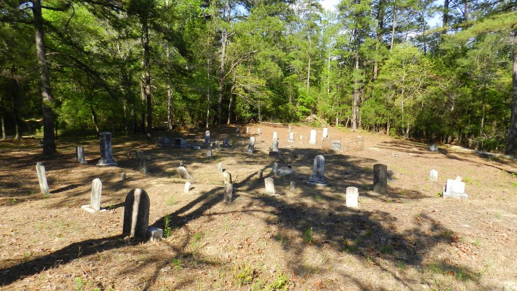
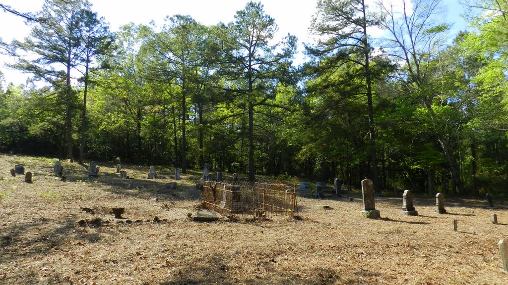
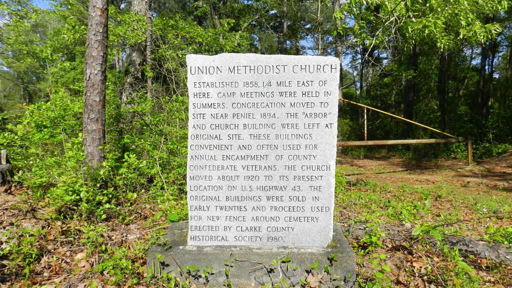
| Description | : | Cemetery is located approximately ¼ mile off Winn Road; look for cemetery marker in photograph which is next to the dirt one-lane path up to property. It is blocked by a gate and not visible from Winn Road. |
frequently asked questions (FAQ):
-
Where is Union Methodist Church Cemetery?
Union Methodist Church Cemetery is located at Winn Road Jackson, Clarke County ,Alabama ,USA.
-
Union Methodist Church Cemetery cemetery's updated grave count on graveviews.com?
0 memorials
-
Where are the coordinates of the Union Methodist Church Cemetery?
Latitude: 31.6341991
Longitude: -87.8878021

Nearby Cemetories:
1. Pine Chapel No. 2 Missionary Baptist Church Cemete
Toddtown, Clarke County, USA
Coordinate: 31.6183510, -87.8762470
2. Smith Family Cemetery
Clarke County, USA
Coordinate: 31.6549160, -87.8751330
3. Peniel Cemetery
McVay, Clarke County, USA
Coordinate: 31.6110992, -87.9002991
4. Harrell Family Cemetery
Grove Hill, Clarke County, USA
Coordinate: 31.6346402, -87.8529718
5. Antioch Cemetery
Jackson, Clarke County, USA
Coordinate: 31.6238995, -87.8544006
6. Hollingsworth Cemetery
Clarke County, USA
Coordinate: 31.6285992, -87.8442001
7. Bethlehem Cemetery
Jackson, Clarke County, USA
Coordinate: 31.6299570, -87.9427500
8. Pine Chapel No. 1 Baptist Church Cemetery
Grove Hill, Clarke County, USA
Coordinate: 31.6705570, -87.8357040
9. Mathews Cemetery
Grove Hill, Clarke County, USA
Coordinate: 31.6599998, -87.8202972
10. Jackson Memorial Gardens Cemetery
Clarke County, USA
Coordinate: 31.5688992, -87.8641968
11. Trinity Memorial Gardens
Jackson, Clarke County, USA
Coordinate: 31.5685900, -87.8636200
12. Gaddies Chapel Cemetery
Clarke County, USA
Coordinate: 31.5722008, -87.8463974
13. Tompkins Family Cemetery
Grove Hill, Clarke County, USA
Coordinate: 31.6574570, -87.8040980
14. Parker Cemetery
Jackson, Clarke County, USA
Coordinate: 31.5592400, -87.8834400
15. Tompkins Baptist Church Cemetery
Grove Hill, Clarke County, USA
Coordinate: 31.6585999, -87.8022003
16. Mount Zion Cemetery
Clarke County, USA
Coordinate: 31.5628270, -87.9287980
17. Pleasant Grove Baptist Church Cemetery
Jackson, Clarke County, USA
Coordinate: 31.6847000, -87.9636002
18. Pugh Cemetery
Grove Hill, Clarke County, USA
Coordinate: 31.7003210, -87.8302180
19. Union Baptist Church Cemetery
Grove Hill, Clarke County, USA
Coordinate: 31.6255000, -87.7857300
20. Stave Creek Baptist Church Cemetery
Clarke County, USA
Coordinate: 31.5530610, -87.9348250
21. Austin Cemetery
Clarke County, USA
Coordinate: 31.7150002, -87.9366989
22. Bell Parker Cemetery
Jackson, Clarke County, USA
Coordinate: 31.5429600, -87.8829590
23. Clarkesville Cemetery
Clarksville, Clarke County, USA
Coordinate: 31.7325001, -87.8778000
24. Saint Lukes Cemetery
Clarke County, USA
Coordinate: 31.7327995, -87.8783035