
| Memorials | : | 1 |
| Location | : | Bramfield, Suffolk Coastal District, England |
| Coordinate | : | 52.3119170, 1.5183490 |
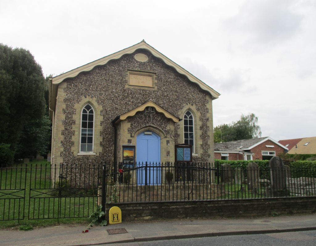
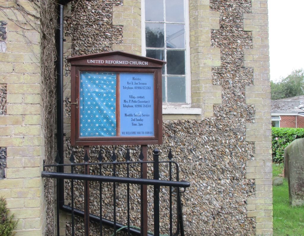
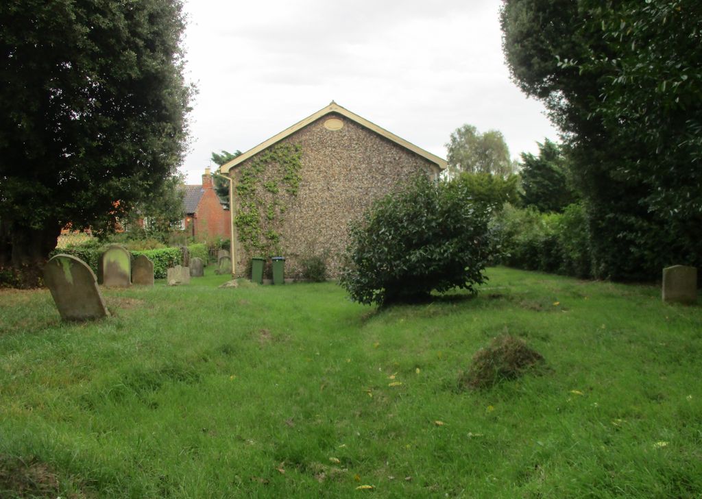
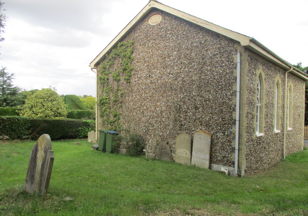
| Description | : | Situated on the main road through the village of Bramfield. Known as Bramfield United Reform Church. |
frequently asked questions (FAQ):
-
Where is United Reform Churchyard?
United Reform Churchyard is located at Bramfield, Suffolk Coastal District ,Suffolk ,England.
-
United Reform Churchyard cemetery's updated grave count on graveviews.com?
1 memorials
-
Where are the coordinates of the United Reform Churchyard?
Latitude: 52.3119170
Longitude: 1.5183490
Nearby Cemetories:
1. St. Andrew's Churchyard
Bramfield, Suffolk Coastal District, England
Coordinate: 52.3102311, 1.5179990
2. Saint Peter's Churchyard
Thorington, Suffolk Coastal District, England
Coordinate: 52.3118310, 1.5534681
3. St Mary Churchyard
Halesworth, Waveney District, England
Coordinate: 52.3423990, 1.5013380
4. Halesworth Cemetery
Halesworth, Waveney District, England
Coordinate: 52.3437080, 1.5097340
5. All Saints Churchyard
Blyford, Waveney District, England
Coordinate: 52.3351840, 1.5574440
6. Saint Peter's Churchyard
Holton, Waveney District, England
Coordinate: 52.3462540, 1.5259730
7. Halesworth & Bramfield United Reformed Churchy
Halesworth, Waveney District, England
Coordinate: 52.3456000, 1.5033000
8. All Saints Churchyard
Darsham, Suffolk Coastal District, England
Coordinate: 52.2741900, 1.5474200
9. St Michael and All Angels Churchyard
Cookley, Suffolk Coastal District, England
Coordinate: 52.3258980, 1.4466090
10. Holy Trinity Churchyard
Blythburgh, Suffolk Coastal District, England
Coordinate: 52.3211920, 1.5947390
11. St. Peter's Churchyard
Sibton, Suffolk Coastal District, England
Coordinate: 52.2730300, 1.4688850
12. St. Mary Churchyard
Chediston, Suffolk Coastal District, England
Coordinate: 52.3475100, 1.4613130
13. St Andrews Churchyard
Wissett, Waveney District, England
Coordinate: 52.3606730, 1.4735980
14. St. Mary The Virgin Churchyard
Huntingfield, Suffolk Coastal District, England
Coordinate: 52.3170350, 1.4263510
15. St. Peter's Churchyard
Spexhall, Waveney District, England
Coordinate: 52.3678960, 1.4923050
16. St Michael Churchyard
Peasenhall, Suffolk Coastal District, England
Coordinate: 52.2706000, 1.4509580
17. St Margaret Churchyard
Heveningham, Suffolk Coastal District, England
Coordinate: 52.3017670, 1.4209263
18. Peasenhall Cemetery
Peasenhall, Suffolk Coastal District, England
Coordinate: 52.2693020, 1.4474450
19. St. Andrew's Churchyard
Westhall, Waveney District, England
Coordinate: 52.3683891, 1.5580100
20. St Andrew's Churchyard
Sotherton, Waveney District, England
Coordinate: 52.3591930, 1.5837900
21. Holy Trinity Churchyard
Middleton, Suffolk Coastal District, England
Coordinate: 52.2542140, 1.5589130
22. St. Margaret's Churchyard of Antioch
Linstead Parva, Suffolk Coastal District, England
Coordinate: 52.3477630, 1.4302960
23. St. Peter's Churchyard
Ubbeston, Suffolk Coastal District, England
Coordinate: 52.3021220, 1.4062940
24. St. James's Churchyard
Dunwich, Suffolk Coastal District, England
Coordinate: 52.2779090, 1.6261340