
| Memorials | : | 27 |
| Location | : | Salina, Jefferson County, USA |
| Coordinate | : | 41.0602989, -91.8807983 |
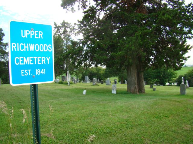
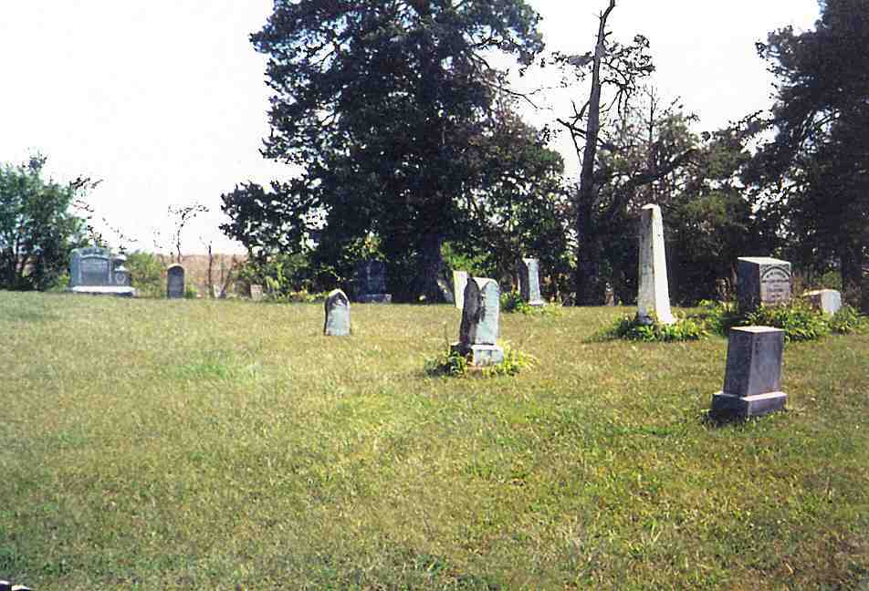
| Description | : | Upper Richwoods cemetery is located in Buchanan Twp., Section 10. On south side of gravel road on 170th St. between Okra and Quince. Cleaned up in 1989 but needs more repairs. 8 Stones fallen or leaning. Note: 76 children under age 5 years are buried in this cemetery. Burials from 1841 to present. Photo taken Sept. 3, 2001. Identity of photographer not indicated. |
frequently asked questions (FAQ):
-
Where is Upper Richwoods Cemetery?
Upper Richwoods Cemetery is located at Salina, Jefferson County ,Iowa ,USA.
-
Upper Richwoods Cemetery cemetery's updated grave count on graveviews.com?
27 memorials
-
Where are the coordinates of the Upper Richwoods Cemetery?
Latitude: 41.0602989
Longitude: -91.8807983
Nearby Cemetories:
1. Perlee Cemetery
Perlee, Jefferson County, USA
Coordinate: 41.0805750, -91.8993380
2. Switzer Cemetery
Fairfield, Jefferson County, USA
Coordinate: 41.0368996, -91.9096985
3. Wheeler Cemetery
Jefferson County, USA
Coordinate: 41.0797000, -91.9185500
4. Westenhaver Family Cemetery
Perlee, Jefferson County, USA
Coordinate: 41.0968240, -91.8829110
5. Chillcott Family Cemetery
Jefferson County, USA
Coordinate: 41.0558000, -91.8286300
6. Salina Cemetery
Salina, Jefferson County, USA
Coordinate: 41.0419006, -91.8330994
7. Antioch Cemetery
Fairfield, Jefferson County, USA
Coordinate: 41.1002998, -91.9147034
8. Bethesda Cemetery
Fairfield, Jefferson County, USA
Coordinate: 41.0019000, -91.8796000
9. Peterson Cemetery
Lockridge, Jefferson County, USA
Coordinate: 41.0393982, -91.8075027
10. Moyer Cemetery
Fairfield, Jefferson County, USA
Coordinate: 41.1046982, -91.9330978
11. Lower Richwoods Cemetery
Salina, Jefferson County, USA
Coordinate: 41.0882000, -91.8085000
12. Walnut Creek Friends Cemetery
Pleasant Plain, Jefferson County, USA
Coordinate: 41.1237500, -91.8747500
13. Polishville Cemetery
East Pleasant Plain, Jefferson County, USA
Coordinate: 41.1116982, -91.8131027
14. Evergreen Cemetery
Fairfield, Jefferson County, USA
Coordinate: 41.0138600, -91.9562100
15. Old Fairfield Cemetery
Fairfield, Jefferson County, USA
Coordinate: 41.0148000, -91.9598000
16. Saint Josephs Cemetery
Pleasant Plain, Jefferson County, USA
Coordinate: 41.1357994, -91.8463974
17. New Sweden Baptist Cemetery
Jefferson County, USA
Coordinate: 41.0242004, -91.7857971
18. Union Cemetery
Lockridge Township, Jefferson County, USA
Coordinate: 40.9878000, -91.8266000
19. New Sweden Lutheran Cemetery
Lockridge, Jefferson County, USA
Coordinate: 41.0238991, -91.7797012
20. Bradshaw Cemetery
Jefferson County, USA
Coordinate: 40.9766998, -91.9032974
21. New Sweden United Methodist Church Cemetery
Lockridge, Jefferson County, USA
Coordinate: 41.0247002, -91.7752991
22. Friends Cemetery
Pleasant Plain, Jefferson County, USA
Coordinate: 41.1478004, -91.8636017
23. McDowell Cemetery
Fairfield, Jefferson County, USA
Coordinate: 41.1380997, -91.9460983
24. Memorial Lawn Cemetery
Fairfield, Jefferson County, USA
Coordinate: 41.0068000, -91.9805000