
| Memorials | : | 1 |
| Location | : | Utrecht, Utrecht Municipality, Netherlands |
| Coordinate | : | 52.0539430, 5.0832590 |
frequently asked questions (FAQ):
-
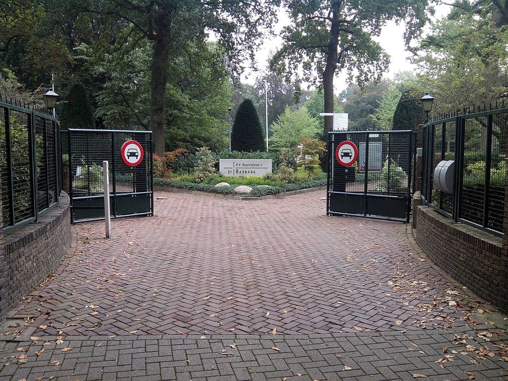
Where is Utrecht Sint-Barbara Roman Catholic Cemetery?
Utrecht Sint-Barbara Roman Catholic Cemetery is located at Prinsesselaan 2 Utrecht, Utrecht Municipality ,Utrecht , 3583 GZNetherlands.
-
Utrecht Sint-Barbara Roman Catholic Cemetery cemetery's updated grave count on graveviews.com?
1 memorials
-
Where are the coordinates of the Utrecht Sint-Barbara Roman Catholic Cemetery?
Latitude: 52.0539430
Longitude: 5.0832590

Nearby Cemetories:
1. Noorderveld
Nieuwegein, Nieuwegein Municipality, Netherlands
Coordinate: 52.0421660, 5.1026720
2. Kerkveld Algemene Begraafplaats
Nieuwegein, Nieuwegein Municipality, Netherlands
Coordinate: 52.0371800, 5.0857400
3. Hoge Akker Begraafplaats
IJsselstein, IJsselstein Municipality, Netherlands
Coordinate: 52.0357500, 5.0380900
4. Utrecht Tolsteeg Cemetery
Utrecht, Utrecht Municipality, Netherlands
Coordinate: 52.0724100, 5.1318400
5. Utrecht Soestbergen Algemene Begraafplaats
Utrecht, Utrecht Municipality, Netherlands
Coordinate: 52.0776100, 5.1295100
6. Utrecht Kovelswade Algemene Begraafplaats
Utrecht, Utrecht Municipality, Netherlands
Coordinate: 52.0759735, 5.1351638
7. Mariakerk
Utrecht, Utrecht Municipality, Netherlands
Coordinate: 52.0891440, 5.1166030
8. Sint Nicolaas Kerk
IJsselstein, IJsselstein Municipality, Netherlands
Coordinate: 52.0206960, 5.0449240
9. Utrecht Buurkerk
Utrecht, Utrecht Municipality, Netherlands
Coordinate: 52.0904890, 5.1192320
10. Utrecht Dom Church
Utrecht, Utrecht Municipality, Netherlands
Coordinate: 52.0908090, 5.1217480
11. Vreeswijk Protestant Cemetery
Vreeswijk, Nieuwegein Municipality, Netherlands
Coordinate: 52.0048700, 5.0974600
12. Tull En 't Waal Protestant Cemetery
Tull en 't Waal, Houten Municipality, Netherlands
Coordinate: 52.0017900, 5.1330300
13. Katholieke begraafplaats
Vleuten, Utrecht Municipality, Netherlands
Coordinate: 52.1007835, 5.0162086
14. Vianen Protestant Cemetery
Vianen, Vianen Municipality, Netherlands
Coordinate: 51.9867800, 5.0891100
15. Joodse Begraafplaats
Vianen Municipality, Netherlands
Coordinate: 51.9862400, 5.0874000
16. Oud Protestant begraafplaats
Vleuten, Utrecht Municipality, Netherlands
Coordinate: 52.1065676, 5.0124286
17. Utrecht Daelwijck Cemetery
Utrecht, Utrecht Municipality, Netherlands
Coordinate: 52.1285300, 5.0942700
18. Sint-Barbarakerk Begraafplaats
Bunnik, Bunnik Municipality, Netherlands
Coordinate: 52.0662689, 5.2050647
19. Benschop General Cemetery
Benschop, Lopik Municipality, Netherlands
Coordinate: 52.0097300, 4.9784100
20. Oude Kerkhof Dorpskerk
De Bilt, De Bilt Municipality, Netherlands
Coordinate: 52.1044724, 5.1818385
21. Oud-Zuilen Cemetery
Oud-Zuilen, Stichtse Vecht Municipality, Netherlands
Coordinate: 52.1326100, 5.0685200
22. Begraafplaats ‘t Spijck
Harmelen, Woerden Municipality, Netherlands
Coordinate: 52.1004944, 4.9735318
23. Groenekan Nederlands Hevormde Begraafplaats
Groenekan, De Bilt Municipality, Netherlands
Coordinate: 52.1192100, 5.1654300
24. Montfoort General Cemetery
Montfoort, Montfoort Municipality, Netherlands
Coordinate: 52.0434800, 4.9451700