
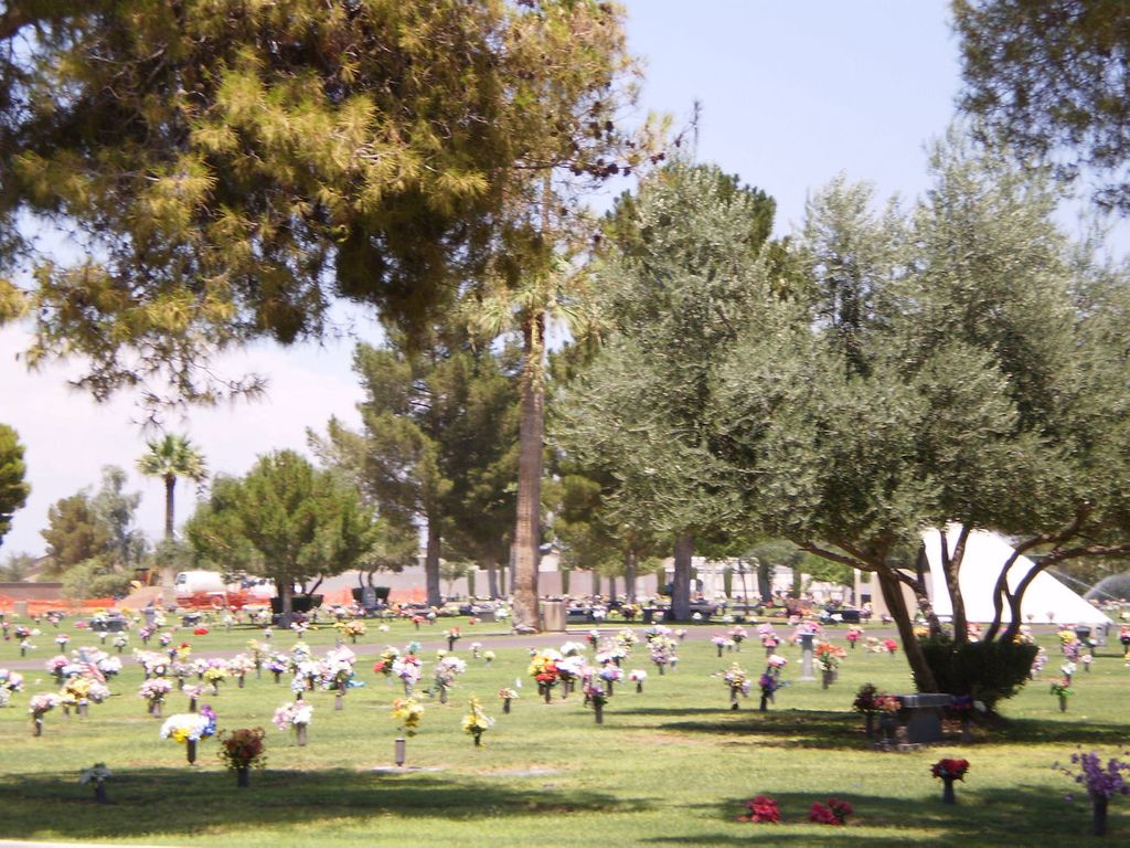
| Memorials | : | 58 |
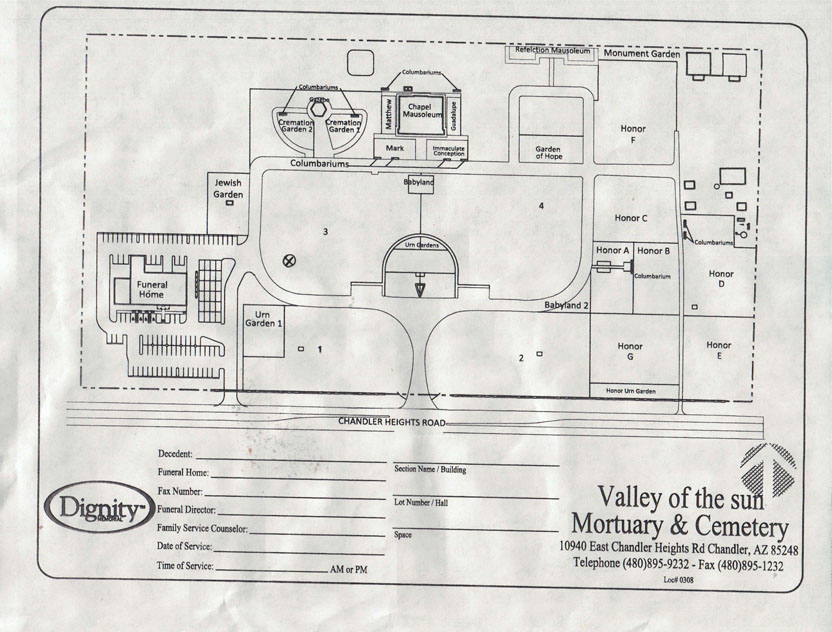
| Location | : | Chandler, Maricopa County, USA |
| Phone | : | 480-895-9232 |
| Coordinate | : | 33.2330818, -111.8478851 |
| Description | : | Cemetery will release plot information only to family members. |
frequently asked questions (FAQ):
-
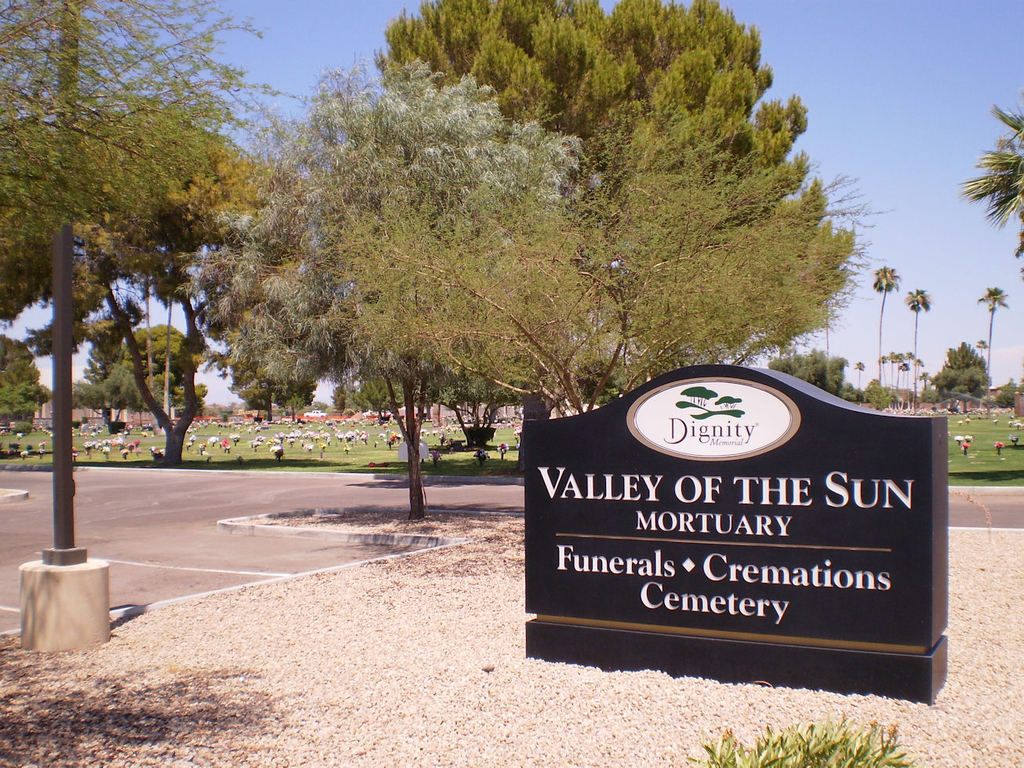
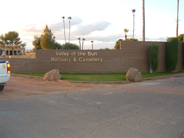
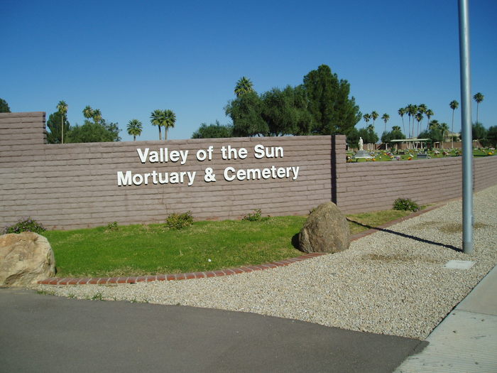
Where is Valley of the Sun Mortuary and Cemetery?
Valley of the Sun Mortuary and Cemetery is located at 10940 E. Chandler Heights Road Chandler, Maricopa County ,Arizona ,USA.
-
Valley of the Sun Mortuary and Cemetery cemetery's updated grave count on graveviews.com?
54 memorials
-
Where are the coordinates of the Valley of the Sun Mortuary and Cemetery?
Latitude: 33.2330818
Longitude: -111.8478851
Nearby Cemetories:
1. Goodyear-Ocotillo Cemetery
Chandler, Maricopa County, USA
Coordinate: 33.2360992, -111.8486023
2. Risen Savior Lutheran Church Columbarium
Chandler, Maricopa County, USA
Coordinate: 33.2296040, -111.8596590
3. Sun Lakes Methodist Church Columbarium
Sun Lakes, Maricopa County, USA
Coordinate: 33.2183800, -111.8829900
4. Snaketown Cemetery
Santan, Pinal County, USA
Coordinate: 33.1822530, -111.9086410
5. Holy Trinity Lutheran Church Memory Gardens
Chandler, Maricopa County, USA
Coordinate: 33.3094100, -111.8532100
6. Saint Matthew’s Episcopal Church Memorial Garden
Chandler, Maricopa County, USA
Coordinate: 33.3092540, -111.8573010
7. Stotonic Cemetery
Stotonic, Pinal County, USA
Coordinate: 33.1567590, -111.7981930
8. Gilbert Memorial Park
Gilbert, Maricopa County, USA
Coordinate: 33.2633783, -111.7456097
9. Lower Santan Cemetery
Sacaton, Pinal County, USA
Coordinate: 33.1493430, -111.7892470
10. Bapchule Cemetery
Bapchule, Pinal County, USA
Coordinate: 33.1367500, -111.8791200
11. Sweetwater Cemetery
Sweetwater, Pinal County, USA
Coordinate: 33.1319975, -111.8406922
12. Sand Trail Cemetery
Sweetwater, Pinal County, USA
Coordinate: 33.1284880, -111.8523050
13. Santan Day School Cemetery
Sacaton, Pinal County, USA
Coordinate: 33.1412500, -111.7647590
14. Mission del Sol Presbyterian Church Columbarium
Tempe, Maricopa County, USA
Coordinate: 33.3347090, -111.9145440
15. First United Methodist Church Columbarium
Gilbert, Maricopa County, USA
Coordinate: 33.3435440, -111.8057160
16. Desert Cross Lutheran Church Columbarium
Tempe, Maricopa County, USA
Coordinate: 33.3372060, -111.9117590
17. Saint James Episcopal Church Memorial Garden
Tempe, Maricopa County, USA
Coordinate: 33.3343160, -111.9274950
18. Vah-Ki Cemetery
Casa Blanca, Pinal County, USA
Coordinate: 33.1175700, -111.9053300
19. Saint Ann Cemetery
Pinal County, USA
Coordinate: 33.1241989, -111.7397003
20. Cowboy Cemetery
Sacate, Pinal County, USA
Coordinate: 33.1408400, -111.9776700
21. Upper Santan Cemetery
Sacaton, Pinal County, USA
Coordinate: 33.1232420, -111.7376830
22. Desert Palm United Church of Christ Columbarium
Tempe, Maricopa County, USA
Coordinate: 33.3647120, -111.9184340
23. Gethsemane Lutheran Church Memorial Garden
Tempe, Maricopa County, USA
Coordinate: 33.3634360, -111.9246770
24. Queen of Heaven Catholic Cemetery
Mesa, Maricopa County, USA
Coordinate: 33.3800011, -111.8000031