
| Memorials | : | 0 |
| Location | : | Fonda, Montgomery County, USA |
| Coordinate | : | 42.9726600, -74.3716800 |
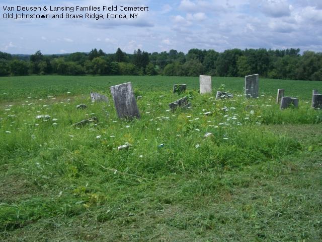
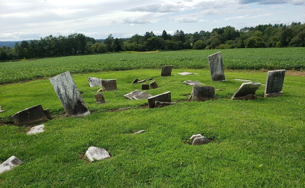
| Description | : | This field cemetery is located on Old Johnstown Road near the intersection with Brave Ridge Road in the town of Mohawk, Montgomery County, NY. It is unkept and only a few of the stones are readable. It appears to contain members of the Van Deusen and Lansing families. |
frequently asked questions (FAQ):
-
Where is Van Deusen and Lansing Family Burial Ground?
Van Deusen and Lansing Family Burial Ground is located at Old Johnstown Road Fonda, Montgomery County ,New York , 12068USA.
-
Van Deusen and Lansing Family Burial Ground cemetery's updated grave count on graveviews.com?
0 memorials
-
Where are the coordinates of the Van Deusen and Lansing Family Burial Ground?
Latitude: 42.9726600
Longitude: -74.3716800
Nearby Cemetories:
1. Wemple Cemetery
Montgomery County, USA
Coordinate: 42.9729729, -74.3899765
2. Saint Cecilia Cemetery
Fonda, Montgomery County, USA
Coordinate: 42.9619600, -74.3836900
3. Sammons Cemetery
Mohawk, Montgomery County, USA
Coordinate: 42.9766300, -74.3913900
4. Caughnawaga Cemetery
Fonda, Montgomery County, USA
Coordinate: 42.9571991, -74.3681030
5. Caughnawaga Castle Site
Montgomery County, USA
Coordinate: 42.9542910, -74.3928310
6. Fultonville Cemetery and Natural Burial Ground
Fultonville, Montgomery County, USA
Coordinate: 42.9450188, -74.3735657
7. Van Epps-Starin Cemetery
Fultonville, Montgomery County, USA
Coordinate: 42.9427780, -74.3709450
8. Saint Patricks Cemetery
Johnstown, Fulton County, USA
Coordinate: 43.0022011, -74.3557968
9. Gardinier Cemetery
Fultonville, Montgomery County, USA
Coordinate: 42.9440560, -74.3477760
10. Sir William Johnson Grave
Johnstown, Fulton County, USA
Coordinate: 43.0067030, -74.3730360
11. Evergreen Cemetery
Fonda, Montgomery County, USA
Coordinate: 42.9552994, -74.4131012
12. Colonial Cemetery
Johnstown, Fulton County, USA
Coordinate: 43.0080986, -74.3732986
13. Maple Avenue Cemetery
Fultonville, Montgomery County, USA
Coordinate: 42.9385695, -74.3570231
14. Johnstown Cemetery
Johnstown, Fulton County, USA
Coordinate: 43.0101800, -74.3701900
15. Boshart Cemetery
Fulton County, USA
Coordinate: 43.0010986, -74.4064026
16. Schenck Martin Farm Graveyard
Fonda, Montgomery County, USA
Coordinate: 42.9429330, -74.4074330
17. Saint Anthonys Cemetery
Johnstown, Fulton County, USA
Coordinate: 43.0133018, -74.3566971
18. Mount Carmel Cemetery
Johnstown, Fulton County, USA
Coordinate: 43.0144005, -74.3550034
19. Danascara Cemetery
Tribes Hill, Montgomery County, USA
Coordinate: 42.9396090, -74.3175850
20. Printup Burial Ground
Stone Ridge, Montgomery County, USA
Coordinate: 42.9305500, -74.4136700
21. Auriesville Cemetery
Glen, Montgomery County, USA
Coordinate: 42.9287900, -74.3133300
22. Quackenbush Cemetery
Auriesville, Montgomery County, USA
Coordinate: 42.9286120, -74.3132120
23. Ferndale Cemetery
Johnstown, Fulton County, USA
Coordinate: 43.0353012, -74.3630981
24. Pine Grove Cemetery
Tribes Hill, Montgomery County, USA
Coordinate: 42.9527950, -74.2863210