
| Memorials | : | 0 |
| Location | : | Aurlandsvangen, Aurland kommune, Norway |
| Coordinate | : | 60.9069870, 7.1888140 |
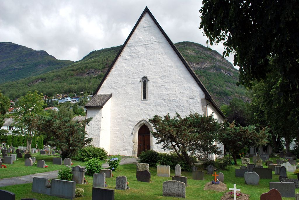
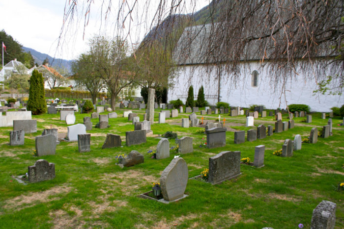
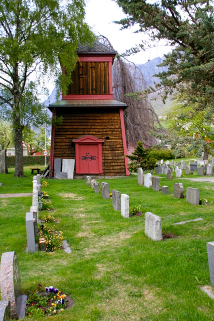
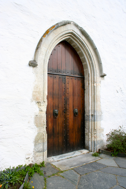
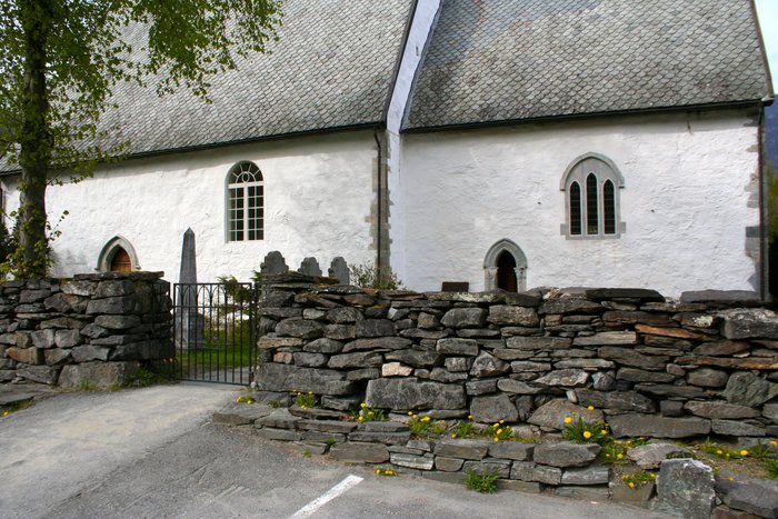
| Description | : | Vangen Kyrkje The Vangen Church was built in 1202. It was built by an ancient family who lived in Aurland in the Viking Age and Middle Ages. The church is built in the early Gothic style influenced by English architecture. A document written in 1714 tells us that the English merchants used to stay in Aurland during long periods to buy different articles and they are supposed to have taken part in the building of the church. Most likely they were have been the master builders. In 1725, the Danish-Norwegian government in financial problems and King Frederick IV sold the church. The... Read More |
frequently asked questions (FAQ):
-
Where is Vangen Kyrkje?
Vangen Kyrkje is located at Aurlandsvangen, Aurland kommune ,Sogn og Fjordane fylke ,Norway.
-
Vangen Kyrkje cemetery's updated grave count on graveviews.com?
0 memorials
-
Where are the coordinates of the Vangen Kyrkje?
Latitude: 60.9069870
Longitude: 7.1888140
Nearby Cemetories:
1. Flaam Church Cemetery
Flam, Aurland kommune, Norway
Coordinate: 60.8378100, 7.1208500
2. Fresvik Church Cemetery
Fresvik, Vik kommune, Norway
Coordinate: 61.0733490, 6.9391750
3. Jordal gravplass
Jordalen, Voss kommune, Norway
Coordinate: 60.8826107, 6.7179916
4. Hauge Church Cemetery
Lærdal kommune, Norway
Coordinate: 61.0991905, 7.4948466
5. Kaupanger
Kaupanger, Sogndal kommune, Norway
Coordinate: 61.1844770, 7.2333140
6. Norum Cemetery
Sogndalsfjora, Sogndal kommune, Norway
Coordinate: 61.1707220, 6.9939710
7. Oppheim Church Cemetery
Voss kommune, Norway
Coordinate: 60.7927800, 6.5752800
8. Oppheim Gamle kyrkjegard
Voss kommune, Norway
Coordinate: 60.7935686, 6.5717445
9. Stedje Church
Sogndalsfjora, Sogndal kommune, Norway
Coordinate: 61.2265220, 7.0957300
10. Borgund Stave Church Cemetery
Laerdalsoyri, Lærdal kommune, Norway
Coordinate: 61.0473408, 7.8126800
11. Skiple gravplass
Skiple, Voss kommune, Norway
Coordinate: 60.6830308, 6.6731636
12. Vinje Church Cemetery
Vinje, Voss kommune, Norway
Coordinate: 60.7925000, 6.5112000
13. Raundalen kyrkjegard
Voss kommune, Norway
Coordinate: 60.6777170, 6.6328429
14. Ulvik Nye
Ulvik, Ulvik kommune, Norway
Coordinate: 60.5696820, 6.9176740
15. Rossvoll Kirkegaard
Ulvik, Ulvik kommune, Norway
Coordinate: 60.5694440, 6.9180160
16. Solvorn Gamle
Solvorn, Luster kommune, Norway
Coordinate: 61.2995680, 7.2365000
17. Hafslo Church Cemetery
Luster kommune, Norway
Coordinate: 61.3109330, 7.1842360
18. Aardalstangen Cemetery
Ardal, Jølster kommune, Norway
Coordinate: 61.2384580, 7.7067610
19. Granvin Kyrkjegård
Granvin, Granvin kommune, Norway
Coordinate: 60.5552000, 6.7320000
20. Tjugum Cemetery
Balestrand, Balestrand kommune, Norway
Coordinate: 61.2154570, 6.5430400
21. Kyrkjetræet kyrkjegard
Eidfjord, Eidfjord kommune, Norway
Coordinate: 60.4621100, 7.0715000
22. Eidfjord gamle Kyrkje
Eidfjord, Eidfjord kommune, Norway
Coordinate: 60.4617720, 7.0715580
23. Tunshovden
Voss, Voss kommune, Norway
Coordinate: 60.6275030, 6.4239051
24. Voss Cemetery
Voss, Voss kommune, Norway
Coordinate: 60.6271990, 6.4230530