
| Memorials | : | 0 |
| Location | : | Sand Fork, Gilmer County, USA |
| Coordinate | : | 38.9254709, -80.7212012 |
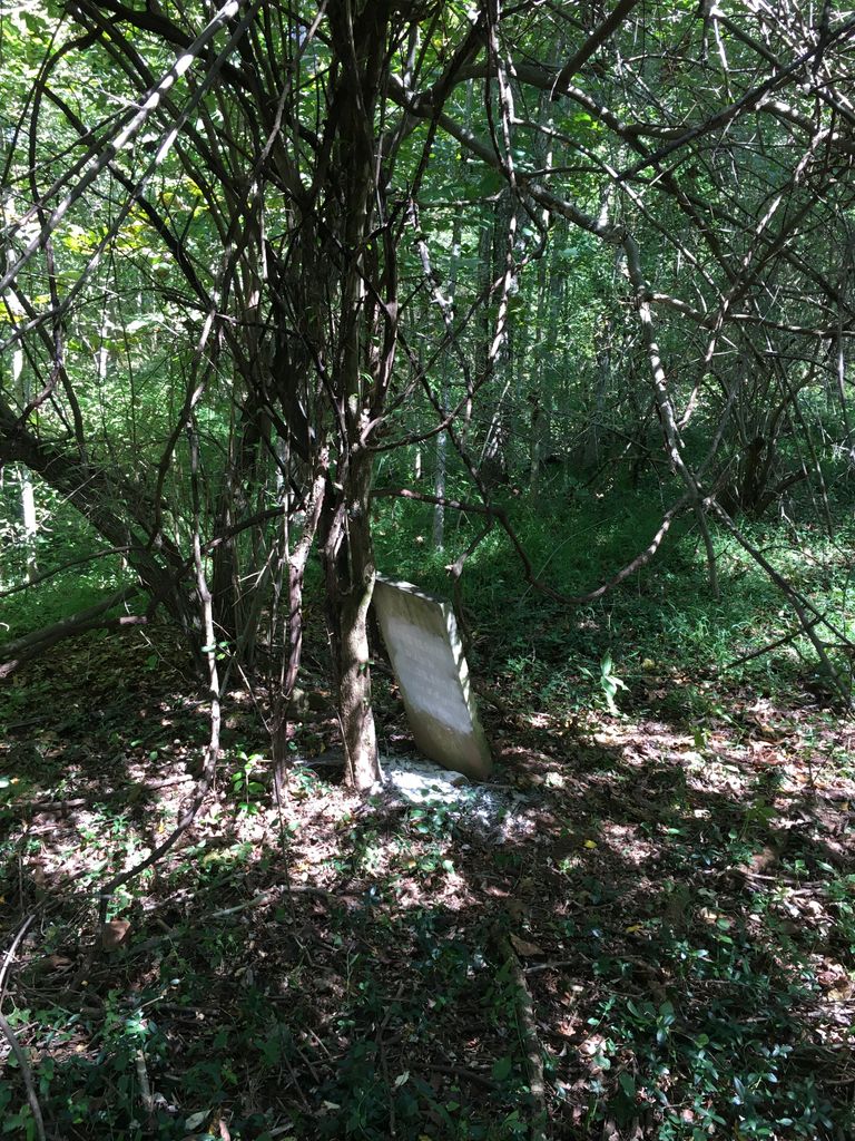
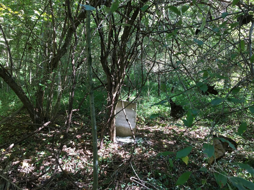
| Description | : | The Varner Cemetery is located roughly 0.4 miles up Joes Run Rd off of Sand Fork, and up the bank to the left of the road; it is less than 50 yards from the edge of the pavement in thick brush. There is one headstone (that of Elias Varner), a depression (too large to be just one grave?), and 2 fieldstones thought to be the head and foot of another grave (but not aligned with said headstone). There is no fence. |
frequently asked questions (FAQ):
-
Where is Varner Cemetery?
Varner Cemetery is located at Joes Run Rd Sand Fork, Gilmer County ,West Virginia ,USA.
-
Varner Cemetery cemetery's updated grave count on graveviews.com?
0 memorials
-
Where are the coordinates of the Varner Cemetery?
Latitude: 38.9254709
Longitude: -80.7212012
Nearby Cemetories:
1. Killingsworth Cemetery
Sand Fork, Gilmer County, USA
Coordinate: 38.9169640, -80.7249834
2. Dyer Cemetery
Gilmer County, USA
Coordinate: 38.9319000, -80.7110977
3. McHenry Cemetery #1
Sand Fork, Gilmer County, USA
Coordinate: 38.9353310, -80.7162630
4. McHenry Cemetery
Gilmer County, USA
Coordinate: 38.9341870, -80.7130200
5. Conrad Cemetery
Sand Fork, Gilmer County, USA
Coordinate: 38.9364014, -80.7296982
6. Sand Fork Cemetery
Gilmer County, USA
Coordinate: 38.9158890, -80.7480520
7. Rogers Cemetery
Gilmer County, USA
Coordinate: 38.9406013, -80.6936035
8. Canfield Cemetery
Gilmer, Gilmer County, USA
Coordinate: 38.9071999, -80.6900024
9. Dusk Camp United Methodist Church Cemetery
Gilmer County, USA
Coordinate: 38.8961140, -80.7325440
10. Snyder Cemetery
Gilmer County, USA
Coordinate: 38.9006004, -80.6964035
11. Schoonover-Dawson Cemetery
Donlan, Gilmer County, USA
Coordinate: 38.9461770, -80.6854790
12. Keith Cemetery
Gilmer County, USA
Coordinate: 38.9561005, -80.6986008
13. Blackburn Cemetery
Blackburn, Gilmer County, USA
Coordinate: 38.9235700, -80.6743200
14. Smith Cemetery
Stouts Mills, Gilmer County, USA
Coordinate: 38.8901800, -80.7333800
15. Isaac B. Garrett Burial Site
Sand Fork, Gilmer County, USA
Coordinate: 38.8934000, -80.7443200
16. Locust Knob Cemetery
Stouts Mills, Gilmer County, USA
Coordinate: 38.8990000, -80.6880000
17. Conrad Cemetery
Stouts Mills, Gilmer County, USA
Coordinate: 38.8869019, -80.7264023
18. Stout Cemetery
Stouts Mills, Gilmer County, USA
Coordinate: 38.8863000, -80.7341000
19. Unity Memorial Garden
Eastover, Richland County, USA
Coordinate: 38.8840220, -80.7040760
20. Hiney Hill Cemetery
Linn, Gilmer County, USA
Coordinate: 38.9676950, -80.7405600
21. Boilon Cemetery
Gilmer County, USA
Coordinate: 38.9519005, -80.6718979
22. Longshoal Cemetery
Gilmer, Gilmer County, USA
Coordinate: 38.8774030, -80.7055340
23. Tumbling Cemetery
Gilmer County, USA
Coordinate: 38.9085999, -80.6594009
24. Tomblin Cemetery
Blackburn, Gilmer County, USA
Coordinate: 38.9076650, -80.6597330