
| Memorials | : | 4 |
| Location | : | Falun, Falu kommun, Sweden |
| Coordinate | : | 60.5133980, 15.7138820 |
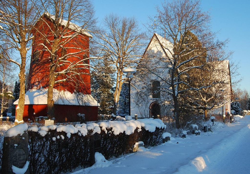
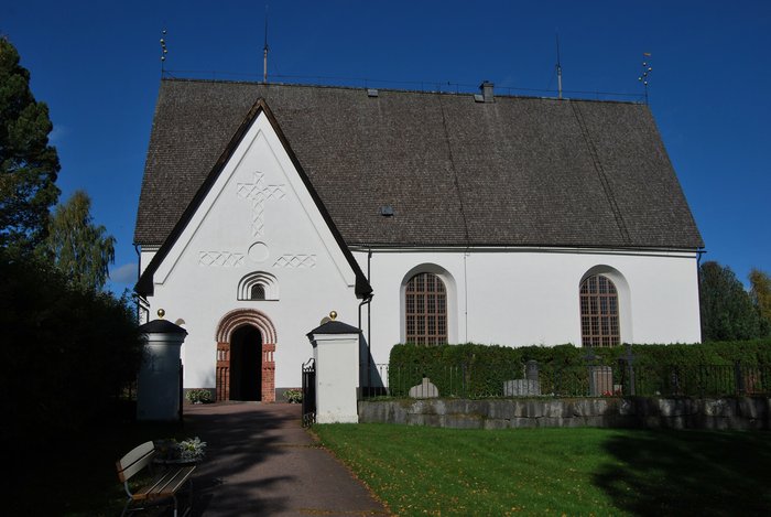
| Description | : | The present church of Vika, probably opened in 1469, has been found in excavations to be the third in order within the same walls. Sometimes during the 1100's a wooden church was erected but later burnt down. In its place a small stone church was built whose walls partially are included in the current rectangular gray stone church. The church has beautiful frescoes from the 1500's. Under the church floor are many old graves. The church had an earthen floor until 1852. In the churchyard stands a belltower from the 1600's. The belltower supports a very large church bell from... Read More |
frequently asked questions (FAQ):
-
Where is Vika kyrkogard?
Vika kyrkogard is located at Vikav. 128 Falun, Falu kommun ,Dalarnas län , 791 95Sweden.
-
Vika kyrkogard cemetery's updated grave count on graveviews.com?
4 memorials
-
Where are the coordinates of the Vika kyrkogard?
Latitude: 60.5133980
Longitude: 15.7138820
Nearby Cemetories:
1. Kristine kyrka
Falun, Falu kommun, Sweden
Coordinate: 60.6077780, 15.6311110
2. Stora Tuna Kyrkogård
Borlänge, Borlänge kommun, Sweden
Coordinate: 60.4501730, 15.4786630
3. Saters Hospital Cemetery
Sater, Säters kommun, Sweden
Coordinate: 60.3367970, 15.6970542
4. Smälla griftegård
Idkerberget, Borlänge kommun, Sweden
Coordinate: 60.3554776, 15.2147511
5. Envikens Kyrkogård
Enviken, Falu kommun, Sweden
Coordinate: 60.8056910, 15.7712940
6. Husby Cemetery
Husby, Hedemora kommun, Sweden
Coordinate: 60.2436280, 16.0242460
7. Gagnefs kyrkogård
Gagnef, Gagnefs kommun, Sweden
Coordinate: 60.5898820, 15.0597170
8. Horndals kyrkogård
Horndal, Avesta kommun, Sweden
Coordinate: 60.2890838, 16.4036744
9. Leksands kyrkogård
Leksand, Leksands kommun, Sweden
Coordinate: 60.7318690, 14.9810310
10. Avesta kyrkogård
Avesta, Avesta kommun, Sweden
Coordinate: 60.1511400, 16.1545000
11. Grytnäs kyrkogård
Avesta kommun, Sweden
Coordinate: 60.1661600, 16.2195020
12. Dådrans kyrkogård
Rättviks kommun, Sweden
Coordinate: 60.9410000, 15.5379200
13. Ovansjö Kyrkogård
Backberg, Sandvikens kommun, Sweden
Coordinate: 60.6145400, 16.6166500
14. Lyvikens kyrkogård
Ludvika, Ludvika kommun, Sweden
Coordinate: 60.1378360, 15.1662830
15. Folkärna kyrkogård
Avesta, Avesta kommun, Sweden
Coordinate: 60.1527340, 16.3147520
16. Rättviks kyrkogård
Rättviks kommun, Sweden
Coordinate: 60.8909900, 15.0963300
17. By gamla kyrkogård
Avesta kommun, Sweden
Coordinate: 60.2019709, 16.4776838
18. Bingsjö Kyrkogård
Bingsjo, Rättviks kommun, Sweden
Coordinate: 61.0230600, 15.6493610
19. Skogskappellet, Västanfors
Fagersta, Fagersta kommun, Sweden
Coordinate: 59.9912440, 15.8036730
20. Sandviken södra kyrkogård
Sandviken, Sandvikens kommun, Sweden
Coordinate: 60.6024100, 16.7760100
21. Karbenning Cemetery
Karbenningby, Norbergs kommun, Sweden
Coordinate: 60.0083200, 16.0780800
22. Grängesberg Cemetery
Grangesberg, Ludvika kommun, Sweden
Coordinate: 60.0789760, 15.0266210
23. Boda Kyrkogård
Boda, Rättviks kommun, Sweden
Coordinate: 61.0115740, 15.2084940
24. Österfärnebo kyrkogård
Osterfarnebo, Sandvikens kommun, Sweden
Coordinate: 60.3019283, 16.7940457