
| Memorials | : | 0 |
| Location | : | Blount County, USA |
| Coordinate | : | 35.8400002, -83.9057999 |
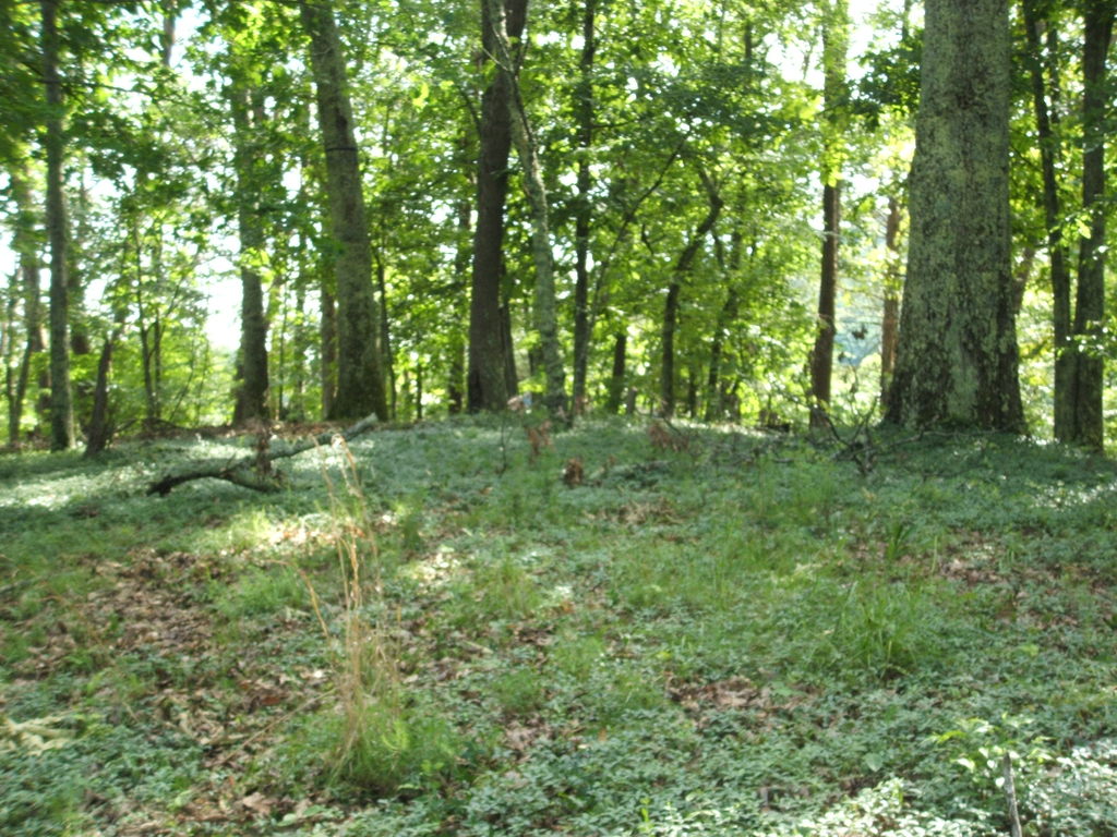
| Description | : | This cemetery has long been abandoned. It sits off the road, atop a hill on private property, with graves located within the area of the photograph. There is one stone left standing, however there is evidence of at least 12 other grave sites. The parents of the gentleman with the remaining stone had tombstones at one time, but have been removed, and thought to have been used in the building of a rock wall. This is a family cemetery, located on what was once the property of Tabler Vineyard and his wife Jane. |
frequently asked questions (FAQ):
-
Where is Vineyard Cemetery?
Vineyard Cemetery is located at Blount County ,Tennessee ,USA.
-
Vineyard Cemetery cemetery's updated grave count on graveviews.com?
0 memorials
-
Where are the coordinates of the Vineyard Cemetery?
Latitude: 35.8400002
Longitude: -83.9057999
Nearby Cemetories:
1. Edington Cemetery
Blount County, USA
Coordinate: 35.8546982, -83.9197006
2. Central Point Baptist Church Cemetery
Blount County, USA
Coordinate: 35.8260994, -83.8855972
3. Harris Cemetery
Blount County, USA
Coordinate: 35.8555984, -83.9297028
4. Wesley Ann Methodist Cemetery
Rockford, Blount County, USA
Coordinate: 35.8492000, -83.9361000
5. Slave Cemetery
Blount County, USA
Coordinate: 35.8241997, -83.8768997
6. Kirby Family Cemetery
Blount County, USA
Coordinate: 35.8527985, -83.9496994
7. Clarks Grove Cemetery
Maryville, Blount County, USA
Coordinate: 35.8093987, -83.9413986
8. Old Mount Lebanon Cemetery
Eagleton Village, Blount County, USA
Coordinate: 35.7991982, -83.9210968
9. Logans Chapel Cemetery
Maryville, Blount County, USA
Coordinate: 35.8046989, -83.8731003
10. Mount Pleasant AME Zion Church Cemetery
Rockford, Blount County, USA
Coordinate: 35.8212340, -83.9555720
11. Mount Lebanon Cemetery
Maryville, Blount County, USA
Coordinate: 35.7949982, -83.9057999
12. Nails Creek Cemetery
Blount County, USA
Coordinate: 35.8347015, -83.8486023
13. Cedar Grove Baptist Church Cemetery
Maryville, Blount County, USA
Coordinate: 35.8344002, -83.8469009
14. Tipton Cemetery
Blount County, USA
Coordinate: 35.8753014, -83.9468994
15. Mount Moriah Cemetery
Blount County, USA
Coordinate: 35.8531700, -83.9684500
16. Sherwood Chapel and Memorial Gardens
Alcoa, Blount County, USA
Coordinate: 35.8283005, -83.9732971
17. Mount Zion Cemetery
Maryville, Blount County, USA
Coordinate: 35.8630981, -83.9777985
18. Cruze Cemetery
Knox County, USA
Coordinate: 35.8819008, -83.8452988
19. Brantleys Chapel Cemetery
Maryville, Blount County, USA
Coordinate: 35.7825600, -83.9436600
20. Davis Cemetery
Knox County, USA
Coordinate: 35.9081001, -83.9207993
21. Union Temple Cemetery
Blount County, USA
Coordinate: 35.7985992, -83.8339005
22. East Maryville Baptist Cemetery
Maryville, Blount County, USA
Coordinate: 35.7708015, -83.9332962
23. Ballards Chapel Cemetery
Louisville, Blount County, USA
Coordinate: 35.8559150, -83.9943510
24. Centennial Cemetery
Blount County, USA
Coordinate: 35.7672005, -83.8908005