
| Memorials | : | 3 |
| Location | : | Rockford, Blount County, USA |
| Coordinate | : | 35.8492000, -83.9361000 |
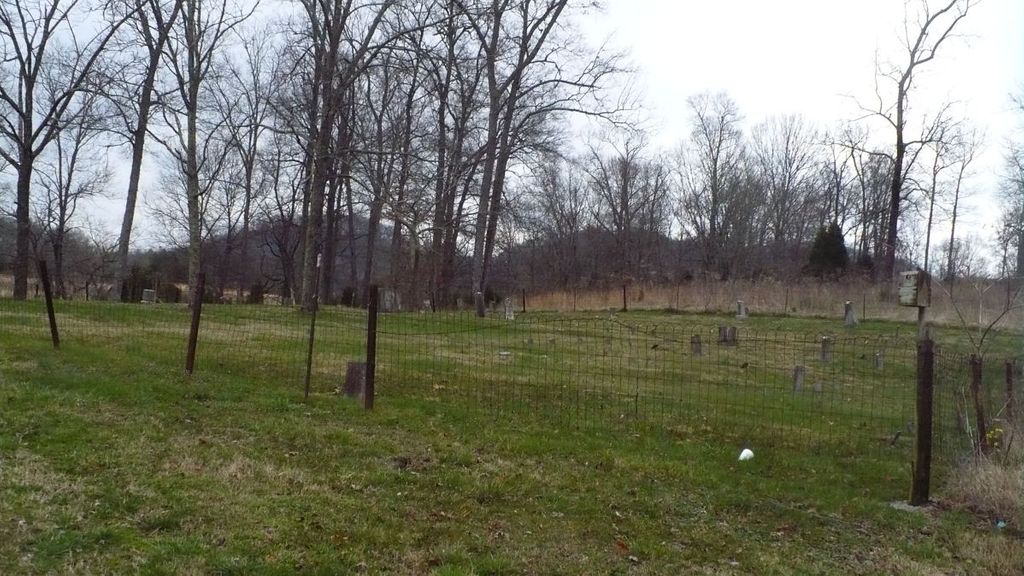
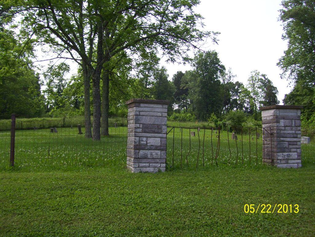
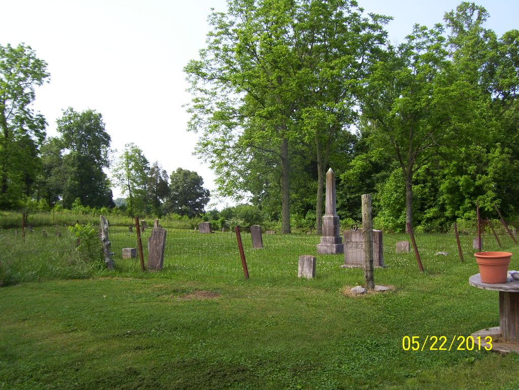
| Description | : | There are 78 unidentified or unmarked stones. This cemetery is on private property behind the third house on the right. Due to vandals, the cemetery has had some damage to stones and a few have been removed. The people who live on the property ask visitors to remember that this is private property and to ask for permission to go into the cemetery. |
frequently asked questions (FAQ):
-
Where is Wesley Ann Methodist Cemetery?
Wesley Ann Methodist Cemetery is located at Roddy Branch Road Rockford, Blount County ,Tennessee ,USA.
-
Wesley Ann Methodist Cemetery cemetery's updated grave count on graveviews.com?
3 memorials
-
Where are the coordinates of the Wesley Ann Methodist Cemetery?
Latitude: 35.8492000
Longitude: -83.9361000
Nearby Cemetories:
1. Harris Cemetery
Blount County, USA
Coordinate: 35.8555984, -83.9297028
2. Kirby Family Cemetery
Blount County, USA
Coordinate: 35.8527985, -83.9496994
3. Edington Cemetery
Blount County, USA
Coordinate: 35.8546982, -83.9197006
4. Vineyard Cemetery
Blount County, USA
Coordinate: 35.8400002, -83.9057999
5. Mount Moriah Cemetery
Blount County, USA
Coordinate: 35.8531700, -83.9684500
6. Tipton Cemetery
Blount County, USA
Coordinate: 35.8753014, -83.9468994
7. Mount Pleasant AME Zion Church Cemetery
Rockford, Blount County, USA
Coordinate: 35.8212340, -83.9555720
8. Mount Zion Cemetery
Maryville, Blount County, USA
Coordinate: 35.8630981, -83.9777985
9. Sherwood Chapel and Memorial Gardens
Alcoa, Blount County, USA
Coordinate: 35.8283005, -83.9732971
10. Clarks Grove Cemetery
Maryville, Blount County, USA
Coordinate: 35.8093987, -83.9413986
11. Central Point Baptist Church Cemetery
Blount County, USA
Coordinate: 35.8260994, -83.8855972
12. Ballards Chapel Cemetery
Louisville, Blount County, USA
Coordinate: 35.8559150, -83.9943510
13. Old Mount Lebanon Cemetery
Eagleton Village, Blount County, USA
Coordinate: 35.7991982, -83.9210968
14. Stockton Burying Ground
Maryville, Blount County, USA
Coordinate: 35.8679020, -83.9959120
15. Slave Cemetery
Blount County, USA
Coordinate: 35.8241997, -83.8768997
16. George Cemetery
Blount County, USA
Coordinate: 35.8424988, -84.0028000
17. Flenniken Cemetery
Knox County, USA
Coordinate: 35.8861008, -83.9860992
18. Taylor Cemetery
Blount County, USA
Coordinate: 35.8274994, -83.9982986
19. Mount Lebanon Cemetery
Maryville, Blount County, USA
Coordinate: 35.7949982, -83.9057999
20. Wright Cemetery
Blount County, USA
Coordinate: 35.8788986, -84.0006027
21. Davis Cemetery
Knox County, USA
Coordinate: 35.9081001, -83.9207993
22. Brantleys Chapel Cemetery
Maryville, Blount County, USA
Coordinate: 35.7825600, -83.9436600
23. Logans Chapel Cemetery
Maryville, Blount County, USA
Coordinate: 35.8046989, -83.8731003
24. Bearden Cemetery
Knox County, USA
Coordinate: 35.8792000, -84.0158005