
| Memorials | : | 21 |
| Location | : | Lexington, Lexington City, USA |
| Phone | : | 540-464-7334 |
| Coordinate | : | 37.7899950, -79.4355080 |
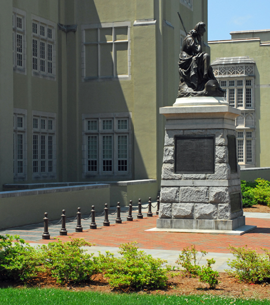
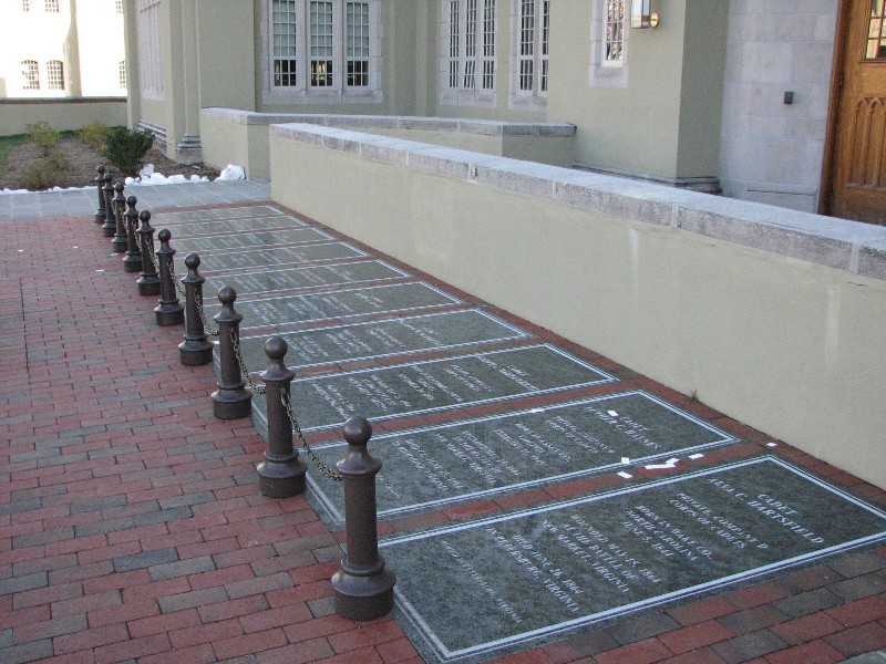
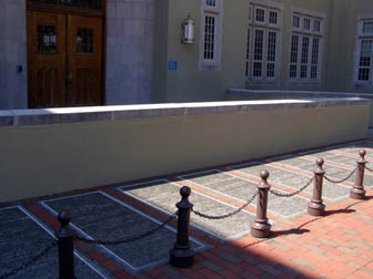
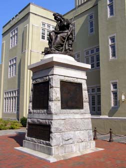
| Description | : | NOTE: There was a VMI Cemetery located near what is today the Marshall Museum, but it was discontinued in 1912 with all graves relocated to the Stonewall Jackson Memorial Cemetery in downtown Lexington, Virginia. Those graves having a direct association with VMI were placed in Sections 587 (4 graves) and 589 (5 graves). The only bodies OFFICIALLY buried at VMI today are 6 of the 10 VMI Cadets killed at the battle of New Market on 15 May 1864 (10 memorial tablets are at the base of the Virginia Mourning Her Dead statue) and Claudius Crozet, who is buried in front... Read More |
frequently asked questions (FAQ):
-
Where is Virginia Military Institute Museum?
Virginia Military Institute Museum is located at Letcher Avenue Lexington, Lexington City ,Virginia , 24450USA.
-
Virginia Military Institute Museum cemetery's updated grave count on graveviews.com?
21 memorials
-
Where are the coordinates of the Virginia Military Institute Museum?
Latitude: 37.7899950
Longitude: -79.4355080
Nearby Cemetories:
1. Lee Chapel Museum
Lexington, Lexington City, USA
Coordinate: 37.7873740, -79.4417470
2. Grace Episcopal Church Columbarium
Lexington, Lexington City, USA
Coordinate: 37.7866290, -79.4431810
3. Evergreen Cemetery
Lexington, Lexington City, USA
Coordinate: 37.7803001, -79.4321976
4. Oak Grove Cemetery
Lexington, Lexington City, USA
Coordinate: 37.7808300, -79.4450600
5. The Meadow
Lexington, Lexington City, USA
Coordinate: 37.7757000, -79.4615900
6. Green Hill Cemetery
Buena Vista, Buena Vista City, USA
Coordinate: 37.7300200, -79.3758200
7. Green Hill Mausoleum
Buena Vista, Buena Vista City, USA
Coordinate: 37.7286700, -79.3759300
8. Clarence Davis Farm Cemetery
Oronoco, Amherst County, USA
Coordinate: 37.7495540, -79.2767500
9. Hico Cemetery
Monroe, Amherst County, USA
Coordinate: 37.6875910, -79.3291640
10. Lipscombe-Garrett Cemetery
Amherst County, USA
Coordinate: 37.6834000, -79.3317000
11. Oronoco Church of the Brethren Cemetery
Oronoco, Amherst County, USA
Coordinate: 37.7447020, -79.2724990
12. Asberry Methodist Church Cemetery
Oronoco, Amherst County, USA
Coordinate: 37.7372208, -79.2538910
13. Bridge Hill Cemetery
Alto, Amherst County, USA
Coordinate: 37.7709570, -79.2309650
14. Richeson Cemetery
Allwood, Amherst County, USA
Coordinate: 37.6811000, -79.2779000
15. Hylton Cemetery
Allwood, Amherst County, USA
Coordinate: 37.6887500, -79.2643170
16. Leonard Coffey Farm Cemetery
Alto, Amherst County, USA
Coordinate: 37.7781570, -79.2199170
17. Roberts Cemetery
Monroe, Amherst County, USA
Coordinate: 37.6519012, -79.3052979
18. Mount Horeb United Methodist Church Cemetery
Amherst, Amherst County, USA
Coordinate: 37.7106911, -79.2419758
19. Tyree off Slapp Creek Cemetery
Willow, Amherst County, USA
Coordinate: 37.6763890, -79.2595980
20. Whitten Family Cemetery
Willow, Amherst County, USA
Coordinate: 37.6932210, -79.2405210
21. Jennings Family Cemetery
Willow, Amherst County, USA
Coordinate: 37.7012790, -79.2342110
22. Hartless Cemetery
Allwood, Amherst County, USA
Coordinate: 37.6695710, -79.2577740
23. Tomlinson Family Cemetery
Forks of Buffalo, Amherst County, USA
Coordinate: 37.7029090, -79.2248080
24. Pera Road Cemetery
Pera, Amherst County, USA
Coordinate: 37.6189315, -79.3161628