| Memorials | : | 1 |
| Location | : | Indian Springs, Madera County, USA |
| Coordinate | : | 37.0384941, -119.7134705 |
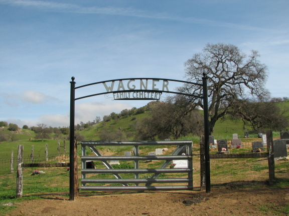
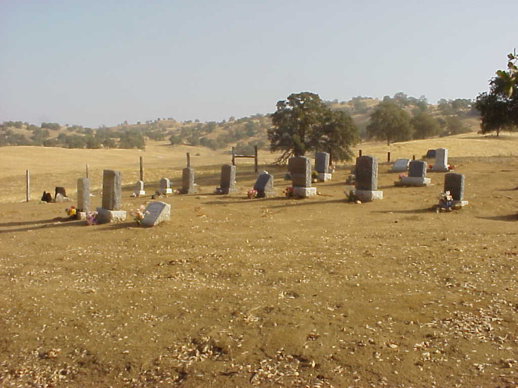
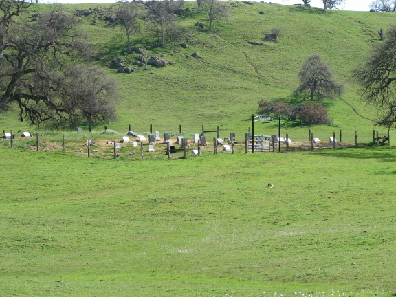
| Description | : | This cemetery lies on approximately two acres of land. It was donated by a local rancher in 1885, upon the untimely death of Georgie Wagner at the age of 5 years. The Wagner Family Cemetery is located approximately 2.3 miles north of the juncture of Roads 145 and 206 (Indian Springs); on Road 211 (the O'Neals Road) and past the Millerton Road turn off. There is a single lane, weather challenged, dirt road to the right which is identified with the address 20085. Turning right and traveling point 1 mile, the cemetery can be seen at a distance on... Read More |
frequently asked questions (FAQ):
-
Where is Wagner Cemetery?
Wagner Cemetery is located at Indian Springs, Madera County ,California ,USA.
-
Wagner Cemetery cemetery's updated grave count on graveviews.com?
1 memorials
-
Where are the coordinates of the Wagner Cemetery?
Latitude: 37.0384941
Longitude: -119.7134705
Nearby Cemetories:
1. Winchell Cove Cemetery
Friant, Fresno County, USA
Coordinate: 36.9975790, -119.6587030
2. Table Mountain Cemetery
Friant, Fresno County, USA
Coordinate: 36.9941200, -119.6435300
3. O'Neal Cemetery
O'Neals, Madera County, USA
Coordinate: 37.1187620, -119.7033690
4. Williams-Hanover Cemetery
Hildreth, Madera County, USA
Coordinate: 37.1132750, -119.6171240
5. Lorentzen Family Cemetery
Coarsegold, Madera County, USA
Coordinate: 37.1501490, -119.7287960
6. Auberry Cemetery
Fresno County, USA
Coordinate: 37.0140290, -119.5593200
7. Hensley-Noble Ranch Cemetery
Raymond, Madera County, USA
Coordinate: 37.1022200, -119.8749160
8. Fine Gold Cemetery
Madera Ranchos, Madera County, USA
Coordinate: 37.1741982, -119.6286011
9. James D Savage Grave Site
Raymond, Madera County, USA
Coordinate: 37.1239860, -119.8740600
10. Sentinel Cemetery
Fresno County, USA
Coordinate: 36.9863510, -119.5282850
11. Picayune Cemetery
Madera County, USA
Coordinate: 37.2101060, -119.6940120
12. Academy Cemetery
Clovis, Fresno County, USA
Coordinate: 36.8939018, -119.5464020
13. Clovis Cemetery
Clovis, Fresno County, USA
Coordinate: 36.8363991, -119.7118988
14. Big Sandy Rancheria Tribal Cemetery
Auberry, Fresno County, USA
Coordinate: 37.0796400, -119.4614000
15. Firebaugh Homestead Cemetery
Tollhouse, Fresno County, USA
Coordinate: 36.9638600, -119.4540700
16. Krohn Family Cemetery
Coarsegold, Madera County, USA
Coordinate: 37.2610300, -119.7027720
17. Hope Lutheran Church Grove Columbarium
Fresno, Fresno County, USA
Coordinate: 36.8158810, -119.7815980
18. Raymond Cemetery
Raymond, Madera County, USA
Coordinate: 37.1849251, -119.9385986
19. Good Shepherd Lutheran Memorial Garden
Fresno, Fresno County, USA
Coordinate: 36.8116100, -119.8162700
20. Melvin Cemetery
Madera County, USA
Coordinate: 37.2859200, -119.7069900
21. Tollhouse Cemetery
Tollhouse, Fresno County, USA
Coordinate: 37.0122300, -119.4039300
22. North Fork Cemetery
North Fork, Madera County, USA
Coordinate: 37.2241707, -119.5008316
23. Redbank Cemetery
Clovis, Fresno County, USA
Coordinate: 36.8088989, -119.5761032
24. Calvary Cemetery
Madera, Madera County, USA
Coordinate: 36.9529457, -120.0298004


