
| Memorials | : | 0 |
| Location | : | Bad Wildbad, Landkreis Calw, Germany |
| Coordinate | : | 48.7664456, 8.5561592 |
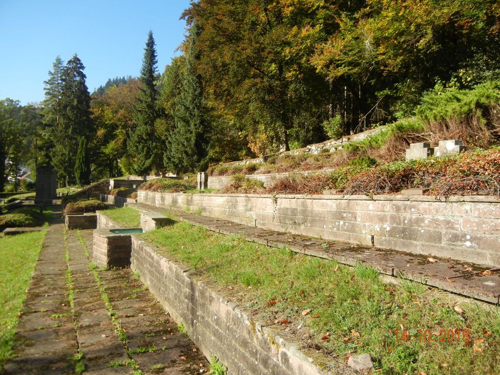
| Description | : | Auf dem Waldfriedhof der Stadt liegt auch der Teil mit Soldatengräbern. Die Anlage ist terrassenförmig angelegt. In der Mitte steht erhöht das Kriegerdenkmal. Über das Gräberfeld sind Zweier-Kreuzgruppen verteilt. Die Namen der Gefallenen sind auf liegenden Steinen festgehalten. This cemetery is for soldiers only with a backing to the forest. It is situated directly above and connected with the civil cemetery of Bad Wildbad immediately below it. |
frequently asked questions (FAQ):
-
Where is Waldfriedhof Bad Wildbad?
Waldfriedhof Bad Wildbad is located at Paulinenstraße Bad Wildbad, Landkreis Calw ,Baden-Württemberg , 75323Germany.
-
Waldfriedhof Bad Wildbad cemetery's updated grave count on graveviews.com?
0 memorials
-
Where are the coordinates of the Waldfriedhof Bad Wildbad?
Latitude: 48.7664456
Longitude: 8.5561592
Nearby Cemetories:
1. Uhlandfriedhof Bad Wildbad
Bad Wildbad, Landkreis Calw, Germany
Coordinate: 48.7527300, 8.5534700
2. Kappelbergfriedhof Bad Wildbad
Bad Wildbad, Landkreis Calw, Germany
Coordinate: 48.7525900, 8.5518400
3. Friedhof Calmbach
Calmbach, Landkreis Calw, Germany
Coordinate: 48.7721125, 8.5854084
4. Friedhof Höfen an der Enz
Höfen an der Enz, Landkreis Calw, Germany
Coordinate: 48.8063229, 8.5854749
5. Waldfriedhof Dobel
Dobel, Landkreis Calw, Germany
Coordinate: 48.7941324, 8.4836293
6. Friedhof Würzbach
Würzbach, Landkreis Calw, Germany
Coordinate: 48.7228008, 8.6287342
7. Friedhof Langenbrand
Langenbrand, Landkreis Calw, Germany
Coordinate: 48.8026940, 8.6381830
8. Friedhof Schömberg
Schömberg, Landkreis Calw, Germany
Coordinate: 48.7855417, 8.6507934
9. Friedhof Meistern
Meistern, Landkreis Calw, Germany
Coordinate: 48.6959570, 8.5480210
10. Friedhof Igelsloch
Igelsloch, Landkreis Calw, Germany
Coordinate: 48.7479151, 8.6610208
11. Friedhof Neusatz
Neusatz, Landkreis Calw, Germany
Coordinate: 48.8180165, 8.4760068
12. Friedhof Oberreichenbach
Oberreichenbach, Landkreis Calw, Germany
Coordinate: 48.7368096, 8.6607977
13. Friedhof Neuenbürg
Neuenbürg, Enzkreis, Germany
Coordinate: 48.8372000, 8.5960000
14. Friedhof Agenbach
Agenbach, Landkreis Calw, Germany
Coordinate: 48.6926279, 8.5848604
15. Friedhof Sprollenhaus
Sprollenhaus, Landkreis Calw, Germany
Coordinate: 48.6975797, 8.5050443
16. Friedhof Rotensol
Rotensol, Landkreis Calw, Germany
Coordinate: 48.8157209, 8.4661288
17. Friedhof Conweiler
Conweiler, Enzkreis, Germany
Coordinate: 48.8458540, 8.5352830
18. Friedhof Oberlengenhardt
Oberlengenhardt, Landkreis Calw, Germany
Coordinate: 48.7827474, 8.6763495
19. Friedhof Schwann
Schwann, Enzkreis, Germany
Coordinate: 48.8484200, 8.5414000
20. Alter Friedhof Neuenbürg
Neuenbürg, Enzkreis, Germany
Coordinate: 48.8469897, 8.5900378
21. Kloster Herrenalb
Bad Herrenalb, Landkreis Calw, Germany
Coordinate: 48.7961700, 8.4371500
22. Friedhof Bad Herrenalb
Bad Herrenalb, Landkreis Calw, Germany
Coordinate: 48.7937232, 8.4351038
23. Friedhof Schwarzenberg
Schwarzenberg, Landkreis Calw, Germany
Coordinate: 48.7891600, 8.6793700
24. Friedhof Oberkollbach
Oberkollbach, Landkreis Calw, Germany
Coordinate: 48.7440860, 8.6825460