
| Memorials | : | 0 |
| Location | : | Fürstenfeldbruck, Landkreis Fürstenfeldbruck, Germany |
| Coordinate | : | 48.1793098, 11.2339497 |
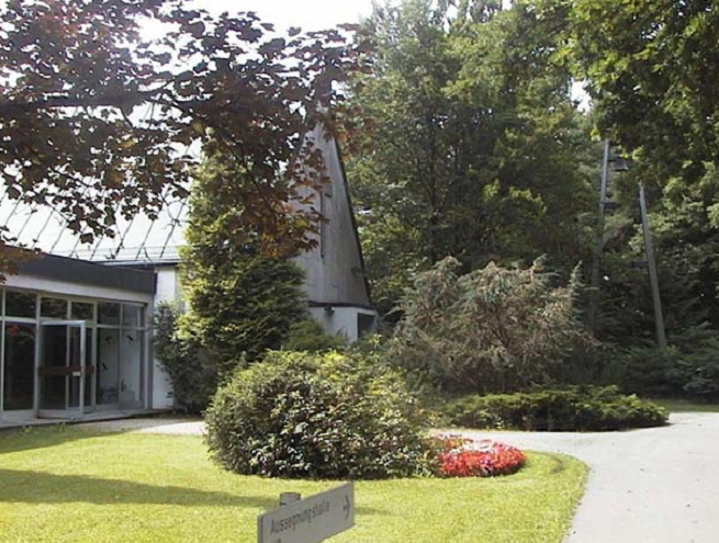
| Description | : | The park-like Waldfriedhof Fürstenfeldbruck (created in 1965) is a non-denominational, city-run, cemetery in the Western part of Fürstenfeldbruck. This is a town in Bavaria, Germany. It is the capital of the district of Fürstenfeldbruck. As of 2004 it has a population of 35,494. It has been the site of an Air Base since 1936. It was used by the Luftwaffe before and during World War II. It was used by United States Air Force after World War II and returned to the German government in 1957 and used as a base for the modern German Air Force ever since. Address: Waldfriedhofstr. 1 82256... Read More |
frequently asked questions (FAQ):
-
Where is Waldfriedhof Fürstenfeldbruck?
Waldfriedhof Fürstenfeldbruck is located at Waldfriedhofstr. 1 Fürstenfeldbruck, Landkreis Fürstenfeldbruck ,Bavaria (Bayern) , 82256Germany.
-
Waldfriedhof Fürstenfeldbruck cemetery's updated grave count on graveviews.com?
0 memorials
-
Where are the coordinates of the Waldfriedhof Fürstenfeldbruck?
Latitude: 48.1793098
Longitude: 11.2339497
Nearby Cemetories:
1. Klosterkirche Fürstenfeld
Fürstenfeldbruck, Landkreis Fürstenfeldbruck, Germany
Coordinate: 48.1695630, 11.2494740
2. Alter Friedhof
Fürstenfeldbruck, Landkreis Fürstenfeldbruck, Germany
Coordinate: 48.1776230, 11.2586830
3. Alter Friedhof Emmering
Emmering, Landkreis Fürstenfeldbruck, Germany
Coordinate: 48.1802177, 11.2805393
4. Neuer Friedhof Emmering
Emmering, Landkreis Fürstenfeldbruck, Germany
Coordinate: 48.1818595, 11.2825354
5. Friedhof St. Vitus
Maisach, Landkreis Fürstenfeldbruck, Germany
Coordinate: 48.2191660, 11.2590095
6. Friedhof Esting
Esting, Landkreis Fürstenfeldbruck, Germany
Coordinate: 48.1994400, 11.3077700
7. Friedhof am Pult Mammendorf
Mammendorf, Landkreis Fürstenfeldbruck, Germany
Coordinate: 48.2081100, 11.1648900
8. Friedhof Gernlinden
Gernlinden, Landkreis Fürstenfeldbruck, Germany
Coordinate: 48.2135150, 11.2976559
9. Friedhof am Friedensweg
Mammendorf, Landkreis Fürstenfeldbruck, Germany
Coordinate: 48.2059590, 11.1611253
10. Friedhof Mariä Geburt
Alling, Landkreis Fürstenfeldbruck, Germany
Coordinate: 48.1412714, 11.2976892
11. Friedhof Eichenau
Eichenau, Landkreis Fürstenfeldbruck, Germany
Coordinate: 48.1613600, 11.3291600
12. Friedhof Schopflach
Puchheim, Landkreis Fürstenfeldbruck, Germany
Coordinate: 48.1636200, 11.3342600
13. Friedhof Gilching
Gilching, Landkreis Starnberg, Germany
Coordinate: 48.1214120, 11.2941940
14. Alter Friedhof Olching
Olching, Landkreis Fürstenfeldbruck, Germany
Coordinate: 48.2063232, 11.3318251
15. Parkfriedhof Olching
Olching, Landkreis Fürstenfeldbruck, Germany
Coordinate: 48.2039951, 11.3374794
16. Friedhof Puchheim-Bahnhof
Puchheim, Landkreis Fürstenfeldbruck, Germany
Coordinate: 48.1707587, 11.3530343
17. Friedhof Puchheim-Ort
Puchheim, Landkreis Fürstenfeldbruck, Germany
Coordinate: 48.1476100, 11.3488600
18. Friedhof Argelsried
Gilching, Landkreis Starnberg, Germany
Coordinate: 48.1047970, 11.3095530
19. Friedhof Palsweis
Palsweis, Landkreis Dachau, Germany
Coordinate: 48.2540016, 11.3149738
20. Friedhof Sankt Jakob
Germering, Landkreis Fürstenfeldbruck, Germany
Coordinate: 48.1285295, 11.3498356
21. Friedhof Kottgeisering
Kottgeisering, Landkreis Fürstenfeldbruck, Germany
Coordinate: 48.1166992, 11.1313820
22. Puchheimer Russenfriedhof
Puchheim, Landkreis Fürstenfeldbruck, Germany
Coordinate: 48.1793000, 11.3733200
23. Wenigmuenchen DE-82281
Wenigmunchen, Landkreis Fürstenfeldbruck, Germany
Coordinate: 48.2734350, 11.2154260
24. Friedhof Germering
Germering, Landkreis Fürstenfeldbruck, Germany
Coordinate: 48.1368500, 11.3664300