
| Memorials | : | 0 |
| Location | : | Palsweis, Landkreis Dachau, Germany |
| Coordinate | : | 48.2540016, 11.3149738 |
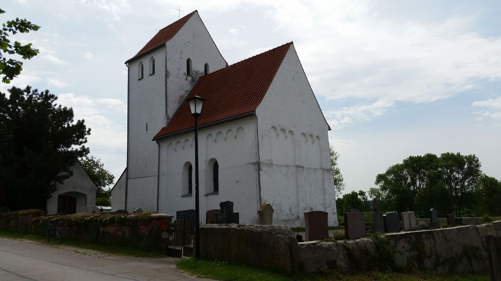
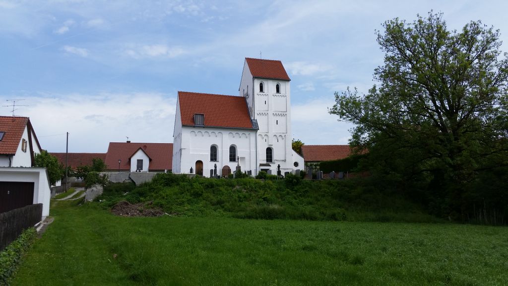
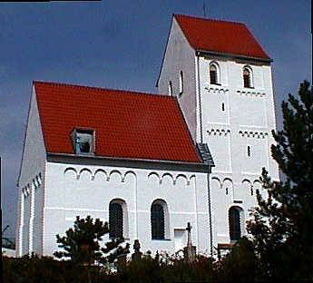
| Description | : | Palsweis is a smal village in Dachau County in the German State of Bavaria. The small church inside the cemetery is dedicated to St. Urban. As often in Germany the cemetery and church within have different names. Most German cemeteries have a period of repose of 20-40 years, which means that after about 25 years of a person's death the plot will be re-used. Unless there is family left which purchases another period of repose for a pre-set time. If no one is left the grave will eventually be leveled and re-used. |
frequently asked questions (FAQ):
-
Where is Friedhof Palsweis?
Friedhof Palsweis is located at Sankt-Urban-Strasse Palsweis, Landkreis Dachau ,Bavaria (Bayern) ,Germany.
-
Friedhof Palsweis cemetery's updated grave count on graveviews.com?
0 memorials
-
Where are the coordinates of the Friedhof Palsweis?
Latitude: 48.2540016
Longitude: 11.3149738
Nearby Cemetories:
1. Friedhof Deutenhausen
Deutenhausen, Landkreis Dachau, Germany
Coordinate: 48.2630463, 11.3419781
2. Kreuzholzhausen Cemetery
Kreuzholzhausen, Landkreis Dachau, Germany
Coordinate: 48.2736397, 11.3290815
3. Gemeindefriedhof Bergkirchen
Bergkirchen, Landkreis Dachau, Germany
Coordinate: 48.2556114, 11.3634996
4. Puchschlagen Cemetery
Puchschlagen, Landkreis Dachau, Germany
Coordinate: 48.2897600, 11.3429900
5. Friedhof Gernlinden
Gernlinden, Landkreis Fürstenfeldbruck, Germany
Coordinate: 48.2135150, 11.2976559
6. Friedhof Oberbachern
Oberbachern, Landkreis Dachau, Germany
Coordinate: 48.2828941, 11.3664398
7. Alter Friedhof Olching
Olching, Landkreis Fürstenfeldbruck, Germany
Coordinate: 48.2063232, 11.3318251
8. Friedhof St. Vitus
Maisach, Landkreis Fürstenfeldbruck, Germany
Coordinate: 48.2191660, 11.2590095
9. Parkfriedhof Olching
Olching, Landkreis Fürstenfeldbruck, Germany
Coordinate: 48.2039951, 11.3374794
10. Friedhof Unterbachern
Unterbachern, Landkreis Dachau, Germany
Coordinate: 48.2792091, 11.3841429
11. Friedhof Günding
Gunding, Landkreis Dachau, Germany
Coordinate: 48.2551880, 11.3943892
12. Friedhof Esting
Esting, Landkreis Fürstenfeldbruck, Germany
Coordinate: 48.1994400, 11.3077700
13. Neuer Friedhof Unterbachern
Unterbachern, Landkreis Dachau, Germany
Coordinate: 48.2837313, 11.3859010
14. Pfarrfriedhof St. Peter und Paul
Oberroth, Landkreis Dachau, Germany
Coordinate: 48.3091654, 11.3282816
15. Schwabhausen Kirchfriedhof
Schwabhausen, Landkreis Dachau, Germany
Coordinate: 48.3071700, 11.3526500
16. Schwabhausen Neuer Friedhof am Wasserturm
Schwabhausen, Landkreis Dachau, Germany
Coordinate: 48.3111900, 11.3547000
17. Friedhof St. Laurentius
Rumeltshausen, Landkreis Dachau, Germany
Coordinate: 48.3018740, 11.3841920
18. Pfarrfriedhof St. Georg
Grossberghofen, Landkreis Dachau, Germany
Coordinate: 48.3220293, 11.3131773
19. Friedhof Mittendorf
Mitterndorf, Landkreis Dachau, Germany
Coordinate: 48.2566414, 11.4177446
20. Wenigmuenchen DE-82281
Wenigmunchen, Landkreis Fürstenfeldbruck, Germany
Coordinate: 48.2734350, 11.2154260
21. Friedhof Wiedenzhausen
Wiedenzhausen, Landkreis Dachau, Germany
Coordinate: 48.2995003, 11.2369038
22. Gemeindefriedhof Rumelsthausen
Rumeltshausen, Landkreis Dachau, Germany
Coordinate: 48.3033578, 11.3884687
23. Friedhof Erdweg
Erdweg, Landkreis Dachau, Germany
Coordinate: 48.3279575, 11.3056390
24. Eschenried Cemetery
Eschenried, Landkreis Dachau, Germany
Coordinate: 48.2162200, 11.4118400