
| Memorials | : | 0 |
| Location | : | Grafing bei München, Landkreis Ebersberg, Germany |
| Coordinate | : | 48.0383450, 11.9670600 |
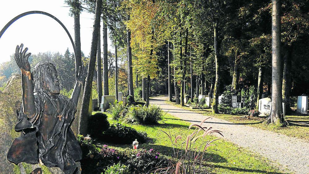
| Description | : | This is the municipal cemetery in Grafing. There is also a Catholic cemtery at Kirchenplatz 4 in the center of the town. Please note that the graves in Germany are not perpetual. After a certain period of repose (10-30 years) the graves are being leveled and re-used. There is no toxic embalming being done in Germany, so the coffin and the corpse have decomposed naturally. If the family of the deceased decides to purchase another period the duration can be extended by another 10-30 years. War Graves are considered memorials and are kept up by the owner of the cemetery. Those... Read More |
frequently asked questions (FAQ):
-
Where is Waldfriedhof Grafing?
Waldfriedhof Grafing is located at Pfarrer-Dr.Rauch-Strasse 1 Grafing bei München, Landkreis Ebersberg ,Bavaria (Bayern) , 85567Germany.
-
Waldfriedhof Grafing cemetery's updated grave count on graveviews.com?
0 memorials
-
Where are the coordinates of the Waldfriedhof Grafing?
Latitude: 48.0383450
Longitude: 11.9670600
Nearby Cemetories:
1. Pfarrfriedhof Grafing bei Munchen
Grafing bei München, Landkreis Ebersberg, Germany
Coordinate: 48.0471710, 11.9691270
2. Oberelkofen Soldatenfriedhof
Assling, Landkreis Ebersberg, Germany
Coordinate: 48.0251380, 11.9633460
3. Friedhof Straußdorf
Straussdorf, Landkreis Ebersberg, Germany
Coordinate: 48.0233003, 11.9934930
4. Neuer Friedhof Ebersberg
Ebersberg, Landkreis Ebersberg, Germany
Coordinate: 48.0706200, 11.9759100
5. Alter Friedhof Ebersberg
Ebersberg, Landkreis Ebersberg, Germany
Coordinate: 48.0735990, 11.9710730
6. Mainkofen District Hospital
Deggendorf, Landkreis Deggendorf, Germany
Coordinate: 48.0000000, 12.0000000
7. Wallfahrtskirche St. Sebastian
Ebersberg, Landkreis Ebersberg, Germany
Coordinate: 48.0833330, 11.9666670
8. Frauenneuharting Friedhof
Fraueneuharting, Landkreis Ebersberg, Germany
Coordinate: 48.0392720, 12.0486350
9. Waldfriedhof Glonn
Glonn, Landkreis Ebersberg, Germany
Coordinate: 47.9802100, 11.8688200
10. Pfarrfriedhof Mariä Himmelfahrt
Tuntenhausen, Landkreis Rosenheim, Germany
Coordinate: 47.9491380, 11.9681560
11. Friedhof Ostermünchen
Ostermunchen, Landkreis Rosenheim, Germany
Coordinate: 47.9533329, 12.0308687
12. Gemeindefriedhof Zorneding
Zorneding, Landkreis Ebersberg, Germany
Coordinate: 48.0795380, 11.8265320
13. WALLFAHRTSBASILIKA MARIA HIMMELFAHRT
Tuntenhausen, Landkreis Rosenheim, Germany
Coordinate: 47.9348160, 12.0149370
14. Friedhof Albaching
Albaching, Landkreis Rosenheim, Germany
Coordinate: 48.1113892, 12.1105137
15. Friedhof Ramerberg
Ramerberg, Landkreis Rosenheim, Germany
Coordinate: 48.0179966, 12.1453783
16. Friedhof Rott am Inn
Rott am Inn, Landkreis Rosenheim, Germany
Coordinate: 47.9826501, 12.1297863
17. Katholischer Friedhof Edling
Edling, Landkreis Rosenheim, Germany
Coordinate: 48.0581600, 12.1620400
18. Friedhof Maitenbeth
Maitenbeth, Landkreis Mühldorf am Inn, Germany
Coordinate: 48.1467470, 12.0927180
19. Kirchhof Maitenbeth
Maitenbeth, Landkreis Mühldorf am Inn, Germany
Coordinate: 48.1498900, 12.0930000
20. Friedhof Vaterstetten
Vaterstetten, Landkreis Ebersberg, Germany
Coordinate: 48.1065700, 11.7749400
21. Waldfriedhof Neukeferloh
Neukeferloh, Landkreis München, Germany
Coordinate: 48.0880307, 11.7577478
22. Friedhof
Rechtmehring, Landkreis Mühldorf am Inn, Germany
Coordinate: 48.1274560, 12.1575826
23. Pfarrfriedhof St.Leonhard
Höhenkirchen-Siegertsbrunn, Landkreis München, Germany
Coordinate: 48.0179100, 11.7323400
24. Friedhof Ellmosen
Ellmosen, Landkreis Rosenheim, Germany
Coordinate: 47.8814302, 12.0233899