
| Memorials | : | 0 |
| Location | : | Albaching, Landkreis Rosenheim, Germany |
| Website | : | www.albaching.de |
| Coordinate | : | 48.1113892, 12.1105137 |
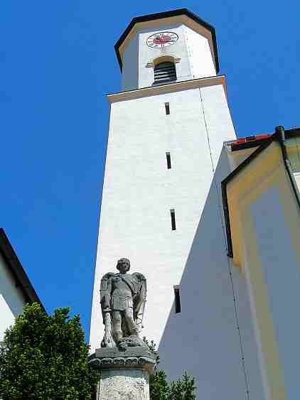
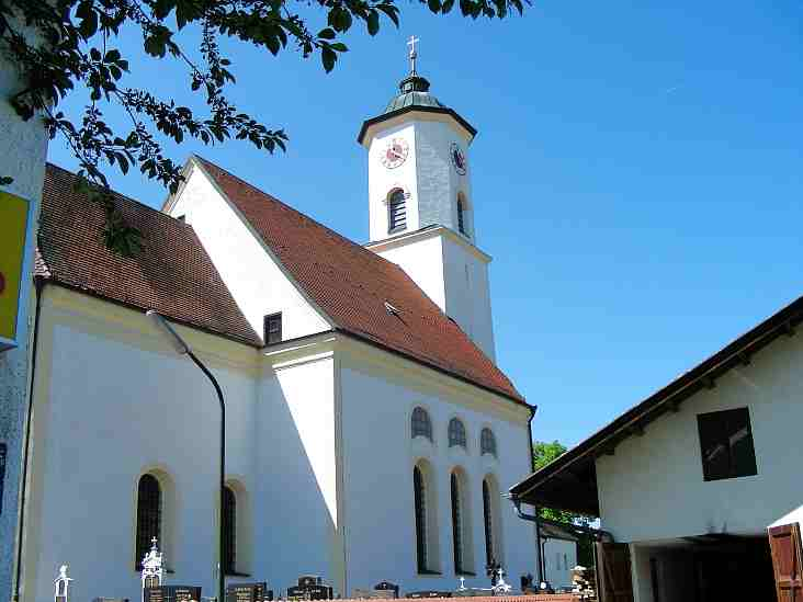
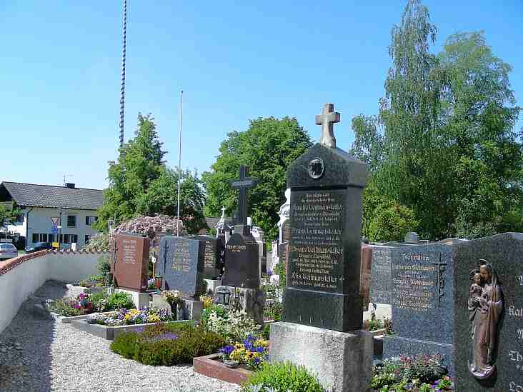
| Description | : | German name: Friedhof Albaching Albaching is a small village in Bavaria, within the administrative district of Rosenheim, about 28 miles East of Munich. Albaching's St. Nikolaus Kirche sits in the middle of the village, at Wasserburger Strasse. The village is first named in 808 A.D. - In 1561 most of Albaching, including the church, was lost in a fire. The current church building dates back to the end of the 16th century. In 1790 the structure was enlarged and in 1811 the tower was added, which houses three large bells. Most recent renovations of the church building and the grave yard... Read More |
frequently asked questions (FAQ):
-
Where is Friedhof Albaching?
Friedhof Albaching is located at Albaching, Kreis Rosenheim Albaching, Landkreis Rosenheim ,Bavaria (Bayern) ,Germany.
-
Friedhof Albaching cemetery's updated grave count on graveviews.com?
0 memorials
-
Where are the coordinates of the Friedhof Albaching?
Latitude: 48.1113892
Longitude: 12.1105137
Nearby Cemetories:
1. Friedhof
Rechtmehring, Landkreis Mühldorf am Inn, Germany
Coordinate: 48.1274560, 12.1575826
2. Friedhof Maitenbeth
Maitenbeth, Landkreis Mühldorf am Inn, Germany
Coordinate: 48.1467470, 12.0927180
3. Kirchhof Maitenbeth
Maitenbeth, Landkreis Mühldorf am Inn, Germany
Coordinate: 48.1498900, 12.0930000
4. Katholischer Friedhof Edling
Edling, Landkreis Rosenheim, Germany
Coordinate: 48.0581600, 12.1620400
5. Friedhof Haag
Haag in Oberbayern, Landkreis Mühldorf am Inn, Germany
Coordinate: 48.1592500, 12.1805700
6. Frauenneuharting Friedhof
Fraueneuharting, Landkreis Ebersberg, Germany
Coordinate: 48.0392720, 12.0486350
7. Stadtfriedhof Wasserburg
Wasserburg am Inn, Landkreis Rosenheim, Germany
Coordinate: 48.0625800, 12.2297800
8. Friedhof Am Herder Wasserburg am Inn
Wasserburg am Inn, Landkreis Rosenheim, Germany
Coordinate: 48.0451622, 12.2118379
9. Friedhof Ramerberg
Ramerberg, Landkreis Rosenheim, Germany
Coordinate: 48.0179966, 12.1453783
10. Neuer Friedhof Ebersberg
Ebersberg, Landkreis Ebersberg, Germany
Coordinate: 48.0706200, 11.9759100
11. Wallfahrtskirche St. Sebastian
Ebersberg, Landkreis Ebersberg, Germany
Coordinate: 48.0833330, 11.9666670
12. Kloster Ramsau
Ramsau, Landkreis Mühldorf am Inn, Germany
Coordinate: 48.1735950, 12.2284910
13. Alter Friedhof Ebersberg
Ebersberg, Landkreis Ebersberg, Germany
Coordinate: 48.0735990, 11.9710730
14. Pfarrfriedhof Grafing bei Munchen
Grafing bei München, Landkreis Ebersberg, Germany
Coordinate: 48.0471710, 11.9691270
15. Friedhof Straußdorf
Straussdorf, Landkreis Ebersberg, Germany
Coordinate: 48.0233003, 11.9934930
16. Klosterkirche Mariä Himmelfahrt
Gars, Landkreis Mühldorf am Inn, Germany
Coordinate: 48.1559580, 12.2760530
17. Waldfriedhof Grafing
Grafing bei München, Landkreis Ebersberg, Germany
Coordinate: 48.0383450, 11.9670600
18. Kirchenfriedhof Großschwindau
Grossschwindau, Landkreis Erding, Germany
Coordinate: 48.2315752, 12.1394149
19. Friedhof Rott am Inn
Rott am Inn, Landkreis Rosenheim, Germany
Coordinate: 47.9826501, 12.1297863
20. Oberelkofen Soldatenfriedhof
Assling, Landkreis Ebersberg, Germany
Coordinate: 48.0251380, 11.9633460
21. Mainkofen District Hospital
Deggendorf, Landkreis Deggendorf, Germany
Coordinate: 48.0000000, 12.0000000
22. Friedhof Ostermünchen
Ostermunchen, Landkreis Rosenheim, Germany
Coordinate: 47.9533329, 12.0308687
23. Friedhof Dorfen
Dorfen, Landkreis Erding, Germany
Coordinate: 48.2774300, 12.1465400
24. Kirchhof St. Erhard
Walpertskirchen, Landkreis Erding, Germany
Coordinate: 48.2582742, 11.9765125