
| Memorials | : | 0 |
| Location | : | Kreis Bergstraße, Germany |
| Coordinate | : | 49.5999520, 8.5061320 |
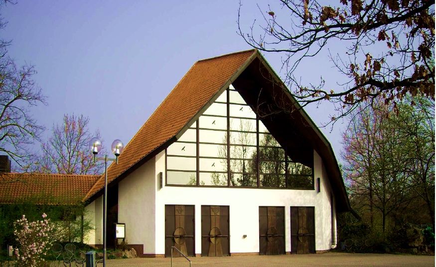
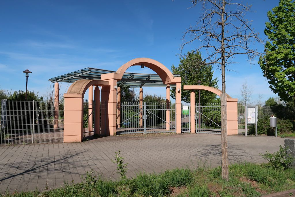
| Description | : | AKA Lampertheimer Waldfriedhof Neuschloss Address: Forsthausstrasse 68623 Lampertheim Opened in 1984, when the inner-city cemetery (Stadtfriedhof) became too small. This cemetery is located outside of Lampertheim in a wooded area, therefore called "Forest Cemetery" (Waldfriedhof). Located at County Route (Landstrasse) 3110. It is one of five cemeteries, which are under the administration of the city of Lampertheim: - Lampertheim (Stadtfriedhof) - Waldfriedhof - Lampertheim (Friedhof Hofheim) - Lampertheim (Friedhof Hüttenfeld) - Friedhof Rosengarten There is also a Jewish Cemetery in Lampertheim. Lampertheim is a city in the German State of Hessen. The closest city is Mannheim. Please note that the final resting places in Germany are not eternal, due to lack of space.... Read More |
frequently asked questions (FAQ):
-
Where is Waldfriedhof Lampertheim?
Waldfriedhof Lampertheim is located at Lampertheim, Kreis Bergstraße ,Hessen ,Germany.
-
Waldfriedhof Lampertheim cemetery's updated grave count on graveviews.com?
0 memorials
-
Where are the coordinates of the Waldfriedhof Lampertheim?
Latitude: 49.5999520
Longitude: 8.5061320
Nearby Cemetories:
1. Lampertheim Waldfriedhof
Lampertheim, Kreis Bergstraße, Germany
Coordinate: 49.5989380, 8.5032680
2. Stadtfriedhof Lampertheim
Kreis Bergstraße, Germany
Coordinate: 49.5956460, 8.4768960
3. Friedhof Huettenfeld Lampertheim
Kreis Bergstraße, Germany
Coordinate: 49.5987050, 8.5886480
4. Friedhof Mannheim Gartenstadt
Mannheim, Stadtkreis Mannheim, Germany
Coordinate: 49.5362300, 8.4943500
5. Kloster Lorsch
Lorsch, Kreis Bergstraße, Germany
Coordinate: 49.6538890, 8.5688890
6. Lorsch Abbey
Lorsch, Kreis Bergstraße, Germany
Coordinate: 49.6538750, 8.5691850
7. Friedhof Lorscher Strasse in Viernheim
Kreis Bergstraße, Germany
Coordinate: 49.5453290, 8.5779080
8. Friedhof Bobstadt
Kreis Bergstraße, Germany
Coordinate: 49.6629290, 8.4369640
9. Friedhof Käfertal
Mannheim, Stadtkreis Mannheim, Germany
Coordinate: 49.5179910, 8.5220440
10. Friedhof Hofheim Lampertheim
Kreis Bergstraße, Germany
Coordinate: 49.6606100, 8.4124160
11. Friedhof Roxheim
Bobenheim-Roxheim, Rhein-Pfalz-Kreis, Germany
Coordinate: 49.5804700, 8.3621900
12. Friedhof Laudenbach
Laudenbach, Rhein-Neckar-Kreis, Germany
Coordinate: 49.6158300, 8.6524100
13. Friedhof Stadt Hemsbach
Hemsbach, Rhein-Neckar-Kreis, Germany
Coordinate: 49.5873949, 8.6548724
14. Friedhof Stadt Heppenheim
Heppenheim an der Bergstrasse, Kreis Bergstraße, Germany
Coordinate: 49.6366490, 8.6454490
15. Friedhof Oppau
Ludwigshafen am Rhein, Stadtkreis Ludwigshafen am Rhein, Germany
Coordinate: 49.5246250, 8.4101880
16. Friedhof Stadt Heppenheim
Heppenheim an der Bergstrasse, Kreis Bergstraße, Germany
Coordinate: 49.6333646, 8.6478892
17. Friedhof Ludwigshafen am Rhein - Oppau
Oppau, Stadtkreis Ludwigshafen am Rhein, Germany
Coordinate: 49.5240580, 8.4100770
18. Cathedral of St Peter
Worms, Stadtkreis Worms, Germany
Coordinate: 49.6302780, 8.3597220
19. Friedhof Sulzbach
Weinheim, Rhein-Neckar-Kreis, Germany
Coordinate: 49.5819909, 8.6582973
20. Jüdischer Friedhof Heiliger Sand
Worms, Stadtkreis Worms, Germany
Coordinate: 49.6297800, 8.3555100
21. Friedhof Wallstadt
Mannheim, Stadtkreis Mannheim, Germany
Coordinate: 49.5005945, 8.5545729
22. Mannheim Hauptfriedhof
Mannheim, Stadtkreis Mannheim, Germany
Coordinate: 49.4935324, 8.4959866
23. Hauptfriedhof Weinheim
Weinheim, Rhein-Neckar-Kreis, Germany
Coordinate: 49.5692327, 8.6645942
24. Jüdischer Friedhof Hemsbach
Hemsbach, Rhein-Neckar-Kreis, Germany
Coordinate: 49.5934100, 8.6718900