
| Memorials | : | 0 |
| Location | : | East Point, Johnson County, USA |
| Coordinate | : | 37.7333260, -82.8218079 |
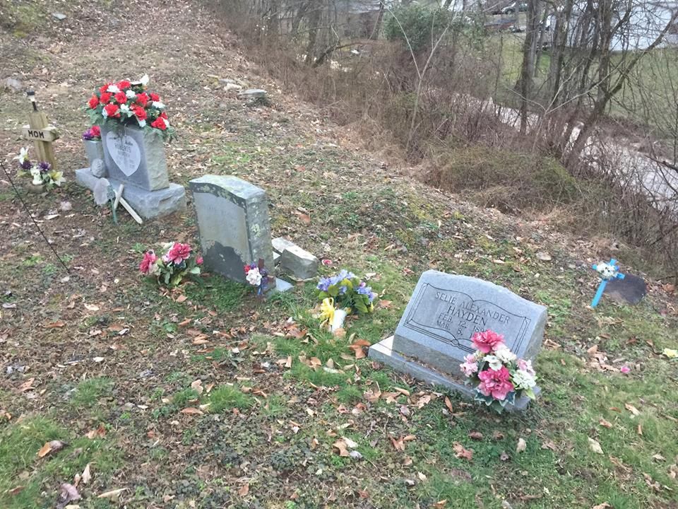
| Description | : | Located on the left fork of Bear Hollow at East Point, Ky. The cemetery sits to the left of the old Walker Hayden house which has now been torn down. The site was bulldozed recently, but the four tombstones have not been bothered by the construction. |
frequently asked questions (FAQ):
-
Where is Walker Hayden Family Cemetery?
Walker Hayden Family Cemetery is located at East Point, Johnson County ,Kentucky ,USA.
-
Walker Hayden Family Cemetery cemetery's updated grave count on graveviews.com?
0 memorials
-
Where are the coordinates of the Walker Hayden Family Cemetery?
Latitude: 37.7333260
Longitude: -82.8218079
Nearby Cemetories:
1. East Point Cemetery
East Point, Johnson County, USA
Coordinate: 37.7333260, -82.8218070
2. Elijab B. Arms Cemetery
East Point, Johnson County, USA
Coordinate: 37.7447280, -82.8116050
3. Blair Cemetery
Johnson County, USA
Coordinate: 37.7514000, -82.8281021
4. John D Music Cemetery
East Point, Johnson County, USA
Coordinate: 37.7530260, -82.8009610
5. Adams Cemetery
East Point, Johnson County, USA
Coordinate: 37.7594430, -82.8209060
6. Fishbaugh Cemetery
East Point, Johnson County, USA
Coordinate: 37.7636860, -82.8321020
7. Auxier Cemetery #1
Johnson County, USA
Coordinate: 37.7483360, -82.7831970
8. Conley Cemetery
Johnson County, USA
Coordinate: 37.7682991, -82.8277969
9. Nathaniel Auxier Cemetery
Hagerhill, Johnson County, USA
Coordinate: 37.7523040, -82.7821980
10. Auxier Cemetery #5
Hagerhill, Johnson County, USA
Coordinate: 37.7434700, -82.7688330
11. Samuel Auxier
Hagerhill, Johnson County, USA
Coordinate: 37.7435370, -82.7688410
12. Bayes Branch Cemetery
Bays Branch, Floyd County, USA
Coordinate: 37.7233200, -82.7666600
13. Ratliff Cemetery
Denver, Johnson County, USA
Coordinate: 37.7762200, -82.8482300
14. Ellis Ratliff Cemetery
Denver, Johnson County, USA
Coordinate: 37.7762420, -82.8482250
15. Wells Cemetery
Auxier, Floyd County, USA
Coordinate: 37.7338630, -82.7612640
16. Moore Family Cemetery #6
Cliff, Floyd County, USA
Coordinate: 37.7017220, -82.7762220
17. Denver Hill Cemetery
Denver, Johnson County, USA
Coordinate: 37.7740200, -82.8540940
18. Topsy Ratliff Family Cemetery
Denver, Johnson County, USA
Coordinate: 37.7722230, -82.8579470
19. Collins Cemetery #3
Auxier, Floyd County, USA
Coordinate: 37.7324371, -82.7589569
20. John P. M. Rice Cemetery
Collista, Johnson County, USA
Coordinate: 37.7835600, -82.8256000
21. Childers Family Cemetery
Auxier, Floyd County, USA
Coordinate: 37.7393278, -82.7580566
22. Hagerhill Cemetery
Hagerhill, Johnson County, USA
Coordinate: 37.7802000, -82.7958520
23. Howell-Griffith Cemetery
Hagerhill, Johnson County, USA
Coordinate: 37.7801980, -82.7958360
24. Jack Rice Cemetery
Collista, Johnson County, USA
Coordinate: 37.7843270, -82.8275020