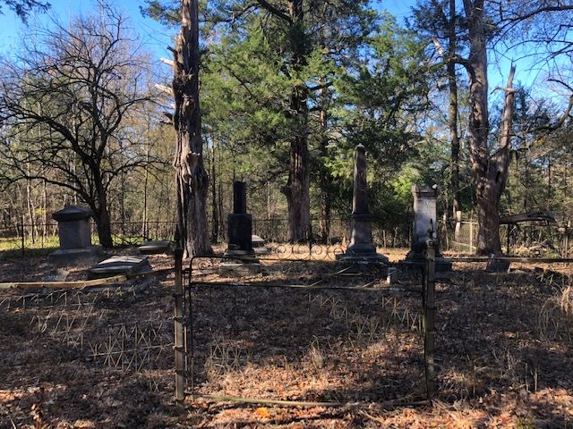
| Memorials | : | 0 |
| Location | : | Prairie, Monroe County, USA |
| Coordinate | : | 33.7049470, -88.6964740 |
| Description | : | According to "A History of Monroe County Mississippi": "Gone are 'Echo Hall' and the 'Prairie Mound', but there remains nearby a small enclosure for the family cemetery where classic gravestones mark the resting places for some Walkers of the Colonel John A Walker and John T Jameson families who knew and loved the area" "The Walker family cemetery is located in Section 8, Township 16S, Range 6E, about a mile and a half west of present day Highway 45, about a mile and half east of the county line (Clay) and nearly two miles north of the county line (also Clay). It... Read More |
frequently asked questions (FAQ):
-
Where is Walker-Jameson Cemetery?
Walker-Jameson Cemetery is located at Prairie, Monroe County ,Mississippi ,USA.
-
Walker-Jameson Cemetery cemetery's updated grave count on graveviews.com?
0 memorials
-
Where are the coordinates of the Walker-Jameson Cemetery?
Latitude: 33.7049470
Longitude: -88.6964740
Nearby Cemetories:
1. Sykes Cemetery
Aberdeen, Monroe County, USA
Coordinate: 33.7027100, -88.6980020
2. Third Union Missionary Baptist Church Cemetery
Prairie, Monroe County, USA
Coordinate: 33.7289009, -88.7016983
3. Greenwood MB Church Cemetery
Monroe County, USA
Coordinate: 33.6837730, -88.6667380
4. Lenoir Cemetery
Monroe County, USA
Coordinate: 33.7489014, -88.6980972
5. Shady Grove Abbott Church Cemetery
Abbott, Clay County, USA
Coordinate: 33.7023910, -88.7571240
6. Chandler Grove M.B. Church Cemetery
Abbott, Clay County, USA
Coordinate: 33.7243090, -88.7536130
7. Paine Chapel Cemetery
Prairie, Monroe County, USA
Coordinate: 33.6875000, -88.6316986
8. West Point Memorial Gardens Cemetery
West Point, Clay County, USA
Coordinate: 33.6500015, -88.6667023
9. Sweet Pilgrim Church
Monroe County, USA
Coordinate: 33.6875000, -88.6232986
10. Mount Union Missionary Baptist Church Cemetery
Aberdeen, Monroe County, USA
Coordinate: 33.7388992, -88.6250000
11. Abbott Cemetery
Abbott, Clay County, USA
Coordinate: 33.6741982, -88.7755966
12. Strong Cemetery
Strong, Monroe County, USA
Coordinate: 33.6817017, -88.6117020
13. Baptist Grove M. B. Church Cemetery
West Point, Clay County, USA
Coordinate: 33.7829700, -88.6888370
14. Mount Zion White Cemetery
Clay County, USA
Coordinate: 33.6664950, -88.6135290
15. Mount Zion Missionary Baptist Church Cemetery
Pheba, Clay County, USA
Coordinate: 33.6663910, -88.6135510
16. Strong Cemetery
Clay County, USA
Coordinate: 33.6556015, -88.6196976
17. Peterson Cemetery
Siloam, Clay County, USA
Coordinate: 33.6323960, -88.7414200
18. Gospel Temple Cemetery
West Point, Clay County, USA
Coordinate: 33.6221085, -88.6837006
19. New Hope Missionary Baptist Church Cemetery
West Point, Clay County, USA
Coordinate: 33.6228190, -88.6765390
20. Siloam Cemetery
Siloam, Clay County, USA
Coordinate: 33.6293983, -88.7491989
21. Mount Nebo Church Cemetery
Prairie, Monroe County, USA
Coordinate: 33.7755280, -88.6325640
22. Hampton Cemetery
Clay County, USA
Coordinate: 33.6519012, -88.6113968
23. Westbrook Cemetery
West Point, Clay County, USA
Coordinate: 33.6213989, -88.6572037
24. Lake Grove Missionary Baptist Church Cemetery
Una, Clay County, USA
Coordinate: 33.7666180, -88.7753320

