
| Memorials | : | 0 |
| Location | : | Norwood, Stanly County, USA |
| Coordinate | : | 35.1718150, -80.0760200 |
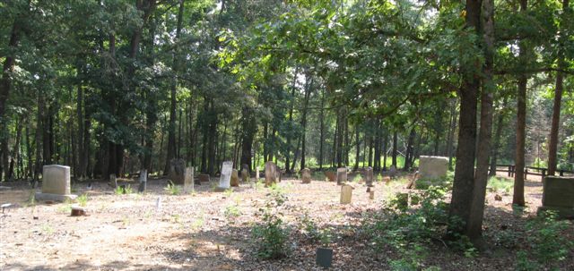
| Description | : | CEMETERY IS LISTED AS WALL-ALMOND CEMETERY IN 'THESE HALLOWED GROUNDS', BUT DEATH CERTIFICATES LIST IT AS ALMOND CEMETERY. PAUL MORRISON FROM THE STANLY COUNTY LIBRARY, 21 AUG 2013, VERIFIED THE NAME AS WALL-ALMOND TO CONTRIBUTOR 47232933. Per 'These Hallowed Grounds', directions are: *From Albemarle, take Hwy 52S to Norwood. Turn left onto Fork Rd. Continue on Fork Rd, crossing Hwy 731. Follow several miles to the end of the road. Enter The Forks Stable property at gate. Cemetery on dirt road to the left beyond the office. Stop at the office for permission and directions. *Owner: The Forks... Read More |
frequently asked questions (FAQ):
-
Where is Wall-Almond Cemetery?
Wall-Almond Cemetery is located at Norwood, Stanly County ,North Carolina ,USA.
-
Wall-Almond Cemetery cemetery's updated grave count on graveviews.com?
0 memorials
-
Where are the coordinates of the Wall-Almond Cemetery?
Latitude: 35.1718150
Longitude: -80.0760200
Nearby Cemetories:
1. Watkins Cemetery
Norwood, Stanly County, USA
Coordinate: 35.1860940, -80.0738730
2. Saint Stephen AME Church Cemetery
Mount Gilead, Montgomery County, USA
Coordinate: 35.1479550, -80.0447190
3. Thomasville Missionary Baptist Church Cemetery
Mount Gilead, Montgomery County, USA
Coordinate: 35.1718180, -80.0203510
4. Benjamin Lilly Burial Ground
Norwood, Stanly County, USA
Coordinate: 35.1798167, -80.1345500
5. Barringer Chapel Baptist Church Cemetery
Norwood, Stanly County, USA
Coordinate: 35.2134500, -80.1077100
6. Galloway Cemetery
Mount Gilead, Montgomery County, USA
Coordinate: 35.1779210, -80.0155840
7. Gaddy-Allen-Threadgill Cemetery
Ansonville, Anson County, USA
Coordinate: 35.1275250, -80.1046820
8. Cedar Hill AME Zion Church Cemetery
Ansonville, Anson County, USA
Coordinate: 35.1436100, -80.1281100
9. Melton Grove United Methodist Church Cemetery
Mount Gilead, Montgomery County, USA
Coordinate: 35.1698160, -80.0134250
10. Hamer Creek Baptist Church Cemetery
Mount Gilead, Montgomery County, USA
Coordinate: 35.1593370, -80.0138730
11. Bennett Chapel AME Zion Cemetery
Norwood, Stanly County, USA
Coordinate: 35.2167100, -80.1103900
12. Concord United Methodist Church Cemetery
Ansonville, Anson County, USA
Coordinate: 35.1466610, -80.1338440
13. S Lilly Cemetery
Norwood, Stanly County, USA
Coordinate: 35.1739900, -80.1437200
14. Chestnut AME Zion Church Cemetery
Richmond County, USA
Coordinate: 35.1269770, -80.0311010
15. Cochran Cemetery
Norwood, Stanly County, USA
Coordinate: 35.2292167, -80.0934167
16. Bethel Baptist Church Cemetery
Mount Gilead, Montgomery County, USA
Coordinate: 35.2234300, -80.0391800
17. Full Gospel Community Cemetery
Norwood, Stanly County, USA
Coordinate: 35.2167090, -80.1258880
18. Poplar Springs Cemetery
Norwood, Stanly County, USA
Coordinate: 35.1959667, -80.1492167
19. Norwood Cemetery
Norwood, Stanly County, USA
Coordinate: 35.2243510, -80.1297100
20. First Baptist Church Cemetery
Norwood, Stanly County, USA
Coordinate: 35.2340570, -80.1157200
21. Mount Zion United Methodist Church Cemetery
Norwood, Stanly County, USA
Coordinate: 35.1896320, -80.1592460
22. Legrand Cemetery
Richmond County, USA
Coordinate: 35.1156006, -80.0227966
23. Pleasant Grove Church Cemetery
Mount Gilead, Montgomery County, USA
Coordinate: 35.1967010, -79.9944000
24. Frazier Family Cemetery
Mount Gilead, Montgomery County, USA
Coordinate: 35.1786400, -79.9854870