
| Memorials | : | 1 |
| Location | : | Warnock, Belmont County, USA |
| Coordinate | : | 39.9961110, -80.9769440 |
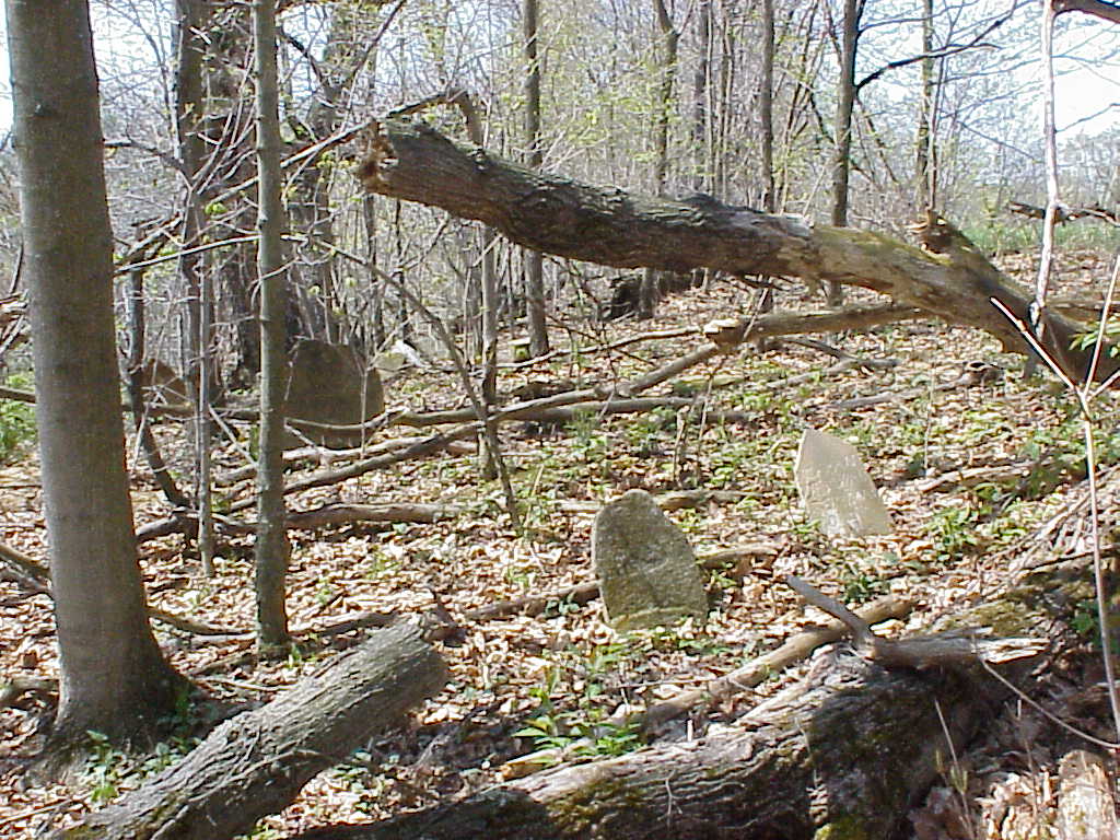
| Description | : | Close to Bethel Methodist Cemetery in Smith Township (Section 28), lies a small burying ground that dates to the first years Ohio was a state. In the woods, just north of Williams Creek are the graves of Walters and Rose family members. This appears to be an old family plot dating from at least 1808 when the Walters were farming on this land. The Rose family resided here later, although more research needs to be done on who held title to the land. Only seven tombstones remain at this small family burying ground. This cemetery is on private property, so... Read More |
frequently asked questions (FAQ):
-
Where is Walters Cemetery?
Walters Cemetery is located at Hart Road Warnock, Belmont County ,Ohio , 43718USA.
-
Walters Cemetery cemetery's updated grave count on graveviews.com?
1 memorials
-
Where are the coordinates of the Walters Cemetery?
Latitude: 39.9961110
Longitude: -80.9769440
Nearby Cemetories:
1. Bethel Cemetery
Warnock, Belmont County, USA
Coordinate: 39.9954680, -80.9755900
2. Wesley Chapel Cemetery
Centerville, Belmont County, USA
Coordinate: 40.0074997, -80.9981003
3. Centerville Cemetery
Centerville, Belmont County, USA
Coordinate: 39.9756012, -80.9561005
4. Scatterday Cemetery
Centerville, Belmont County, USA
Coordinate: 39.9706001, -80.9375000
5. Chestnut Level Church Cemetery
Belmont, Belmont County, USA
Coordinate: 39.9880981, -81.0289001
6. Warnock Cemetery
Warnock, Belmont County, USA
Coordinate: 40.0205994, -80.9293976
7. McGaughey Family Cemetery
Smith Township, Belmont County, USA
Coordinate: 39.9863280, -80.9160000
8. Bend Fork Christian Church Cemetery
Centerville, Belmont County, USA
Coordinate: 39.9441986, -80.9955978
9. Belmont Cemetery
Belmont, Belmont County, USA
Coordinate: 40.0281263, -81.0367659
10. Belmont Methodist Protestant Church Cemetery
Belmont, Belmont County, USA
Coordinate: 40.0304820, -81.0400790
11. Jesse Taylor Cemetery
Jacobsburg, Belmont County, USA
Coordinate: 39.9555560, -80.9200000
12. Henry Neff Family Cemetery
Jacobsburg, Belmont County, USA
Coordinate: 39.9887000, -80.8985100
13. East Richland Cemetery
Richland Township, Belmont County, USA
Coordinate: 40.0555992, -80.9561005
14. Burns Family Cemetery
Bethesda, Belmont County, USA
Coordinate: 40.0123670, -81.0568450
15. Mount Zion Methodist Episcopal Church Cemetery
Bethesda, Belmont County, USA
Coordinate: 39.9514008, -81.0391998
16. Jacobsburg Cemetery
Jacobsburg, Belmont County, USA
Coordinate: 39.9603004, -80.9030991
17. Old Bethesda ME Cemetery
Bethesda, Belmont County, USA
Coordinate: 39.9991400, -81.0655500
18. Dutch Hill Cemetery
Saint Clairsville, Belmont County, USA
Coordinate: 40.0436080, -80.9091680
19. Plainfield Cemetery
Lloydsville, Belmont County, USA
Coordinate: 40.0643997, -81.0033035
20. Ramsay Cemetery # 2
Jacobsburg, Belmont County, USA
Coordinate: 39.9492130, -80.9070030
21. Purdy Cemetery
Lloydsville, Belmont County, USA
Coordinate: 40.0644440, -81.0033360
22. Glencoe Cemetery
Glencoe, Belmont County, USA
Coordinate: 40.0078011, -80.8850021
23. Bethesda Cemetery
Bethesda, Belmont County, USA
Coordinate: 40.0144005, -81.0671997
24. Ault-Warren Cemetery
Glencoe, Belmont County, USA
Coordinate: 40.0366510, -80.8930420