
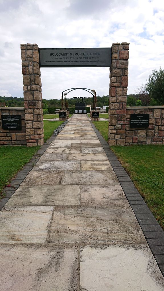
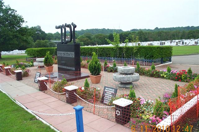
| Memorials | : | 6 |
| Location | : | Waltham Abbey, Epping Forest District, England |
| Coordinate | : | 51.6778780, 0.0389240 |
frequently asked questions (FAQ):
-
Where is Waltham Abbey Jewish Cemetery?
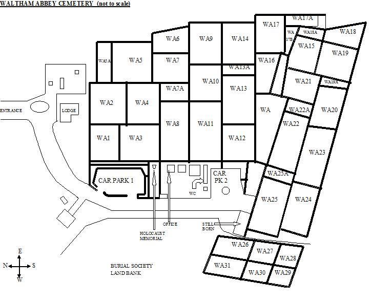
Waltham Abbey Jewish Cemetery is located at Skillet Hill, Honey Lane Waltham Abbey, Epping Forest District ,Essex , EN9 3QSEngland.
-
Waltham Abbey Jewish Cemetery cemetery's updated grave count on graveviews.com?
4 memorials
-
Where are the coordinates of the Waltham Abbey Jewish Cemetery?
Latitude: 51.6778780
Longitude: 0.0389240
Nearby Cemetories:
1. St. Thomas Churchyard
Upshire, Epping Forest District, England
Coordinate: 51.6898890, 0.0465860
2. Holy Innocents Churchyard
High Beach, Epping Forest District, England
Coordinate: 51.6617140, 0.0343380
3. Waltham Holy Cross Old Cemetery
Waltham Abbey, Epping Forest District, England
Coordinate: 51.6823480, 0.0027610
4. Waltham Holy Cross-New Cemetery
Waltham Abbey, Epping Forest District, England
Coordinate: 51.6822880, 0.0024510
5. Waltham Abbey
Waltham Abbey, Epping Forest District, England
Coordinate: 51.6876010, -0.0034070
6. St. John the Baptist Churchyard
Loughton, Epping Forest District, England
Coordinate: 51.6530400, 0.0644100
7. Loughton Cemetery
Loughton, Epping Forest District, England
Coordinate: 51.6519200, 0.0647400
8. St Mary the Virgin Churchyard
Loughton, Epping Forest District, England
Coordinate: 51.6463600, 0.0548700
9. St. Mary the Virgin Churchyard
Theydon Bois, Epping Forest District, England
Coordinate: 51.6736030, 0.0931960
10. St Nicholas Churchyard
Loughton, Epping Forest District, England
Coordinate: 51.6485000, 0.0788000
11. Epping Cemetery
Epping, Epping Forest District, England
Coordinate: 51.6978250, 0.0974260
12. Theydon Bois Cemetery
Theydon Bois, Epping Forest District, England
Coordinate: 51.6651420, 0.1117300
13. St George Churchyard
Freezywater, London Borough of Enfield, England
Coordinate: 51.6738060, -0.0389670
14. St John the Baptist Churchyard
Buckhurst Hill, Epping Forest District, England
Coordinate: 51.6291780, 0.0332990
15. St Peter and St Paul Parish Church
Chingford, London Borough of Waltham Forest, England
Coordinate: 51.6311710, 0.0011370
16. All Saints Churchyard
Epping Upland, Epping Forest District, England
Coordinate: 51.7207440, 0.0888980
17. All Saints Churchyard
Theydon Garnon, Epping Forest District, England
Coordinate: 51.6738900, 0.1272110
18. Hertford Road Cemetery
Enfield, London Borough of Enfield, England
Coordinate: 51.6554120, -0.0449750
19. St. James' Churchyard
Enfield, London Borough of Enfield, England
Coordinate: 51.6558850, -0.0470570
20. Enfield Crematorium
Enfield, London Borough of Enfield, England
Coordinate: 51.6699829, -0.0544380
21. St. Mary the Less Churchyard
Chigwell, Epping Forest District, England
Coordinate: 51.6244780, 0.0803260
22. St Mary the Virgin Church
Cheshunt, Broxbourne Borough, England
Coordinate: 51.7042420, -0.0489450
23. Gardens of Peace Muslim Cemetery
Chigwell, Epping Forest District, England
Coordinate: 51.6238710, 0.0842271
24. Western Synagogue Cemetery
Cheshunt, Broxbourne Borough, England
Coordinate: 51.6850350, -0.0615410