
| Memorials | : | 9 |
| Location | : | Elk Mound, Dunn County, USA |
| Coordinate | : | 44.8356018, -91.7425003 |
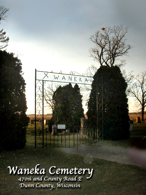
| Description | : | Formerly known as one of 2 Spring Brook cemeteries within Spring Brook Township until 1943 when the name was officially changed to Waneka. NE corner of SW 1/4 of section 8 was established in 1858 10 rods by 20 rods sold for $20.00 to be used for a cemetery to the trustees of the Spring Brook Cemetery Association. Additional space was purchased of one acre adjoining to the south in 1912 and again in 1980. In 1943 it was voted to change the name to Waneka to reduce confusion between the 2 separate cemeteries with the same name of Spring... Read More |
frequently asked questions (FAQ):
-
Where is Waneka Cemetery?
Waneka Cemetery is located at Waneka Road/470th Avenue Elk Mound, Dunn County ,Wisconsin ,USA.
-
Waneka Cemetery cemetery's updated grave count on graveviews.com?
8 memorials
-
Where are the coordinates of the Waneka Cemetery?
Latitude: 44.8356018
Longitude: -91.7425003
Nearby Cemetories:
1. Iron Creek Cemetery
Spring Brook, Dunn County, USA
Coordinate: 44.8527985, -91.7786026
2. Saint Joseph Cemetery
Elk Mound, Dunn County, USA
Coordinate: 44.8555984, -91.7058029
3. Fall City Cemetery
Downsville, Dunn County, USA
Coordinate: 44.7919006, -91.7510986
4. Saint Johns Lutheran Cemetery
Menomonie, Dunn County, USA
Coordinate: 44.8568993, -91.8022003
5. Evergreen Cemetery
Elk Mound, Dunn County, USA
Coordinate: 44.8586693, -91.6702652
6. Sand Hill Cemetery
Caryville, Dunn County, USA
Coordinate: 44.7705994, -91.7416992
7. Forest Center Cemetery
Falls City, Dunn County, USA
Coordinate: 44.7785450, -91.8003850
8. Springbrook Lutheran Cemetery
Caryville, Dunn County, USA
Coordinate: 44.7750015, -91.6908035
9. Peterson Cemetery
Caryville, Dunn County, USA
Coordinate: 44.7667007, -91.6757965
10. Barum Cemetery
Elk Mound, Dunn County, USA
Coordinate: 44.9049900, -91.6710400
11. Beyer Settlement Cemetery
Red Cedar, Dunn County, USA
Coordinate: 44.9161110, -91.7925520
12. Froens Cemetery
Menomonie, Dunn County, USA
Coordinate: 44.8288994, -91.8728027
13. Little Elk Creek Cemetery
Downsville, Dunn County, USA
Coordinate: 44.8101000, -91.8726000
14. Rock Creek Cemetery
Meridean, Dunn County, USA
Coordinate: 44.7383003, -91.7613983
15. Potters Field Cemetery
Menomonie, Dunn County, USA
Coordinate: 44.8898900, -91.8701000
16. McCombs Cemetery
Pine Grove, Chippewa County, USA
Coordinate: 44.8722000, -91.5832977
17. Rock Falls Cemetery
Rock Falls, Dunn County, USA
Coordinate: 44.7197000, -91.7014010
18. Big Elk Creek Lutheran Church Cemetery
Chippewa County, USA
Coordinate: 44.9298600, -91.6340200
19. Saint Joseph Catholic Cemetery
Rock Falls, Dunn County, USA
Coordinate: 44.7203800, -91.6864200
20. Peace Lutheran Cemetery
Menomonie, Dunn County, USA
Coordinate: 44.8502998, -91.9152985
21. Pleasant Valley Cemetery
Dunnville, Dunn County, USA
Coordinate: 44.7528000, -91.8732986
22. Cedar Falls Cemetery
Cedar Falls, Dunn County, USA
Coordinate: 44.9247017, -91.8656006
23. Peru Cemetery
Meridean, Dunn County, USA
Coordinate: 44.7141991, -91.7906036
24. Saint Pauls Cemetery
Menomonie, Dunn County, USA
Coordinate: 44.8532982, -91.9199982