
| Memorials | : | 0 |
| Location | : | Concho, Apache County, USA |
| Coordinate | : | 34.6233014, -109.7602670 |
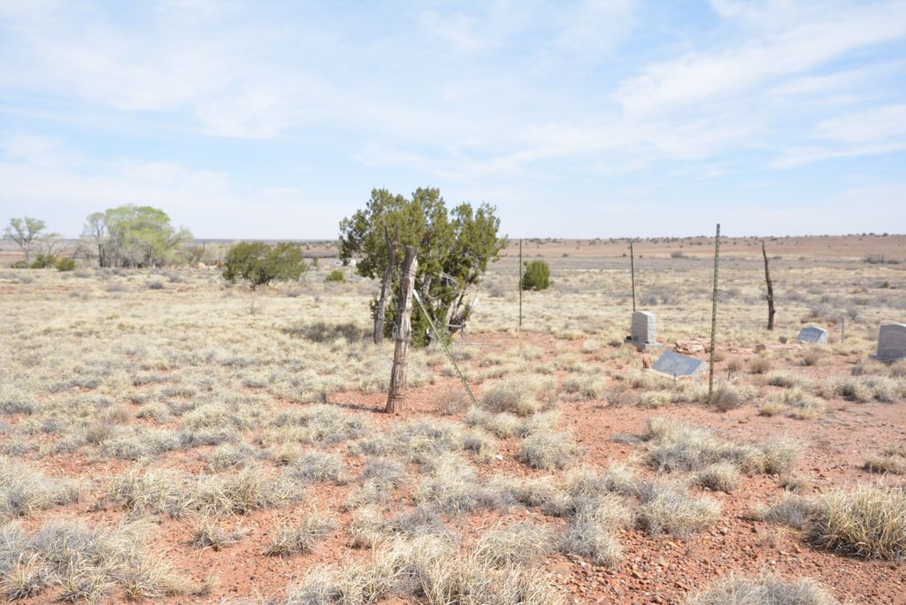
| Description | : | This private cemetery is 100'x100' land area and located on homesteaded ranch land pioneered by members of the Cheney, Ward, Gullick, and Guffey families. The cemetery is recorded in Apache County, Arizona under record 2018-005893. Internments in this cemetery include Dowell P. Ward, James E. Ward, Wyatt Aaron Ward, Jean Phillip Ward, and Irl Guffey. The nearest town is Concho, Arizona, located several miles to the southeast. Reaching the cemetery is difficult and not recommended except for authorized family members with 4-wheel drive vehicle. Access from the Snowflake-Concho Highway 5020, then northeast on Ranch Road... Read More |
frequently asked questions (FAQ):
-
Where is Ward Cemetery?
Ward Cemetery is located at Concho, Apache County ,Arizona ,USA.
-
Ward Cemetery cemetery's updated grave count on graveviews.com?
0 memorials
-
Where are the coordinates of the Ward Cemetery?
Latitude: 34.6233014
Longitude: -109.7602670
Nearby Cemetories:
1. Concho Catholic Cemetery
Concho, Apache County, USA
Coordinate: 34.4870770, -109.6064540
2. Erastus Cemetery
Concho, Apache County, USA
Coordinate: 34.4722300, -109.6242800
3. Woodruff Cemetery
Woodruff, Navajo County, USA
Coordinate: 34.7775000, -110.0325000
4. R V Mike Ramsay Memorial Cemetery
Snowflake, Navajo County, USA
Coordinate: 34.5044000, -110.0869000
5. Love Lake Ranch Cemetery
Shumway, Navajo County, USA
Coordinate: 34.3984820, -110.0192360
6. Taylor Cemetery
Taylor, Navajo County, USA
Coordinate: 34.4644012, -110.0971985
7. Saint Johns Cemetery
Saint Johns, Apache County, USA
Coordinate: 34.5143500, -109.3720200
8. Shumway Cemetery
Shumway, Navajo County, USA
Coordinate: 34.4077988, -110.0824966
9. Saint Johns Catholic Cemetery
Saint Johns, Apache County, USA
Coordinate: 34.5125008, -109.3289032
10. Vernon Cemetery
Vernon, Apache County, USA
Coordinate: 34.2421989, -109.6992035
11. El Tuele Cemetery
Apache County, USA
Coordinate: 34.3753330, -109.4026160
12. Conklin Gravesite
Show Low, Navajo County, USA
Coordinate: 34.2551613, -110.0244522
13. Show Low Cemetery
Show Low, Navajo County, USA
Coordinate: 34.2576830, -110.0392330
14. Burton Cemetery
Navajo County, USA
Coordinate: 34.3314800, -110.1494000
15. Holbrook Cemetery
Holbrook, Navajo County, USA
Coordinate: 34.9097600, -110.1572500
16. Adair Cemetery
Show Low, Navajo County, USA
Coordinate: 34.2688500, -110.0647300
17. Seventh Day Adventist Mission Cemetery
Holbrook, Navajo County, USA
Coordinate: 34.8842400, -110.1906100
18. Frost Family Cemetery
Linden, Navajo County, USA
Coordinate: 34.2932816, -110.1576004
19. H-Y Ranch Family Cemetery
Holbrook, Navajo County, USA
Coordinate: 34.9014659, -110.2159816
20. Church Of Our Saviour Columbarium
Pinetop-Lakeside, Navajo County, USA
Coordinate: 34.1869800, -110.0050700
21. Kempton Gravesite
Joseph City, Navajo County, USA
Coordinate: 34.9195500, -110.2546700
22. Lakeside Cemetery
Pinetop-Lakeside, Navajo County, USA
Coordinate: 34.1521930, -109.9895570
23. Pinedale Cemetery
Pinedale, Navajo County, USA
Coordinate: 34.3068000, -110.2467000
24. Clay Springs Cemetery
Clay Springs, Navajo County, USA
Coordinate: 34.3686500, -110.2988300