| Memorials | : | 10 |
| Location | : | Warrensburg, Johnson County, USA |
| Coordinate | : | 38.7262688, -93.7323227 |
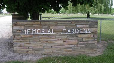
| Description | : | Memorial Gardens Cemetery is located in the Pertle Springs area just south of the Warrensburg city limits. The cemetery is on 180th Road and approximately 300 yards east of Highway 13. |
frequently asked questions (FAQ):
-
Where is Warrensburg Memorial Gardens Cemetery?
Warrensburg Memorial Gardens Cemetery is located at Warrensburg, Johnson County ,Missouri ,USA.
-
Warrensburg Memorial Gardens Cemetery cemetery's updated grave count on graveviews.com?
7 memorials
-
Where are the coordinates of the Warrensburg Memorial Gardens Cemetery?
Latitude: 38.7262688
Longitude: -93.7323227
Nearby Cemetories:
1. Roop Cemetery
Warrensburg, Johnson County, USA
Coordinate: 38.7341995, -93.7288971
2. Fickas Cemetery
Johnson County, USA
Coordinate: 38.7139015, -93.7217026
3. Sutton Cemetery
Johnson County, USA
Coordinate: 38.7257996, -93.6893997
4. Holden Street Cemetery
Warrensburg, Johnson County, USA
Coordinate: 38.7648930, -93.7405070
5. Old Warrensburg Cemetery
Warrensburg, Johnson County, USA
Coordinate: 38.7664986, -93.7542038
6. Maxwell Cemetery
Warrensburg, Johnson County, USA
Coordinate: 38.7663994, -93.7014008
7. Sunset Hill Cemetery
Warrensburg, Johnson County, USA
Coordinate: 38.7708015, -93.7574997
8. Poor Farm Cemetery
Warrensburg, Johnson County, USA
Coordinate: 38.7748230, -93.7089920
9. Mount Zion Cemetery
Warrensburg, Johnson County, USA
Coordinate: 38.6730995, -93.7343979
10. Marr-Greer Cemetery
Johnson County, USA
Coordinate: 38.6769000, -93.7603000
11. Whitman Cemetery
Warrensburg, Johnson County, USA
Coordinate: 38.7066450, -93.6584530
12. Adams Memorial Cemetery
Bristle Ridge, Johnson County, USA
Coordinate: 38.7002983, -93.6485977
13. Jones Family Cemetery
Montserrat, Johnson County, USA
Coordinate: 38.6864000, -93.6556000
14. Mayes Cemetery
Montserrat, Johnson County, USA
Coordinate: 38.7675018, -93.6455994
15. Cornelia Cemetery
Cornelia, Johnson County, USA
Coordinate: 38.6451400, -93.7409200
16. Cecil Memorial Cemetery
Post Oak, Johnson County, USA
Coordinate: 38.6433900, -93.7411900
17. Adams Cemetery
Montserrat, Johnson County, USA
Coordinate: 38.7542000, -93.6311035
18. Conner-Curnutt Cemetery
Montserrat, Johnson County, USA
Coordinate: 38.7863900, -93.6506200
19. Granger Cemetery
Johnson County, USA
Coordinate: 38.8157997, -93.7285995
20. Centerview Cemetery
Centerview, Johnson County, USA
Coordinate: 38.7504997, -93.8440781
21. Greer Cemetery
Johnson County, USA
Coordinate: 38.6442100, -93.6783800
22. Sluder Cemetery
Centerview, Johnson County, USA
Coordinate: 38.7324982, -93.8506012
23. Ellis Cemetery
Johnson County, USA
Coordinate: 38.6996994, -93.6183014
24. Lea Cemetery
Johnson County, USA
Coordinate: 38.7641983, -93.6216965

