| Memorials | : | 0 |
| Location | : | Dillon County, USA |
| Coordinate | : | 34.3050003, -79.3747025 |
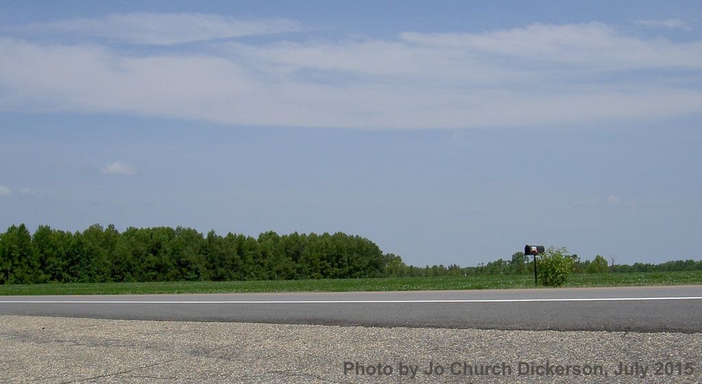
| Description | : | There are no longer any markers and the cemetery was plowed over. The old Barnabas Watson Cemetery was somewhere in this field on Highway 917, across from the grain bin at Deerpatch Road near Temperance Hill. The cemetery disappeared and was plowed over sometime between the 1952 survey for the “Dillon County Cemetery Book” and 1984 when I first went looking for it. The memorial marker erected for Barnabas Watson (1758-1841) by his descendants was moved to Antioch Baptist Church sometime prior to the 1952 survey. It is not known if the remaining three markers were moved, fell over, or... Read More |
frequently asked questions (FAQ):
-
Where is Watson Cemetery?
Watson Cemetery is located at Dillon County ,South Carolina ,USA.
-
Watson Cemetery cemetery's updated grave count on graveviews.com?
0 memorials
-
Where are the coordinates of the Watson Cemetery?
Latitude: 34.3050003
Longitude: -79.3747025
Nearby Cemetories:
1. Johnson Cemetery
Dillon County, USA
Coordinate: 34.3003006, -79.3747025
2. McDonald Family Cemetery
Latta, Dillon County, USA
Coordinate: 34.3177020, -79.3722150
3. Bryant Cemetery
Marion County, USA
Coordinate: 34.2903800, -79.3764400
4. Tyndall Cemetery
Dillon County, USA
Coordinate: 34.2942009, -79.3602982
5. Lee Cemetery
Marion County, USA
Coordinate: 34.2971992, -79.3918991
6. Union Baptist Church Cemetery
Temperance Hill, Marion County, USA
Coordinate: 34.2871475, -79.3754730
7. Stewart Family Cemetery
Marion County, USA
Coordinate: 34.2888985, -79.3861008
8. Resthaven Cemetery
Latta, Dillon County, USA
Coordinate: 34.3248291, -79.3799362
9. Lane Cemetery
Floydale, Dillon County, USA
Coordinate: 34.3253632, -79.3806381
10. Allen Cemetery
Latta, Dillon County, USA
Coordinate: 34.3149986, -79.3974991
11. Lane Cemetery
Temperance Hill, Marion County, USA
Coordinate: 34.2860985, -79.3891983
12. Bethlehem Freewill Baptist Church Cemetery
Marion, Marion County, USA
Coordinate: 34.2806200, -79.3820900
13. Mount Andrew Cemetery
Dillon County, USA
Coordinate: 34.3167152, -79.3474197
14. Lane Cemetery
Marion County, USA
Coordinate: 34.2999992, -79.4049988
15. Lane Cemetery
Latta, Dillon County, USA
Coordinate: 34.3231010, -79.4032974
16. Pyerian Baptist Church Cemetery
Floydale, Dillon County, USA
Coordinate: 34.3347015, -79.3722992
17. Dunbarton Presbyterian Church Cemetery
Floydale, Dillon County, USA
Coordinate: 34.3078575, -79.3374557
18. Page's Cemetery
Floydale, Dillon County, USA
Coordinate: 34.3088112, -79.3327255
19. Ebenezer Methodist Church Cemetery
Temperance Hill, Marion County, USA
Coordinate: 34.2858009, -79.4105988
20. Roberts Cemetery
Latta, Dillon County, USA
Coordinate: 34.2971764, -79.3328247
21. Turner Cemetery
Marion County, USA
Coordinate: 34.2860985, -79.4163971
22. Johnson Cemetery
Latta, Dillon County, USA
Coordinate: 34.3216782, -79.4179153
23. Platt - Deer Cemetery
Marion, Marion County, USA
Coordinate: 34.2675876, -79.3959196
24. Dove Mill Road Cemetery
Dillon, Dillon County, USA
Coordinate: 34.3386500, -79.3450300


