
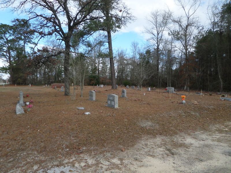
| Memorials | : | 1 |
| Location | : | Marion, Marion County, USA |
| Coordinate | : | 34.2806200, -79.3820900 |
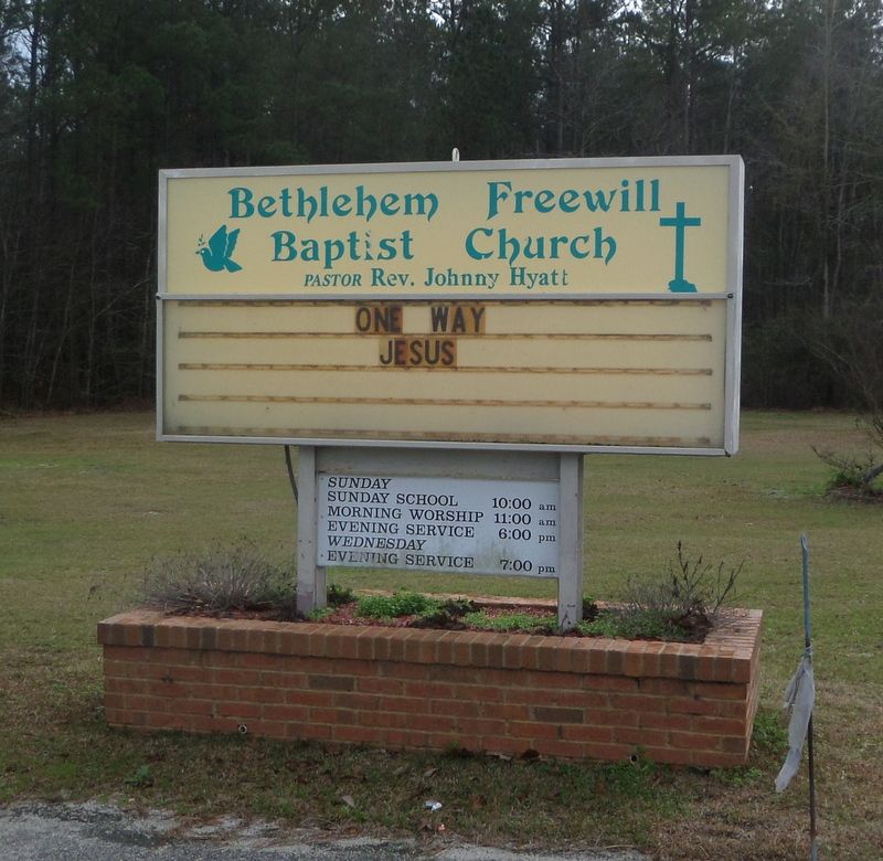
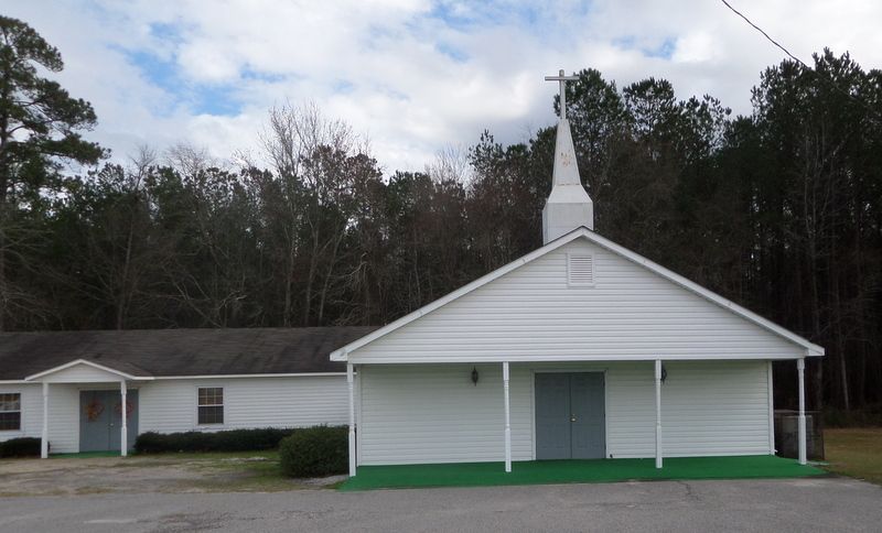
| Description | : | 7 miles north of Marion, near the Dillon County line. East of S-34-23 approximately 7 miles south of intersection of S-34-23 and S-34-22. *Also known as Bethlehem Independent Baptist Cemetery. |
frequently asked questions (FAQ):
-
Where is Bethlehem Freewill Baptist Church Cemetery?
Bethlehem Freewill Baptist Church Cemetery is located at Marion, Marion County ,South Carolina ,USA.
-
Bethlehem Freewill Baptist Church Cemetery cemetery's updated grave count on graveviews.com?
1 memorials
-
Where are the coordinates of the Bethlehem Freewill Baptist Church Cemetery?
Latitude: 34.2806200
Longitude: -79.3820900
Nearby Cemetories:
1. Lane Cemetery
Temperance Hill, Marion County, USA
Coordinate: 34.2860985, -79.3891983
2. Union Baptist Church Cemetery
Temperance Hill, Marion County, USA
Coordinate: 34.2871475, -79.3754730
3. Stewart Family Cemetery
Marion County, USA
Coordinate: 34.2888985, -79.3861008
4. Bryant Cemetery
Marion County, USA
Coordinate: 34.2903800, -79.3764400
5. Platt - Deer Cemetery
Marion, Marion County, USA
Coordinate: 34.2675876, -79.3959196
6. Lee Cemetery
Marion County, USA
Coordinate: 34.2971992, -79.3918991
7. Johnson Cemetery
Dillon County, USA
Coordinate: 34.3003006, -79.3747025
8. Tyndall Cemetery
Dillon County, USA
Coordinate: 34.2942009, -79.3602982
9. Ebenezer Methodist Church Cemetery
Temperance Hill, Marion County, USA
Coordinate: 34.2858009, -79.4105988
10. Watson Cemetery
Dillon County, USA
Coordinate: 34.3050003, -79.3747025
11. Moody-Berry Cemetery
Marion County, USA
Coordinate: 34.2564011, -79.3908005
12. Lane Cemetery
Marion County, USA
Coordinate: 34.2999992, -79.4049988
13. Turner Cemetery
Marion County, USA
Coordinate: 34.2860985, -79.4163971
14. Greater Fork Chapel AME Church Cemetery
Marion, Marion County, USA
Coordinate: 34.2496986, -79.3929977
15. Sunset Gardens Cemetery
Spring Branch, Marion County, USA
Coordinate: 34.2500300, -79.4057900
16. Allen Cemetery
Latta, Dillon County, USA
Coordinate: 34.3149986, -79.3974991
17. Saint Phillips United Methodist Church Cemetery
Spring Branch, Marion County, USA
Coordinate: 34.2491700, -79.4062600
18. Moody Cemetery
Marion, Marion County, USA
Coordinate: 34.2548409, -79.4154968
19. McDonald Family Cemetery
Latta, Dillon County, USA
Coordinate: 34.3177020, -79.3722150
20. Spring Branch Cemetery
Spring Branch, Marion County, USA
Coordinate: 34.2425003, -79.3925018
21. Little Zion Methodist Church Cemetery
Zion, Marion County, USA
Coordinate: 34.2762000, -79.3347000
22. Spring Branch Baptist Church Cemetery
Spring Branch, Marion County, USA
Coordinate: 34.2420998, -79.3957977
23. Roberts Cemetery
Latta, Dillon County, USA
Coordinate: 34.2971764, -79.3328247
24. Resthaven Cemetery
Latta, Dillon County, USA
Coordinate: 34.3248291, -79.3799362