
| Memorials | : | 7 |
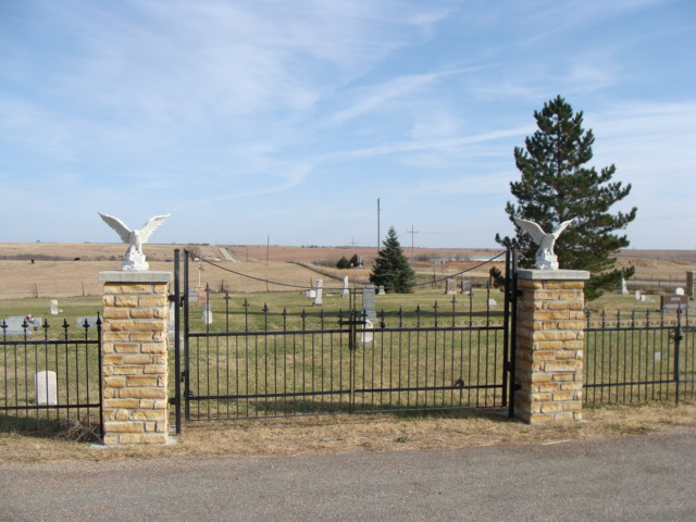
| Location | : | Scottsville, Mitchell County, USA |
| Coordinate | : | 39.4815000, -97.9661600 |
| Description | : | No sign exists to identify cemetery. Source of name is the Mitchell County Appraiser’s Parcel Map website. |
frequently asked questions (FAQ):
-
Where is West Asher Cemetery?
West Asher Cemetery is located at 1902 380 Road Scottsville, Mitchell County ,Kansas ,USA.
-
West Asher Cemetery cemetery's updated grave count on graveviews.com?
3 memorials
-
Where are the coordinates of the West Asher Cemetery?
Latitude: 39.4815000
Longitude: -97.9661600
Nearby Cemetories:
1. McBride Cemetery
Beloit, Mitchell County, USA
Coordinate: 39.4808006, -97.9907990
2. Smith Cemetery
Asherville, Mitchell County, USA
Coordinate: 39.4516690, -98.0098850
3. Summit Cemetery #3
Macyville, Cloud County, USA
Coordinate: 39.5258330, -97.9194440
4. Bell-Bogardus Cemetery
Asherville, Mitchell County, USA
Coordinate: 39.4242410, -97.9919970
5. Asherville Cemetery
Asherville, Mitchell County, USA
Coordinate: 39.4205000, -97.9672900
6. Scottsville Cemetery
Scottsville, Mitchell County, USA
Coordinate: 39.5468102, -97.9474945
7. Summit Cemetery
Jamestown, Cloud County, USA
Coordinate: 39.4813200, -97.8628800
8. Elmwood Cemetery
Beloit, Mitchell County, USA
Coordinate: 39.4693985, -98.1014023
9. Saint Johns Cemetery
Beloit, Mitchell County, USA
Coordinate: 39.4667015, -98.1018982
10. West Hope Cemetery
Jewell County, USA
Coordinate: 39.5896988, -97.9871979
11. Beloit Industrial School Cemetery
Beloit, Mitchell County, USA
Coordinate: 39.4755000, -98.1105810
12. Simpson Cemetery
Simpson, Mitchell County, USA
Coordinate: 39.3633003, -97.9471970
13. West Summit Cemetery
Jamestown, Cloud County, USA
Coordinate: 39.5532900, -97.8312600
14. Morrison Cemetery
Center Township, Cloud County, USA
Coordinate: 39.4817009, -97.7975006
15. Saint Mary's Cemetery
Jamestown, Cloud County, USA
Coordinate: 39.5964012, -97.8850021
16. Jamestown Cemetery
Jamestown, Cloud County, USA
Coordinate: 39.5964012, -97.8839035
17. Pleasant Prairie Cemetery
Randall, Jewell County, USA
Coordinate: 39.5896988, -98.0627975
18. Shiloh Cemetery
Beloit, Mitchell County, USA
Coordinate: 39.3574982, -98.0594025
19. Lovseth Cemetery
Randall, Jewell County, USA
Coordinate: 39.6249000, -97.9685000
20. Saint Lukes Cemetery
Randall, Jewell County, USA
Coordinate: 39.6390000, -97.9325000
21. Pleasant Valley Cemetery
Beloit, Mitchell County, USA
Coordinate: 39.4555900, -98.1722200
22. New Hope Cemetery
Beloit, Mitchell County, USA
Coordinate: 39.3502998, -98.0875015
23. Green Mound Cemetery
Asherville, Mitchell County, USA
Coordinate: 39.3203011, -97.9858017
24. Glasco Cemetery
Glasco, Cloud County, USA
Coordinate: 39.3574000, -97.8265000